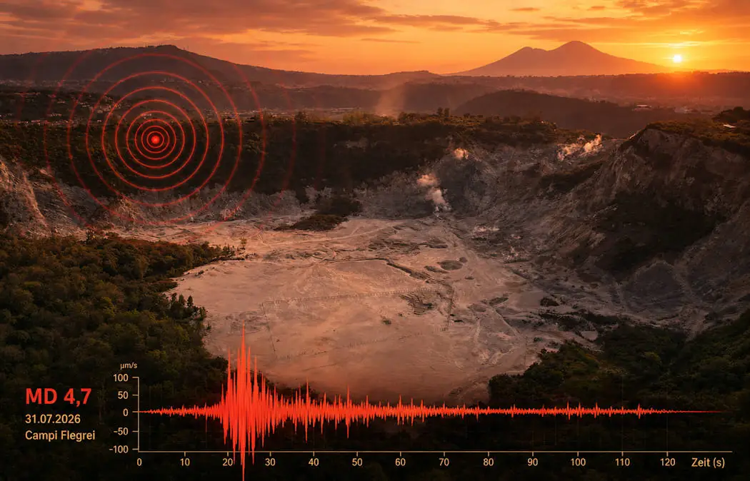
Campi Flegrei: Magnitude 4.7 Earthquake Strikes Volcano

Magnitude 4.7 Earthquake Strikes Campi Flegrei: Strongest Event of Recent Seismic Crisis Felt Across Naples Area

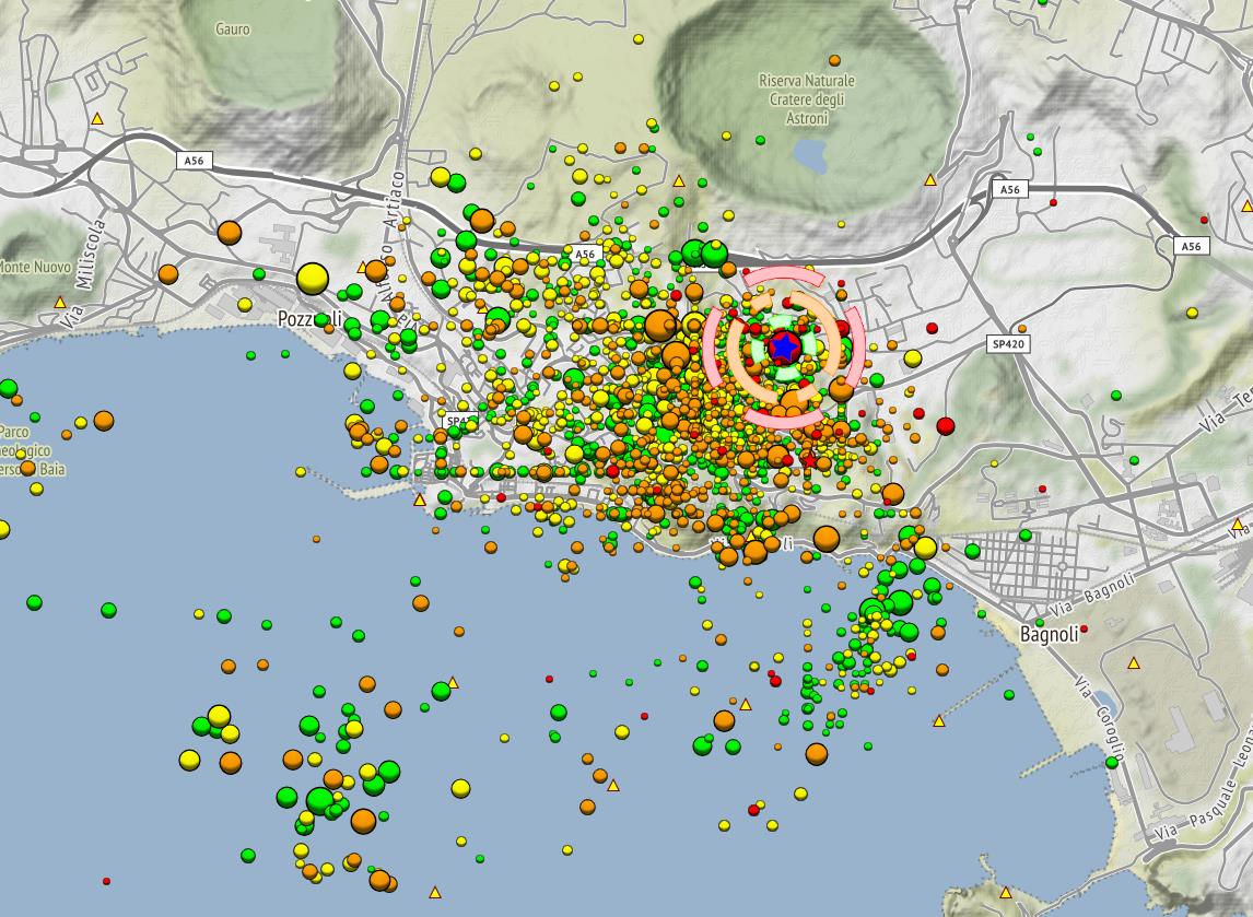
A strong earthquake with a magnitude of 4.7 struck the Campi Flegrei volcanic area near Naples, Italy, causing renewed concern among residents living around one of the world’s most closely monitored volcanic systems. The earthquake occurred on August 2026 (local time) beneath the Phlegraean caldera and was widely felt throughout the Naples metropolitan area, including Pozzuoli, Bacoli, and parts of the city of Naples.

The event was part of an ongoing seismic unrest that has affected the Campi Flegrei region for several years. According to monitoring data from the Italian National Institute of Geophysics and Volcanology (INGV), the earthquake was recorded at shallow depth, typical for seismic activity associated with the volcanic system. The shallow origin contributed to the strong perception of shaking at the surface.

Many residents reported intense shaking, loud noises, and concern about possible damage. While no major structural destruction was reported, inspections were carried out on buildings, and the earthquake increased anxiety among inhabitants who have already experienced frequent tremors during the current phase of unrest. In Pozzuoli and neighboring communities, some people temporarily left their homes due to fear of further earthquakes.

The earthquake is linked to the phenomenon of bradyseism, the slow uplift and subsidence of the Campi Flegrei caldera floor. Since 2005, the area has been undergoing a renewed phase of ground inflation, caused by changes in the volcanic system beneath the surface. Increasing pressure from rising hydrothermal fluids and volcanic gases, as well as possible magma movement at depth, can deform the crust and trigger earthquakes along existing faults.

A magnitude 4.7 earthquake does not indicate that an eruption is imminent by itself. Seismicity at Campi Flegrei is closely monitored because the caldera has produced some of the largest eruptions in European history, including the massive Campanian Ignimbrite eruption around 39,000 years ago and the Monte Nuovo eruption in 1538.

Scientists emphasize that earthquake activity must be interpreted together with other volcanic indicators, such as ground deformation, gas emissions, and changes in the hydrothermal system. The latest event highlights the continuing unrest of Campi Flegrei and the importance of constant surveillance in this densely populated volcanic region.
Kamchatka: Strom Earthquke Mw 7.3

Kamchatka: Series of Strong Earthquakes off the Coast near Petropavlovsk

This morning, the eastern coast of Russia’s Kamchatka Peninsula was shaken by a series of strong earthquakes. The most powerful quake reached a magnitude of Mw 7.3. Three additional tremors ranged between Mw 6.0 and 6.7, accompanied by several weaker aftershocks. The seismic sequence may not yet be over.

The strongest quake occurred at 06:49 UTC (08:49 CEST; 16:49 local time) at a depth of approximately 20 kilometers. The epicenter was located about 136 kilometers east of the regional capital, Petropavlovsk-Kamchatsky. The data comes from the European-Mediterranean Seismological Centre (EMSC) and may still be subject to revision.

Germany’s GFZ (GeoForschungsZentrum) reported the main quake with a magnitude of Mw 7.4, though a manual data review is still pending. Initially, the depth was estimated at 10 kilometers but has since been adjusted to 20 kilometers. In total, five other earthquakes with magnitudes over 6.0 were recorded. The strongest of these, at Mw 6.7, occurred 21 minutes before the main shock.

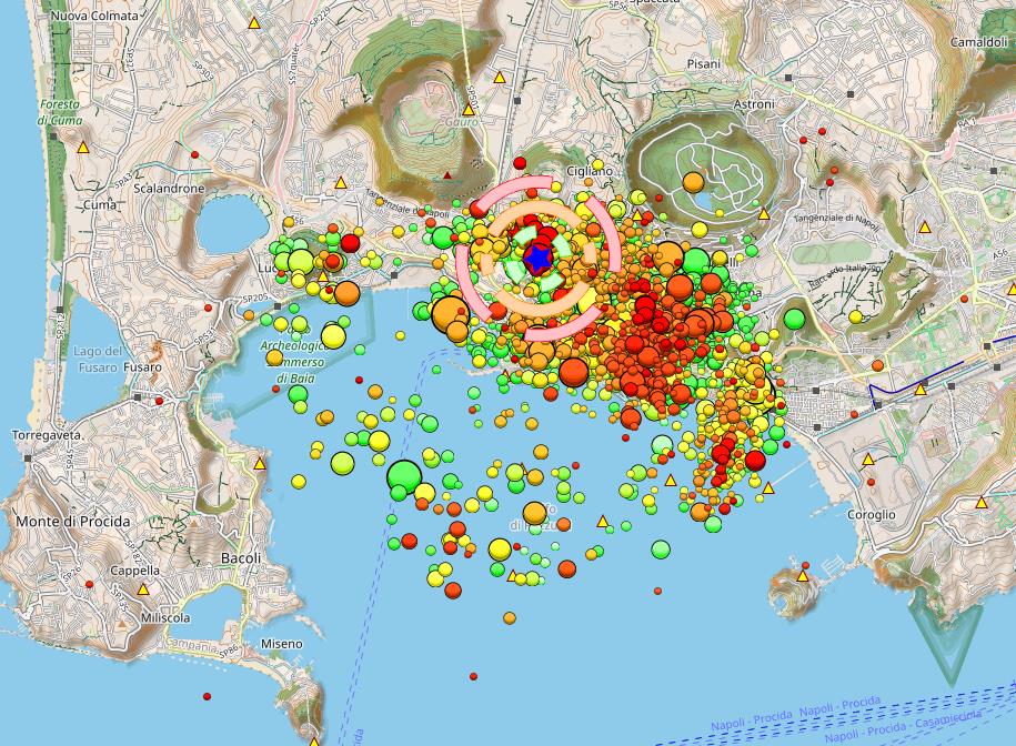
Campi Flegrei: Noticeable M3.2 Earthquake near Pozzuoli

Renewed Seismic Swarm hits Campi Flegrei – Epicenter close to critical Tangenziale Highway

Last night, the Campi Flegrei caldera was once again shaken by a seismic swarm. The strongest event reached a magnitude of 3.2, with the hypocenter located about 2,700 meters deep—beneath the hydrothermal system. Two additional quakes, measuring M2.2 and M2.0, occurred just before and after the main shock. All three epicenters were located northeast of Solfatara, near the Tangenziale highway that connects Pozzuoli to Naples.

This highway is the region’s main evacuation route in the event of a volcanic eruption. It passes through tunnels beneath the caldera’s volcanic hills. A stronger earthquake—above magnitude 5—could seriously damage this critical infrastructure, significantly complicating any last-minute evacuation. Therefore, expanding evacuation capacity via the sea appears increasingly necessary.

The M3.2 tremor was widely felt in Pozzuoli and nearby areas. Many residents reported it on social media. One user expressed concern about potential damage to the ruins of Pompeii, where a similar quake last month caused a wall to collapse.

The latest swarm began at 23:00 UTC and included around 30 individual tremors. Recent hopes that seismic activity might be declining—based on a few quieter days—now seem premature. Past patterns suggest that calmer phases often precede more intense swarms. As long as ground uplift continues, seismic stress will keep building. Even temporary slowdowns in uplift, as seen in past years, are no indication that the unrest is ending.

Columbia: Earthquake Mw 6,3 on June 8

Damage after earthquake in Colombia on June 8, 2025

A strong earthquake with a magnitude of 6.3 struck Colombia at 13:08 UTC (08:08 local time). According to the EMSC, the epicenter was located 23 km east of Medina, around 100 km east of the capital Bogotá. The hypocenter was only 9 km deep, which amplified the effects on the surface. Moderate damage was reported, including several buildings that collapsed near the epicenter. Social media images show destroyed houses, fallen façade parts, and cracks in roads and buildings. There have been no reports of fatalities so far, but panic reactions among the population have been reported.

The quake can be explained by Colombia’s complex tectonic setting. The Nazca and Caribbean Plates converge with the so-called North Andes Block. The earthquake occurred along the East Andean Fault Zone, a major fault in Colombia’s interior. Several aftershocks followed the main event.

Colombia is also volcanically active, with 14 volcanoes classified as potentially active, including Galeras, Nevado del Huila, and Nevado del Ruiz. The latter is located about 250 km from the epicenter and is currently erupting. Today, the VAAC reported ash clouds at 6,100 meters altitude. There is a possibility that the earthquake could influence the volcano and trigger a stronger eruption in the near future.

Seismic Unrest Near Santorini

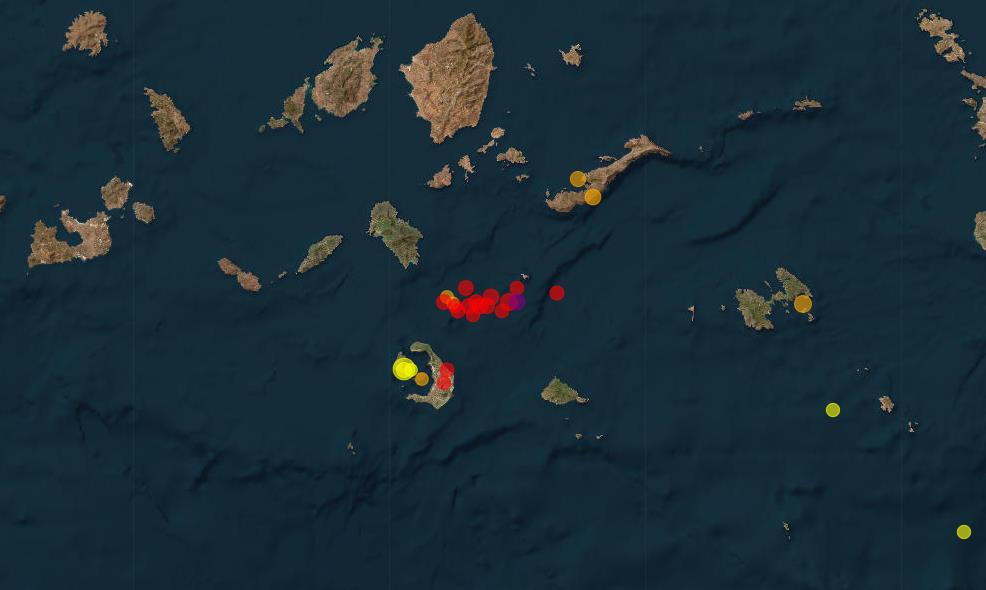
Earthquake Swarm at the Submarine Volcano Kolumbo close to Santorini

The region around the Greek volcanic island of Santorini remains seismically active. Over the past week, numerous earthquakes have occurred, particularly in the area of the submarine volcano Kolumbo. The strongest quake was recorded on January 25 with a magnitude of 3.6. Its hypocenter was at a depth of 11 kilometers near the coast of Thirasia, the western island of the Santorini archipelago. Tremors were also felt on Nea Kameni and Santorini itself.

In the past 24 hours, activity has continued with over 30 earthquakes, most with magnitudes in the 2.0 range. The deepest hypocenter was measured at 13.3 kilometers. In total, more than 70 quakes have been recorded over the past week. The latest swarm affected the Kolumbo volcano area, consisting of 19 tremors with hypocenters ranging between 5 and 21 kilometers in depth.

Whether these quakes are of tectonic origin or caused by the movement of magmatic fluids remains uncertain. Changes in stress due to ground uplift are also a possible explanation. However, no reports of ground deformation have been issued—likely due to a lack of underwater monitoring stations in the area. The ongoing seismic activity in the region requires continued observation.

Ethiopia: Another Earthquake Near Awash on 16.10.24

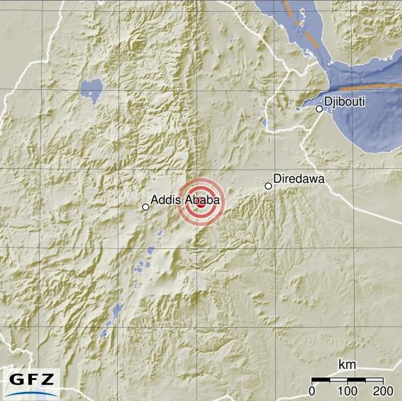
Earthquake Mb 4.6 Shakes Volcano Region Near Awash in Ethiopia – Ground Uplift Detected

On the evening of October 16, a magnitude 4.6 earthquake occurred in the Awash region of Ethiopia near the Fentale volcano, and it was also felt in Addis Ababa. With a depth of about 10 kilometers, the earthquake may have been shallower, as the seismological monitoring in the region is imprecise. For weeks, numerous smaller tremors have been damaging infrastructure such as railways and buildings.

InSAR data shows a possible ground uplift of up to 30 centimeters, indicating magma intrusion close to Fentale volcano. Previous studies have shown that rhyolitic magma intrusions have occurred here before, which is unusual in this basalt-rich region. These intrusions were accompanied by strong earthquake swarms, similar to what is happening now. However, it is possible that the InSAR image reflects other effects, such as a high water level on the Awash River.

The Fentale volcano, dominated by a 5-kilometer-wide caldera, is both effusive and explosive, unlike most other volcanoes in the region. The tectonic activity is driven by the divergent boundary between the Somali Microplate and the African Plate. A phreatic eruption occurred last week in a thermal area near the volcano. It is possible that a volcanic eruption may follow.

Strong earthquake swarm on the Icelandic Reykjanes Peninsula

In the past few days, there has been a significant earthquake swarm on the Icelandic Reykjanes Peninsula. More than 7,500 tremors were recorded. The strongest earthquake had a magnitude of 4.9. These earthquakes were concentrated in an area northwest of the Thorbjorn volcano, specifically beneath the Svartsengi geothermal power plant. A rapidly progressing ground uplift of 3 cm has now been observed, which is caused by a magma accumulation underground. The ground has also risen in the Fagradalsfjall volcano area. Scientists from the Icelandic Meteorological Office (IMO) anticipate a new eruption. The Volcano Observatory Notice for Aviation (VONA) alert status has been raised to “Yellow.”

The strongest earthquake of the uplifting phase has shaken Campi Flegrei

Date: 27.09.23 | Time: 03:35:34 UTC | Location: 40.8170; 14.1560 | Depth: 2.9 km | Magnitude: 4.2

Tonight a moderate earthquake of magnitude 4.2 occurred beneath the southern Italian Caldera volcano Campi Flegrei. It was the strongest earthquake of the current uplift period, which began in 2005. The hypocenter was at a depth of 2900 m. The epicenter was located on the coast in the area of Via Napoli between the towns of Pozzuoli and Bagnoli. The Solfatara is approximately 1300 meters northwest of the epicenter. The earthquake occurred at 03:35:34 UTC (05:35:34 local time) and is likely to have awakened some residents from their sleep. There have been no reports of damage so far, although despite the moderate magnitude, some houses may have developed cracks, as the earthquake’s hypocenter was shallow.

Strong Earthquake Mw 6.9 Causes Casualties in Morocco

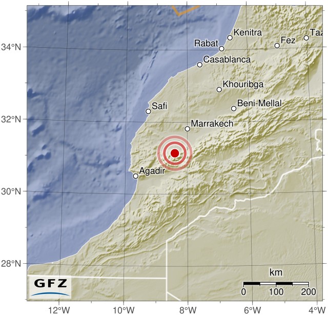
Date 09/08/23 | Time: 22:11:00 UTC | 31.074; -8.477 | Depth: 10 km | Mw 6.9

A strong earthquake with a moment magnitude of 6.9 occurred last night near Agadir and Marrakesh. The earthquake occurred at 22:11:00 UTC. The quake caused significant destruction and has resulted in 632 fatalities and 329 injuries so far. The exact depth of the hypocenter varied depending on the source: EMSC reported a depth of 10 km, GFZ Potsdam measured 27 km, and USGS determined nearly 19 km. EMSC located the epicenter 60 km west-southwest of Oukaïmedene, in a remote region of the Atlas Mountains. There were severe damages, particularly in the mountain villages near the epicenter, where numerous buildings have completely collapsed. The search for victims is still ongoing, and in many areas, there have been power outages and communication disruptions. There is speculation that landslides may have occurred, and some communities could be isolated from the outside world.

Earthquake Mb 3.8 near Solfatara triggers swarm of earthquakes

Date 09/07/23 | Time: 17:45:28 UTC | 40.83; 14.147 | Depth: 2.5 km | Mb 3.8

Yesterday, there was an earthquake in the Campi Flegrei Caldera with a magnitude of 3.8. The earthquake’s epicenter was at a depth of 2.5 km. The earthquake occurred near the northeastern crater rim of Solfatara, close to the thermal area of Piscarelli, and triggered an aftershock sequence with 30 subsequent earthquakes. These aftershocks mostly had low magnitudes in the microseismic range.

The main earthquake was felt in Pozzuoli and parts of Naples. EMSC received reports from people located 16 km away from the epicenter who felt the tremor. For those living closer, the earthquake was strong and frightening, but there are no reports of damage.