The Birth of a Volcano? The Submarine Eruption at Titan Ridge in the Bismarck Sea in Papua New Guinea
In the remote Bismarck Sea north of Papua New Guinea, a volcanic spectacle has been unfolding since early May that is surprising even experienced volcanologists: a submarine eruption at Titan Ridge is raising questions that, for now, remain unanswered—largely because the region is geologically poorly explored. What initially appeared to be a localized disturbance rapidly developed into one of the most remarkable volcanic events of the year.
The first signs appeared on May 8, 2026, when seismic networks detected a swarm of earthquakes, including events up to magnitude 5.6. Such swarms are often precursors to magmatic intrusions, as rising magma fractures surrounding rock. At that stage, however, it remained unclear whether a volcanic eruption was actually underway.
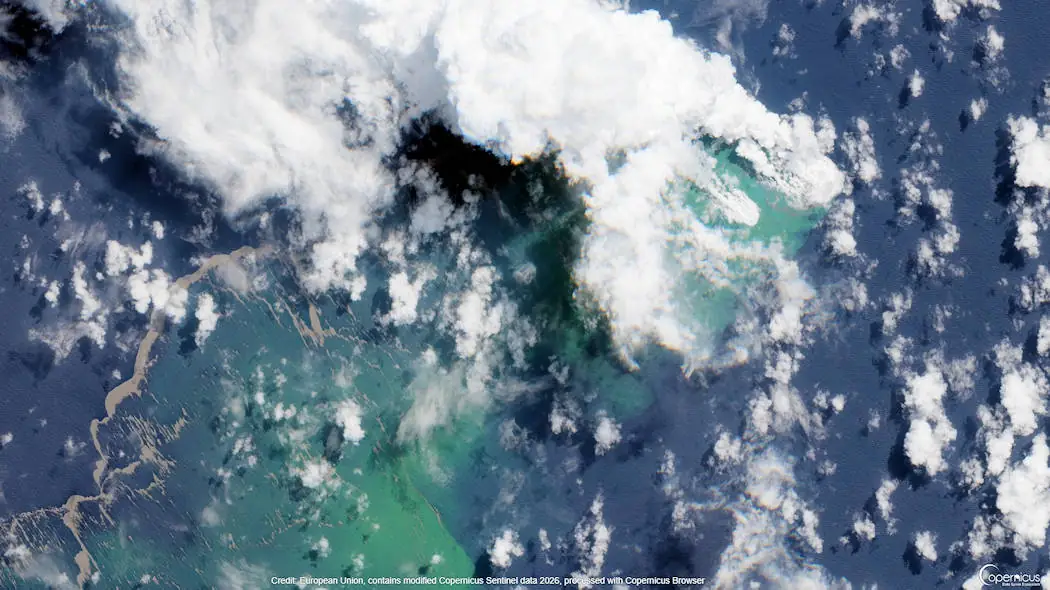
Just one day later, evidence became more compelling: satellite imagery revealed unusual water discoloration and steam plumes above a remote section of Titan Ridge, a submarine volcanic ridge in the central Bismarck Sea. The Darwin Volcanic Ash Advisory Centre (VAAC) also recorded atmospheric signals consistent with volcanic emissions. In the early phase, eruption plumes already reached heights of around 3,000 meters, while more energetic pulses occasionally drove steam-and-ash columns up to 4,500 meters into the atmosphere. For a submarine eruption, these heights are remarkable and suggest either shallow water depths or highly efficient magma–water interaction.
In the following days, scientific understanding of the event developed rapidly. Sentinel satellite data revealed extensive pumice rafts drifting westward—floating mats of volcanic rock fragments produced during explosive magma fragmentation in seawater. These rafts soon expanded to tens of square kilometers, confirming ongoing explosive activity.
At the same time, the geological picture began to shift. Initially, scientists assumed a single eruptive vent. However, reports from the Rabaul Volcano Observatory later indicated at least two active eruption centers, approximately 2.5 kilometers apart. Some observers now suspect that a longer eruptive fissure may have opened along Titan Ridge, suggesting a rift-related system rather than a classic island-arc volcano.
What makes the event particularly striking is how little was previously known about Titan Ridge Volcano. Much of the bathymetric data was only collected in recent years, and some volcanic structures were not mapped until 2024. As a result, researchers are not only observing an eruption but effectively witnessing the discovery of an unknown volcanic system in real time.
It remains uncertain whether the activity will diminish or continue to build. If the eruptive vent shallows further, the hidden eruption could eventually give birth to a new island—emerging from one of the least understood volcanic regions on Earth.