Andaman: Earthquake M 6.1

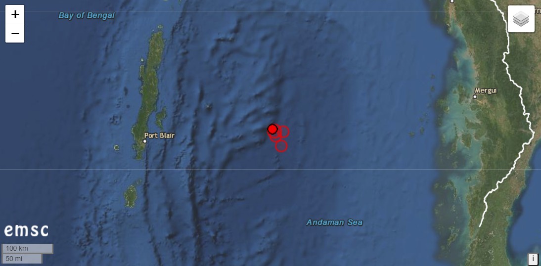
The Andaman and Nicobar Islands were shaken by an earthquake with a magnitude of 6.1. The hypocentre was 10 km deep. The epicentre manifested 236km east of Port Blair. The Indian Ocean archipelago belongs to India, but geographically it is closer to Myanmar. An aftershock of magnitude 5.6 followed at a depth of only 2 km. There had also been several aftershocks in the 4-magnitude range. Seismologists have been expecting a strong quake in the region (Andaman Sea) for some time, which could trigger a tsunami.

The quake was automatically detected.

Nishinoshima grows

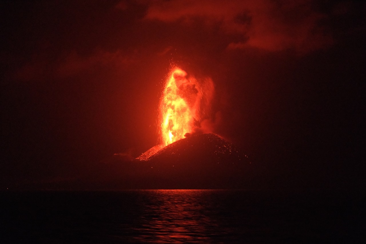
The Japanese volcanic island of Nishinoshima is growing and growing and is not only producing lava flows but also ash clouds. On 13. July these reached an altitude of 6100 m, with a cone height of 200 m.The Japanese coast guard photographed lava fountains that were as high as the cinder cone. Today the activity seems to be decreasing. The VAAC recorded volcanic ash at an altitude of 3700 m.

New observations will be made on July 20 by the meteorological observation ship “Keifu”.

Sangay: Thermal anomalies detected

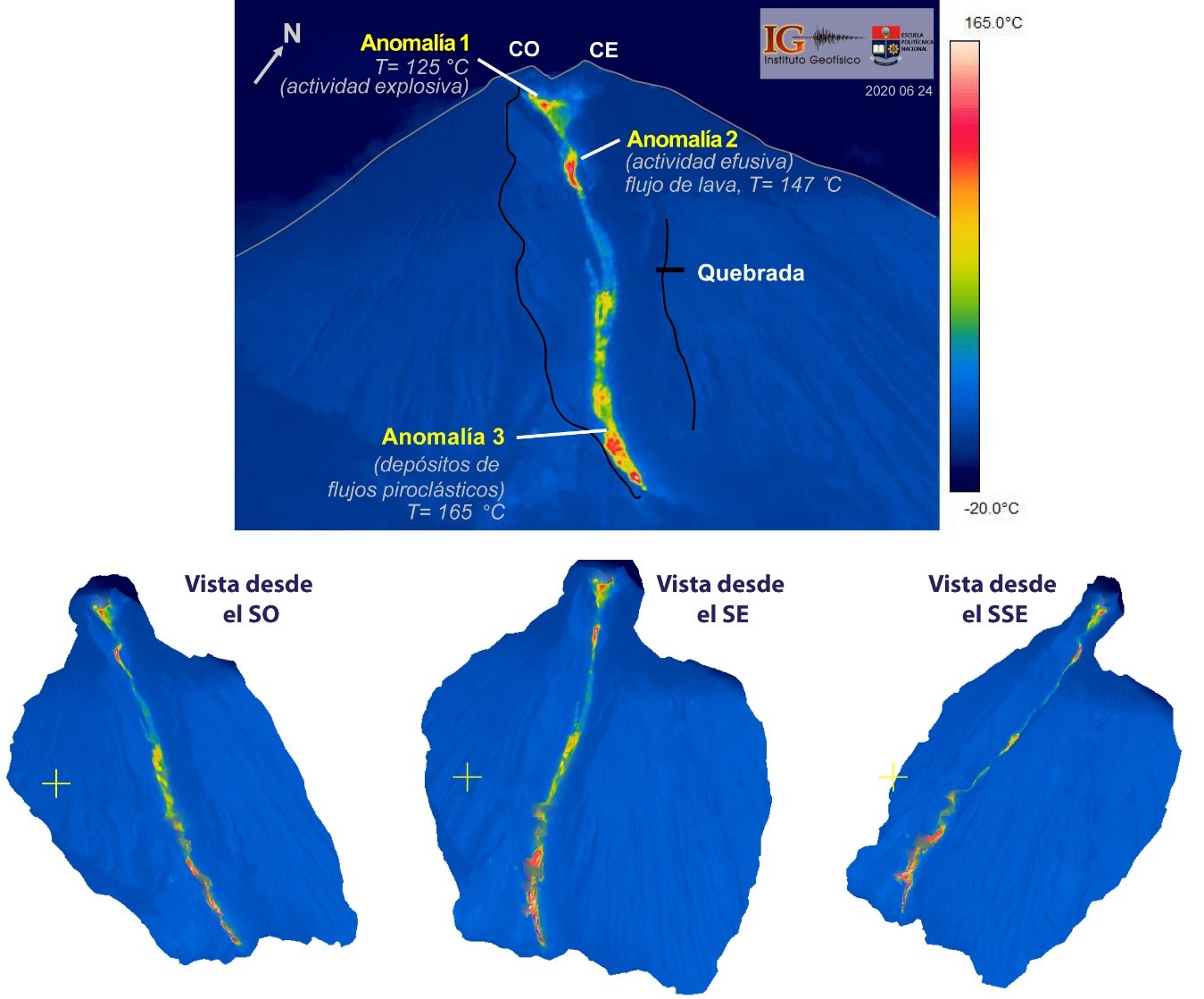
The Ecuadorian volcano Sangay is still active. Today, explosive eruptions were detected, which caused volcanic ash to rise to an altitude of 6400 m. The ash was drifted westward. In a special report of the IGEPN the morphological changes of the volcano caused by the eruptions were investigated. Most striking is a depression on the southeast flank. It was carved into the flank by lava flows, debris avalanches and pyroclastic flows. The gorge is almost 400 m wide, 4 km long and starts from the crater. Three thermal anomalies have been detected in it. 2 of the anomalies are located in the upper part of the canyon. The top anomaly is in the crater area and marks an explosive vent. The 2nd anomaly is below the base of the crater and represents the source of the lava flows. The 3rd heat source is located in the lower part of the gorge and is probably generated by an accumulation of hot deposits of pyroclastic flows.

Piton de la Fournaise: No eruption upcoming

The seismic crisis started on July 3, 2020 at 07:20 local time and ended around 08:00 local time. This episode was accompanied by surface deformations which remained extremely weak and localized at the top of the Piton de la Fournaise. Since then, no resumption of seismic activity or deformation has been observed.
Several hours without any activity being observed are evidence of the deep stop of magma in the building.
Nevertheless, given the resumption of inflation observed since June 16, a medium-term eruption cannot be ruled out.

Popocatepetl: Volcano with spirit

Close to the Mexican capital the Popocatepetl is still active. Yesterday the CENAPRED Institute published a very atmospheric photo of a sunset eruption. Besides the explosion, 169 ash-steam exhalations and 32 minutes of tremors were recorded. Today, explosive volcanic eruptions were also recorded: the VAAC issued 2 VONA messages according to which volcanic ash had risen to an altitude of 5800 m.

Popocatepetl has become a permanently active volcano in recent years. Only seldom there are longer pauses in eruption. In addition a lava dome grows sporadically in the crater. The ascent is prohibited.

Merapi: new dome growth

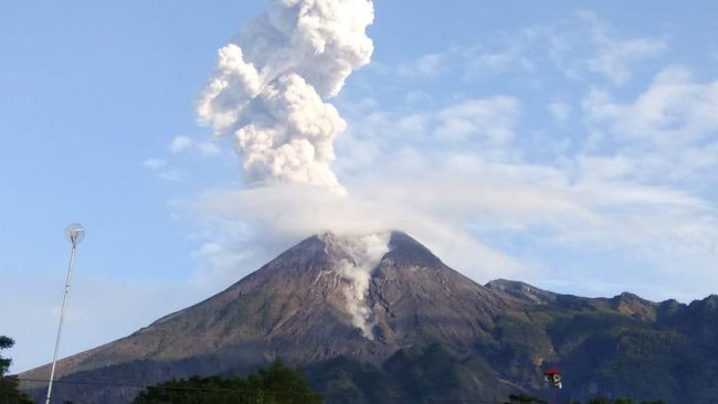
On the Indonesian website krjogja.com it is reported that the Merapi has entered a new phase with dome growth. This information comes from Agus Budi Santoso, the head of the Merapi Volcano section at the BPPTKG. The new intrusion is the 7th phase since the beginning of the eruption and is accompanied by explosive activity and deep seismic. The larger eruptions in the first half of the year would have more than halved the volume of the lava dome to 200,000 cubic metres. Now it looks as if the dome is getting bigger again, increasing the potential danger.

Nishinoshima: Eruption increased

The Japanese island volcano Nishinoshima continues to make headlines. The VAAC issued numerous VONA warnings of ash clouds. Currently volcanic ash is registered at an altitude of 7300 m above sea level. Since the cinder cone is only a few 100 m high, this represents a remarkably large eruption cloud. The peak value yesterday was 4200 m and was described in Japanese media as the highest ash cloud since the beginning of the eruption. The thermal radiation yesterday had a power of 1860 MW and is therefore also in a very high range. So lava flows are still being produced, which will change the face of the island forever. Nishinoshima is growing and growing. Radar images show that not only the coastline is constantly shifting, but also the cinder cone with the explosive crater is subject to major changes. It looks as if a major collapse has occurred in the south of the cone. Probably the collapse was caused by a new lava flow.

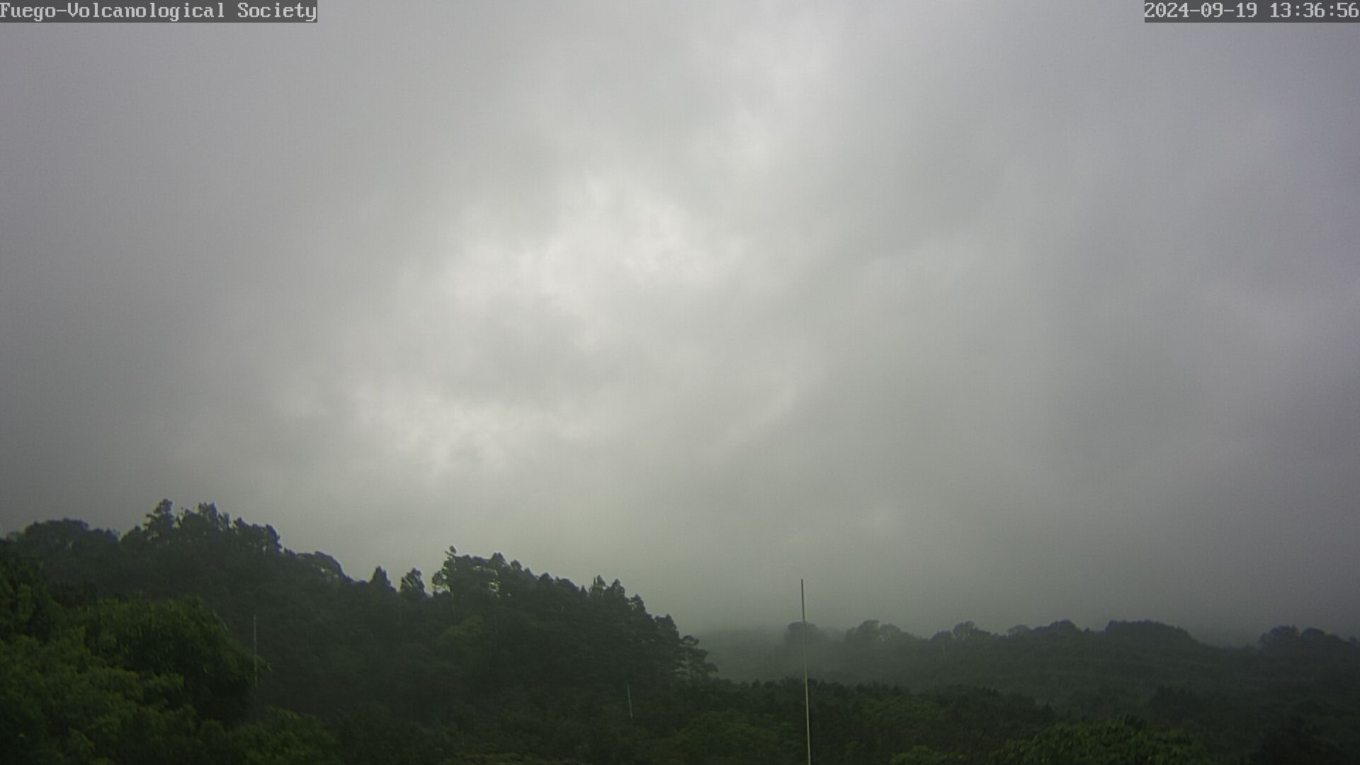
Livecam Fuego

Livecam of the Volcano Fuego in Guatemala. © Volcanological Society e.V.

The Webcam was installed by Marc Szeglat (vulkane.net) in cooperation with the Volcanological Society e.V.. To load a new image, please update the page.

The Livecam is located at the foot of the volcano Fuego, not far from the old golf course near La Reunion. Special thanks to Ulrich Schirmer, on whose property the camera is located.

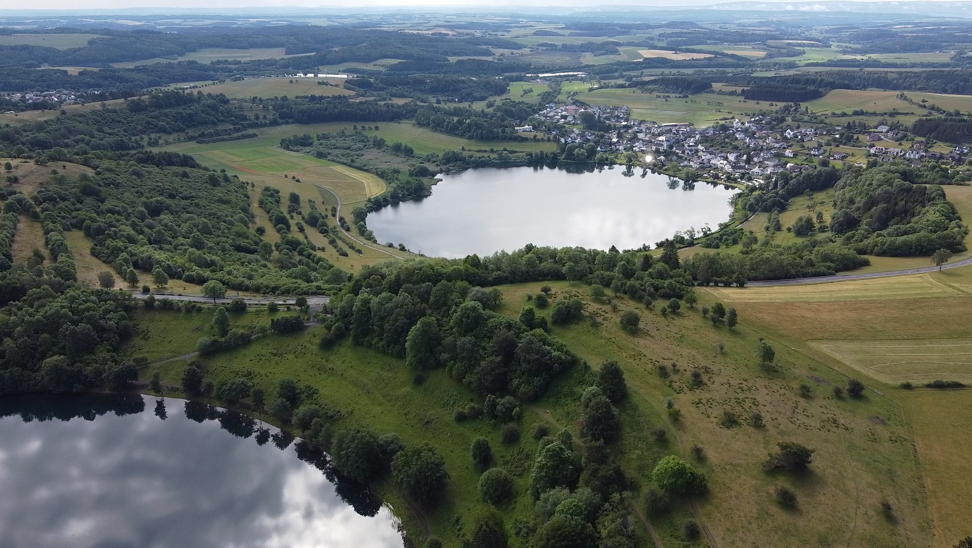
Vulkaneifel: News from the hot spot

The Volcanic Eifel in the mid-west of Germany is home to a volcanic field that many volcanologists classify as active. The last eruption occurred here 10,900 years ago, exceeding the mark by 900 years from which a volcano is considered extinct. But recent studies show that volcanoes can erupt again even after a much longer dormant period.

For a long time, volcanologists puzzled over how the volcanism of the Eifel came about. 2 theories were put forward: The volcanoes are located on the shoulder of a divergent fault zone. This rift is marked by the course of the river Rhine. So the volcanism could be tectonically caused. But often volcanoes are formed in the middle of a continental plate by mantle plumes, which are often called hotspots. Such a hotspot has also been postulated for the Eifel and detected by seismic tomography. However, this did not tell us whether this hotspot was actually still active. Now a new study has shown that the ground in the area of the Volcanic Eifel is rising and the uplift covers a much larger area than previously suspected. Not only the area around the two volcanic fields of the Eifel is being raised, but also a part of the Rhenish Slate Mountains.

A science team led by Corné Kreemer of the University of Nevada, examined millions of GPS data from Europe collected over 20 years to track down possible ground deformations. In fact, in the Eifel region, the researchers discovered not only a vertical ground elevation, but also a zone of horizontal elongation surrounded by a radial pattern of shortening. This area is significantly larger than the Volcanic Eifel. If one corrects the uplift rates of the ground by the value of the isostatic rise, which is still caused by the melting of ice during the last ice age, one arrives at an uplift rate of about 1 mm per year. Scientists describe the rate of uplift as remarkable and assume that it is caused by the buoyancy forces of the mantle plume. Such uplift forces in a rock body can only occur if the rock is less dense than the surrounding rock, which is the case with a plume if at least part of the rock is in the form of melt. These conclusions suggest that the volcanoes of the Eifel could one day become active again. However, there are no signs of an imminent volcanic eruption.

(Source: https://doi.org/10.1093/gji/ggaa227)


Pacaya: Drone shots from January

Eruptions of volcano Pacaya in Guatemala during my stay in January 2020. I climbed the McKenney crater and stood up in front of the active hornito. Lava spattering and mild strombolian eruptions took place. A episode with a lava flow was the highlight of this day.

In the spring of 2021, the volcano’s activity increased significantly. A series of smaller paroxysms occurred, producing ash clouds rising to an altitude of 3800 m. A short eruptive fissure developed on the lower western flank of Mc Kenney cone. Lava flows up to 3 km long flowed down the volcanic slope and reached farmland. Some buildings were destroyed.