Adventures around the volcanoes of East Africa
Author Chris Weber
The Virunga Volcanoes (1996 and 2011)
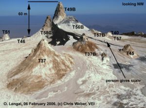
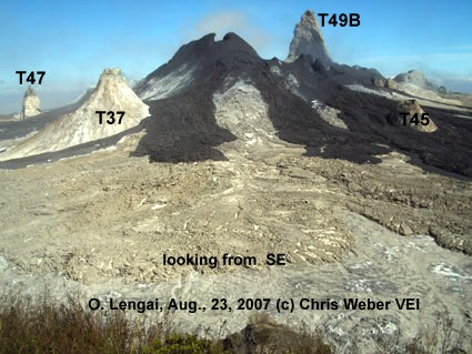
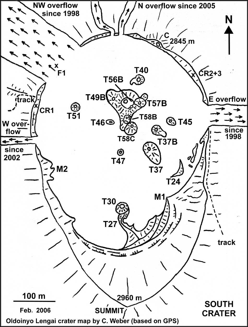
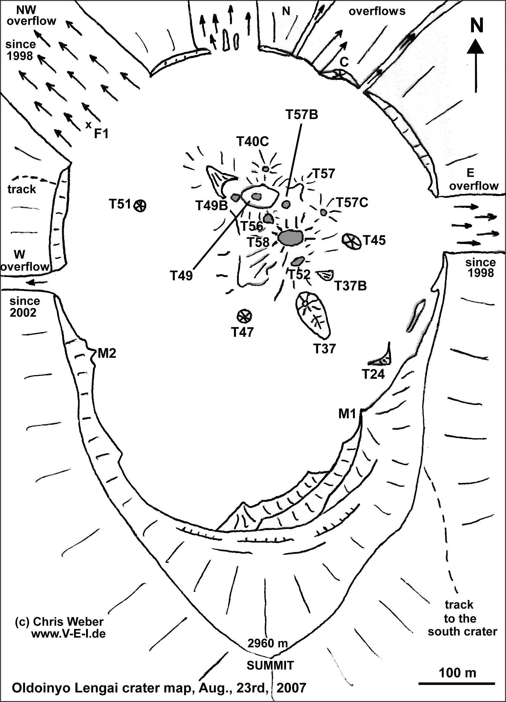
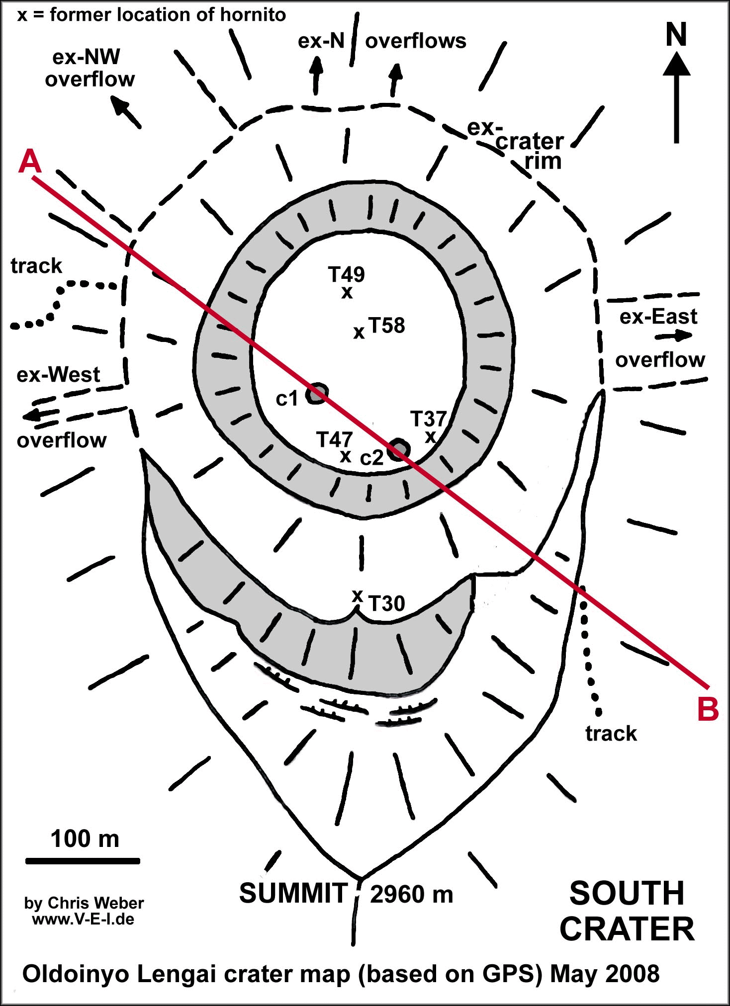
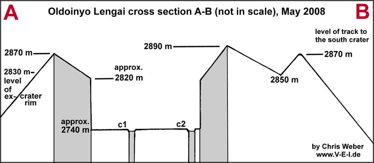
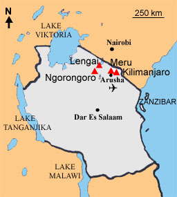
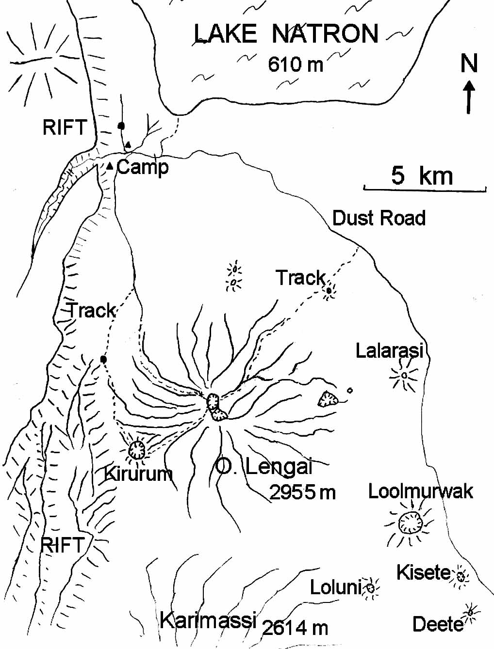
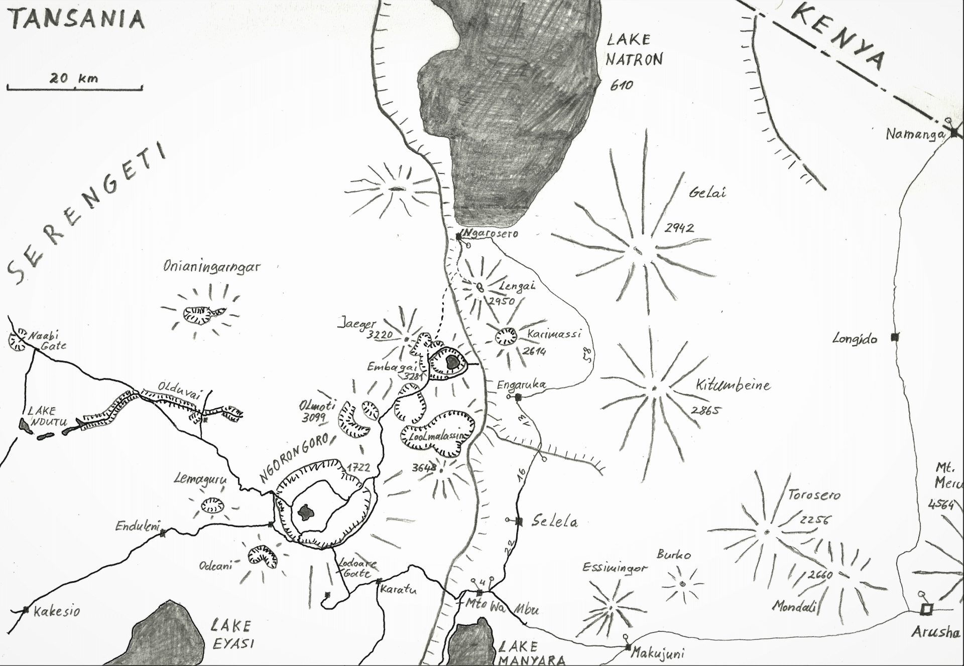
Oldoinyo Lengai: The holy mountain of the Masai (1996 until 2008)
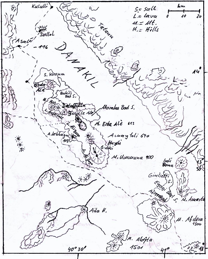
Erta Ale and the Danakil (2002 until 2016)
African Rift Valley East
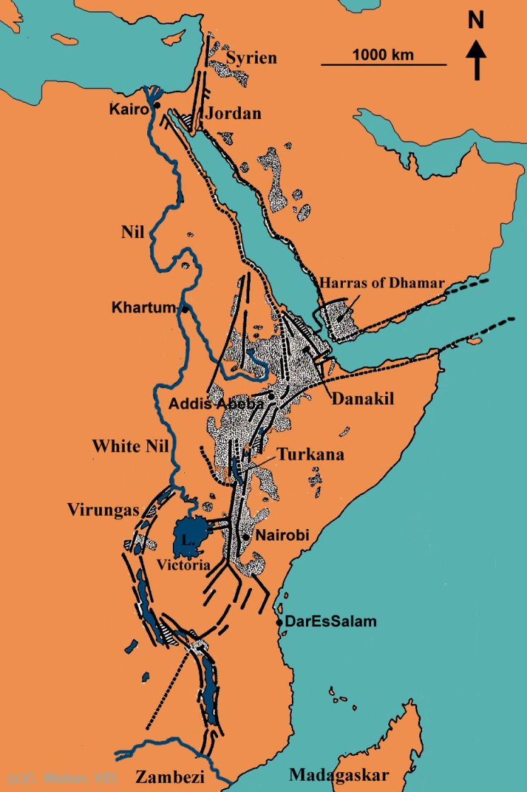
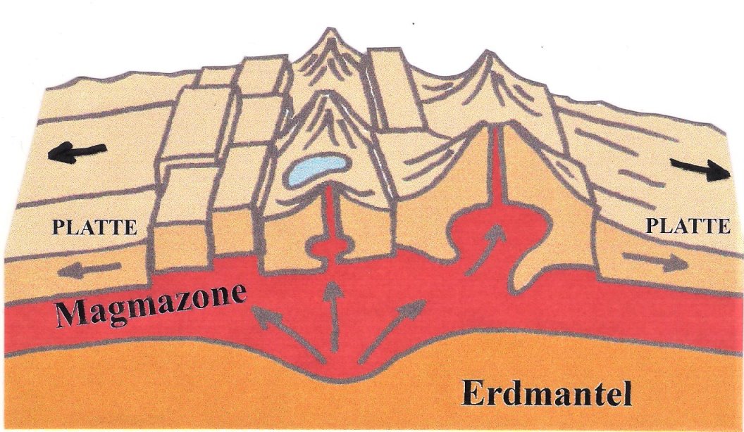
The East African Rift system extends from the Jordan Valley through the Red Sea, southwards through East Africa and then along the Zambezi River. This system is about 6500 km long. The active continental rift volcanism in East Africa created great faults with an average width of 50-60 km. In places, parts of the earth’s crust has sunk, while in other places the edges of the trench has been lifted up.
As a result, the altitude of the bottom of the trench varies from 600-900 meters below the trench shoulders. In some areas this difference in altitude is even up to 3000 meters. Sediments and lava have partially filled the rift over millions of years.
Turning inland from the Red Sea into Ethiopia, the rift is dividing the country into the highlands to the west and lower desert to the east. Then in Kenya and Uganda two separate branches go apart and join together at their southern end in southern Tanzania along its border with Zambia. The Western Rift is also called the Albertinen Rift, including the Ruwenzori Range, plus the Mitumba and Virunga Mountains. The deepest valleys are found to the north of Kenyas capital Niarobi.
The most of the great rift lake was formed as the result of the rift-system, and lies in territories within the rift. Lake Victoria is considered to be part of the rift-valley-system, although its found actually between the two rift branches. The most rift lakes have high mineral contents as result of evaporation of water, like Lake Magadi with a high concentration of soda, meanwhile Lake Bogoria and Lake Natron are all strongly alkaline, while freshwater springs who supply the lake Naivasha do support the current biological variety. The southern section of the Rift Valley with lake Malawi hosts the third deepest freshwater lake in the world and reaches 706 metres surface to bottom.
The two major gateway-towns of the East African Rift are Nairobi in Kenya and Addis Abeba in Ethiopia.
Continental Rift Volcanism
The East African Rift is the most important example of continental rift volcanism. Another good example is the Upper Rhein Graben (rift) in Germany. But much more widespread or predominant on Earth is the mid-ocean rift volcanism usually deep down in the oceans. This is the same geophysical principle of earth plates drifting apart, but differs in the uplifting rock melt (magma).
Continental rift volcanism arises where convection currents in the interior of the earth drive the continental lithospheric plates (earth’s crustal plates) apart. The so formed fracture gaps are then filled up with volcanic products from the earth’s interior. Volcanoes arise and floods of magma pour into the fractures as viscose lava flows.
This process can stretch over hundreds of millions of years and might be accompanied by epochs of immobility. With the current examples of the East African Rift and the Upper Rhein Rift, which today are apparently subject to a small spreading scale, nevertheless, one day the subcontinent could migrate apart so that a new ocean is created.
Adventures around the volcanoes of East Africa
The Virunga volcanoes (1996 and 2011)
Part 1: Gorillas of Zaire (Rep. Kongo)
After I had eaten dust being whirled up by some UN trucks with goods for the refugees in Goma, while sitting on an open pickup truck which had given me a lift, public transport stopped finally at the frontier-post between Uganda and East Zaire. So I had to hire a local guide to continue on foot. We went through lush farmland up on the slopes of Sabinyo volcano.
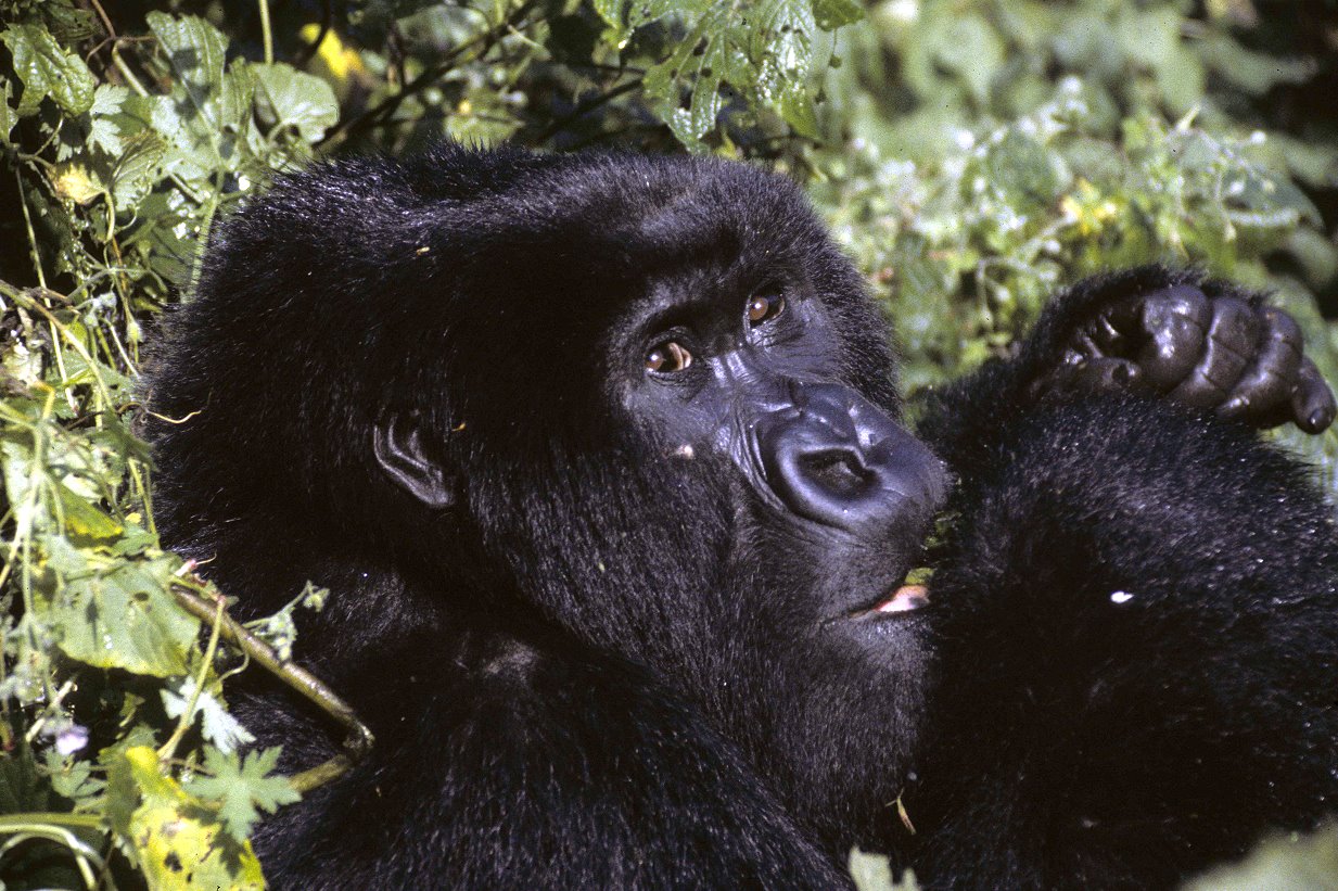
This mountain and the neighboring Virunga volcanoes of Muhavura, Gahinga, just north of Sabinyo, and Visoke, Karisimbi (the highest with 4507m) and Mikeno to the south, give home to the last about remaining 600 mountain gorillas (Gorilla beringe). They hide at higher altitudes of those volcanoes in the tropical so called cloud forest, forming a fairly tale scenic atmosphere.
One day of hard and rough walking along narrow footpaths, luckily free of landmines, brought me up to the cloud forest line of Mikeno. There I had to pay a 130 US fee cash at the basic ranger station to take off the next day visiting the gorillas with an armed patrol. Well, good invested money, to keep the primates protected against poachers, hungry sodliers or refugees. Therefore most of the gorilla families have armed rangers living with them all along the time.
It was early morning when we took off into the mysterious jungle, following the gorillas tracks through thick forest for hours. Finally we arrived at an opening where a big family group of 25 gorillas were feeding and relaxing. A half ton silver back, hat of this group, washed from time to time, while gorilla babies were coming closer to check my photo equipment and my laces. After two hours or so, we left these nice creatures excited and fascinated.
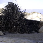
I walked down from these volcanoes and met the paved road to Goma, when an overloaded pickup truck stopped to pick me up. Our truck got stopped three times on a few kilometers and on the third stop zairen soldiers ordered me to hop of. The driver of the truck said sorry drove off. I know, that the zaire soldiers got paid by their government in invalided money such as the Zaire and that’s because of hunger they kill wild animals and steal in villages, even once they looted and ruined Goma.
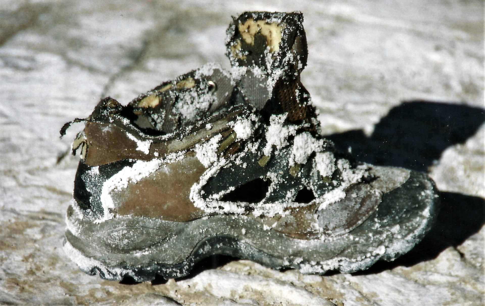
So, I was quite nervous when some lousy looking soldiers escorted me in a dark hut of the road, standing in front of a greening hire raked officer. I explained, that the only reason to come here was the attempt to climb the volcano Nyiragongo, that´s why I was wearing military boots. I knew ahead, that these shoes would have had brought some trouble to me in East Africa. So I had to pay my way out by little cash and cigarettes. John, a local translator for care-oganisations and journalist told me some days later in Goma, that it’s impossibile to get any kind of good shoes around Goma.
In the surrounding of Goma huge refugee camps with kilometers of space hosted some hundreds of thousands of Hutus who had started an exodus from Ruanda into Zaire in the 1970’s after first massacres took place by the Tutsi minority. Then, after many incidences 1994, the Hutu took revenge and killed 75 percent of the Tutsi and moderate Hutus. Alone in June and July up to 1 million people were killed. Finally, the rebel group RPF took over in Ruanda and installed a Tutsi government again, causing countless Hutu to flee out of the country.
Part 2: Nyiragongo volcano hike
There was little to say about Goma itself, because this ruined town was a total mess with hotels and restaurants closed, shops emty and an UN oganisation (pease and aid force) behind many high fence lines. After one night in Goma without any food except Coca Cola, and went out on the road again ot reach the foot of Nyiragongo. It was out of the question to clime up the volcano without guide an armed force, because of gang (bandits) actyvities around volcanoes such as RPF rebels and others.
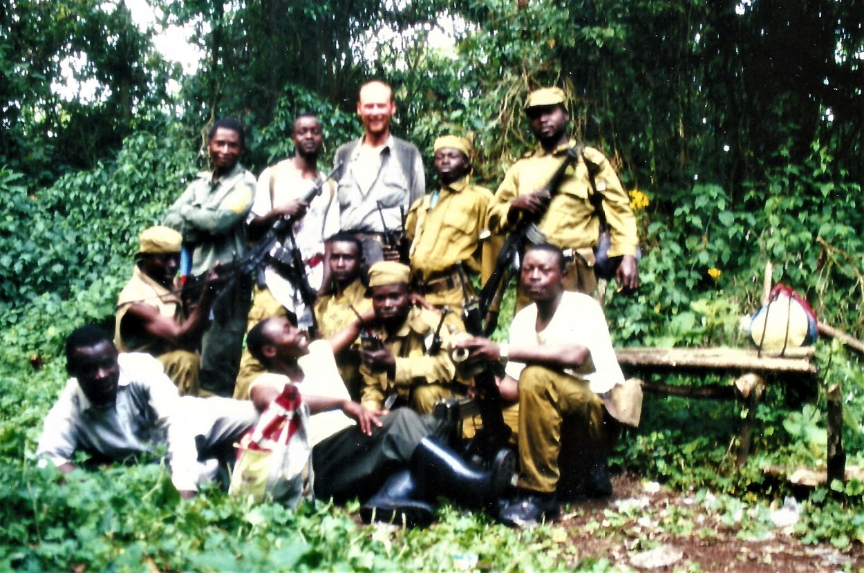
So I went to the national park headquarter asking for help. Two remained officers were surprised to see me as a visitor, but the very nice Mr. Kivuya Wa Viui agreed to join me up the volcano after a long conversation and after paying the 100 US fee for hiking the mountain, plus some extra for my guide. Maybe the only incoming for Kivuya since many mounth. At a nearby zairen military post we founed luckely a solution get a well armed group. The chef officer was so amazed of my crazy wish to clime Nyiragogo, that he ordered a docent soldiers for this expedition.
I wasn’t really sure about of putting my life and my army boots into the hand of a group of Rambos with no shoes. Well, there was one more problem, my leeck of any food. But after checking this jung guys out and the fact, that this forest are hiding places for Hutu and Titsi, gave me no other option. For this evening Mr. Kivuay gave me some food and a place to lay dowen my sleeping bag.
Our expedition started by early morning it was best armed with an amazing viorty of weaponds. Soon we entered the jungle at its best with heat, humidity crying monkeys and crazy loud zikades. During a brack, I pulled out my foto camera and instandly watched into the soldies big eyes. Well, for sure it was in their eyes a fortioned. But they made jokes about in the next minute and asked for a group picture all together. Then they gave me some of their food, an unkowen paste of sweet rood.
We walked up a slippy path under combat conditions with one little group well ahead of us, when suddenly loud gun fire started. I stopped breathing, went down and listened, meanwhile some soldiers rushed up the path. The exosting trecking was forgotten for the monemt. I look to Kivuay next to me. He was shaking his head and asked a soldier with whispering voice. Then he greened to me and explained, that it was just a salute for a shot comrade a while ago. Well thanks, thought I.
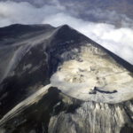
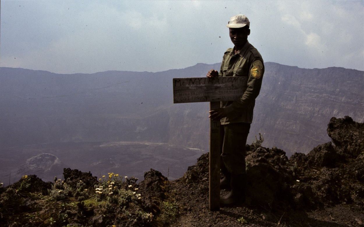
We reached a hut half an hour below the crater rim after 5 hrs. of tracking. Me and the armed ranger Kivuay agreed that the soldiers would retuned slowly back down the volcano. No, rebels, they said, not asking for a single Dollar. Well, only bush land was on the upper slopes of 3470 m high Nyiragongo, and it was quite cold already. Mr. Kivuay and I went up to the crater rim for some hours, so that I could document the geological situation of the volcano.
For this night we returned to a little and cold hut with open door and window. It was aufull only wirh a bed of leaves. The following morning we went up again for some pictures, then we started our descent. Half way douwn Kivuay pulled me of the track deep into the bushes and me getting doon and being quide, so did I. Some sldiers pass by. At the ranger post Kivuay explaned to me, that he was afrait of frandly fire. I left my body with an extra tip, paid my way via Goma to the frontier of Ruanda.
Part 3: Through Ruanda
Crossing for Zaire into Ruanda these days mend unpacking the backpack at cable military checkpoint and explaining my reason of travel, as well why I carried a meter long bush knife (sometimes I asked myself too) and what I’m supposed to do with my photo camera. I maganed anrgy and swetting to anwers this and reached the border town Gisenyi, got a hotl and some food, A riseing dawn I wend out to take a few pitures of destroyed military machenery from the Ruanades conflic, well knowing that I had to be carefully by doing this. But the treets were emty in my opinion, so I took pictures.
When I start to walk back two military guys came across towards me. Oh oh, I thought. They said, ‘it’s forbidden to take pictures in Gisenyi’ and asked for my camera. I said no and that I was only taking pictures of the sun set over lake Kivu. They escorted me to a closed by police station. A nother military showed and after a discusion they aksed the film roll in my camera. To give the roll away with the of Nyiragogo and Gorillas away was out of the question. We argued I asked of higher rank officer again and again They agreed and two of them wend of.
That was my chance. I said ‘I need to go to toilet’ and to my surprise they had one in the station, even a real flushing one, and let me go. I closed the door, pulled out my camera, flushed the toilet, pushed the rewind button the camera motor did so, took the film roll out, a new inside, closed, flushed again and wend out. The militaries igrored me and the matter facted, that I was swetting like hell. Soon after, an argry officer showed amd asked for the film roll. Well, I took it out and handed over to him, than I left. The laugh was on my side for right now.
There was for sure no photo shop to develop my film roll, to make sure I left Gisenyi at dusk without breakfast on a big truck towards the frontier of Tanzania. Counless military stops and the frontier paper work took me all day long. Luckyly I got a nother truck on the tanzanien side, where a million refugees camped along the road since over two years. In one center of those elend I had to hopp of the truck already by night. So far safe, but hungry and tyred.
The nice truck driver asked for me around where to spend the night. An english speaking guy showed me a splace in a tent and a bessar cinemar where I could founde food and a coke. Maybe 50 relativly previleged or so, wathched quite silently the movie ‘Over the top’ with the actor Silvester Stallone on a small TV. Entrance fee of the cine was a quarter of a Dollar. This unreal, real situation made me some tears comming into me eyes. I left this burned, sad and tortured land towards the Serengeti, crossed the national park and reached the town Arusha, an urban paradise in compare.
Nyiragongo
Abstract
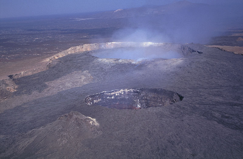
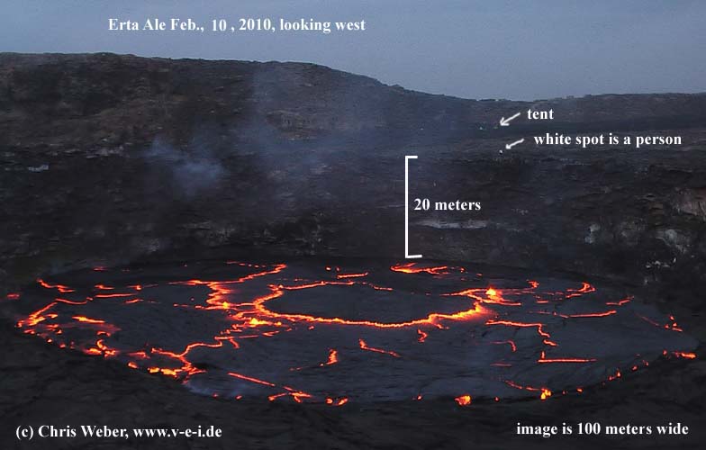
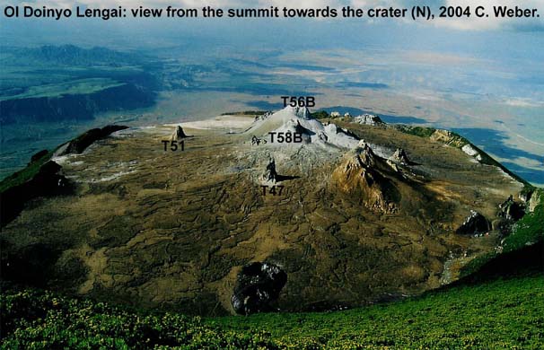
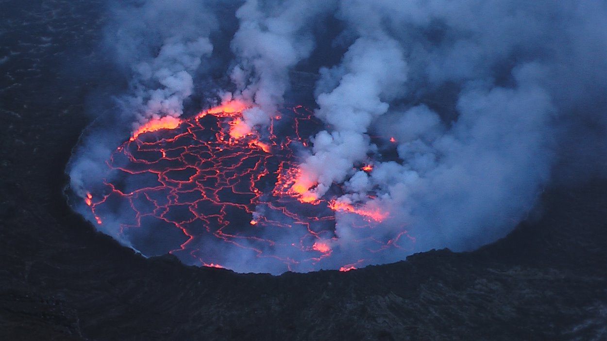
The 3470 m high strato volcano Nyiragongo is part of the Virunga mountains, which consist of 8 volcanoes. One of Africa’s most notable active volcanoes contained a lava lake from time to time in its deep summit crater.This lava lake was exsisting for half a century before outer flanks draining catastrophically in 1977. The steep slopes of a volcano are in contrast to the lower profile of the neighboring shield volcano Nyamuragira to the north. The 1.2 km wide summit crater has benches in the steep walled. Mark levels of former lava lakes, which have been observed since the late 19th century are found. The older strato volcanoes of Baruta and Shaheru are overlapped by the recent Nyiragongo and partially still seen on the north and south. Around 100 parasitic cones are located along radial fissures as far as Lake Kivu to the south. Many cones are buried by lava flows already, that extend long distances down the flanks, In 1977, the extremely fluid lava flows caused many fatalities on the south-east flank. The fluid lava flows towards the south in January 2002, destroyed a major portions of the city of Goma at lake Kivu.
Activity Reports
Observation on 3 August 1996.
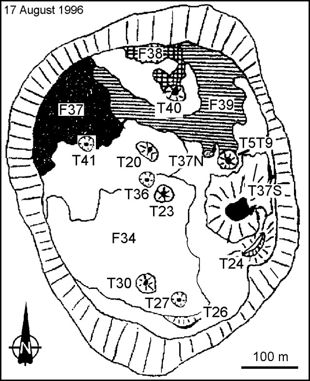
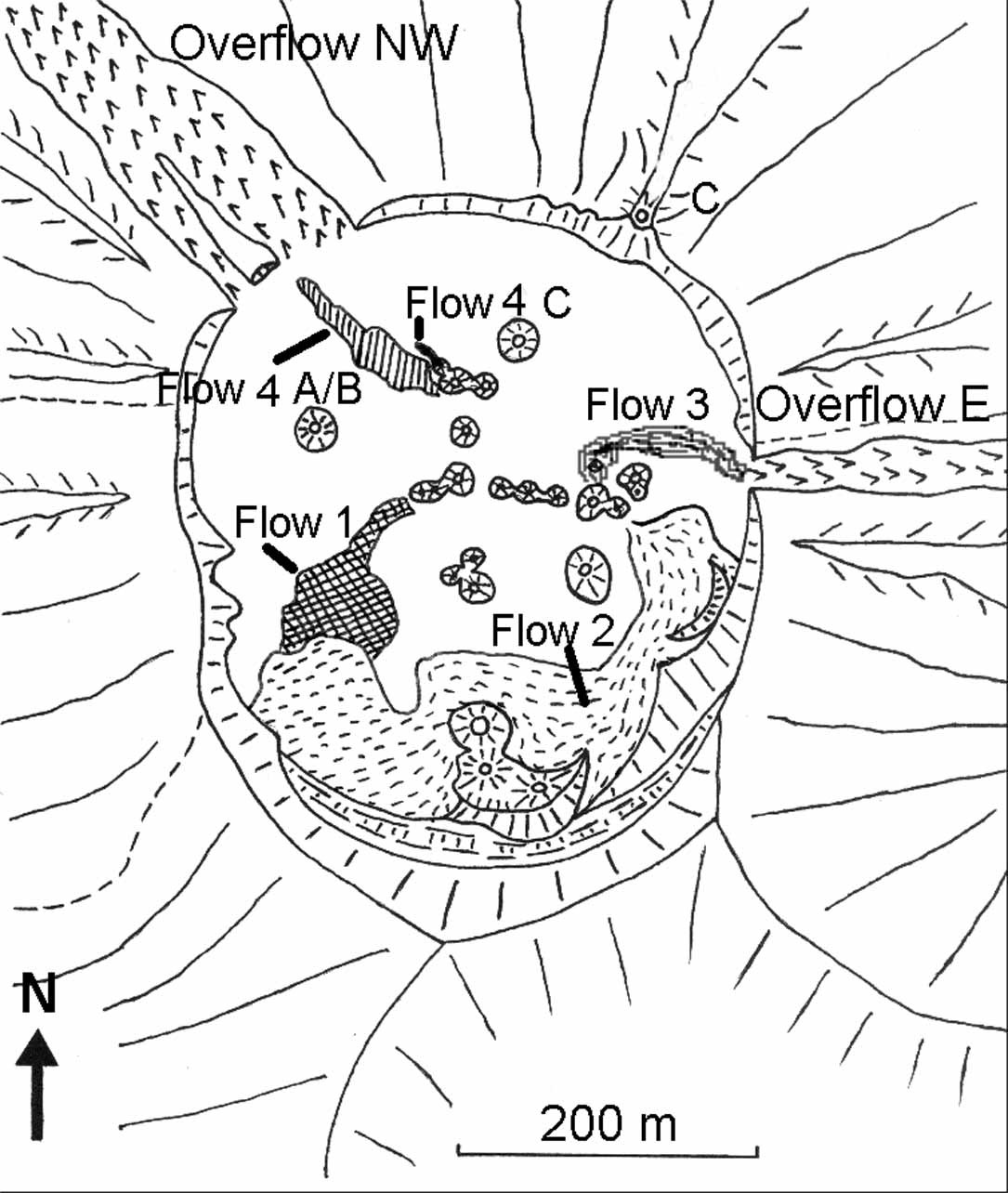
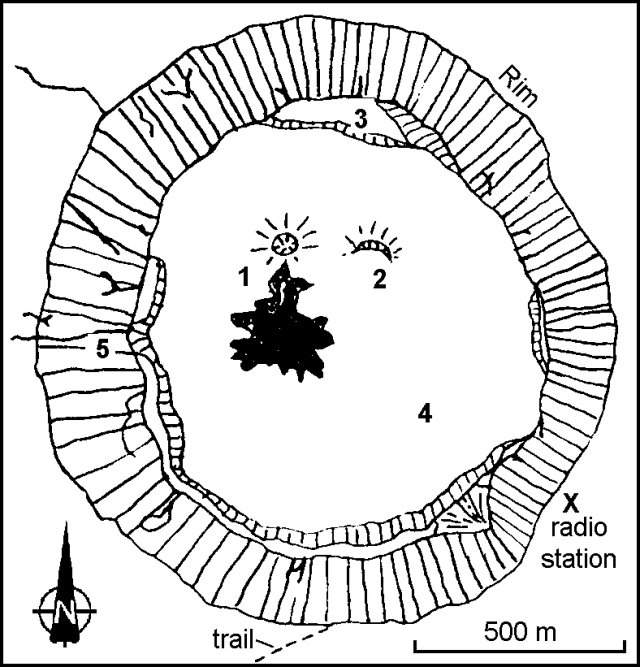
Christoph Weber visited the volcano on 3 August 1996 and made a rough sketch map. Weber also saw no new activity. Features in the crater area included a spatter cone, a feature bordered on its S side with a light gray lava flow (dark shading 1). This flow was apparently the last erupted prior to the visit and it still showed fresh-looking flow channels. Weak fumaroles were located along the SE crater’s wall at concentric fractures ~50-150 m below the crater rim. Weber also relayed that seismologist Mahinda Kasereka had seen typical seismicity around this time interval
Members of an SVE excursion who climbed Nyiragongo during the second week of April 1996 found also no visible eruptive activity. They heard from local residents that the eruption that began in June 1994 (BGVN 19:06-19:08) had ended in September 1995. Whether the eruption actually ceased in September 1995 is ambiguous because Dario Tedesco learned that in November 1995 and in February-March 1996 observers saw glow above the crater at night. Also, Tedesco learned that some tourists spending the night near the summit during this same post-September interval allegedly saw minor activity. Some sustained seismic activity was reported in September through early December 1995 (BGVN 21:01).
Figure below: Nyiragongo sketch map showing the crater in August 1996. Symbols are as follows: 1) Spatter cone with last lava flows (shaded); 2) spatter half-cone; 3) first platform (or bench, ~175 m below the crater rim); 4) surface of chilled lava lake and associated lava flows (~275 m below the rim); and 5) dikes. Courtesy of Christoph Weber.
Observations in January 2011. Chris Weber visited Nyiragongo with an expedition group from 19 until 22 Jan. 2011. Lava lake activity of the last years continued into January. The first platform from the eastern crater rim at 3420 m was still ~175 m below and marked the post-1977 level. The lowest platform inside the crater was at 3020 m (level of post-2002), which made a total of ~400 m. A high dynamics lava lake, consisted of the lava fountains, measured roughly 200 diameter and was hosted behind an 20 m high ring wall built by lava spattering.
References
The following references have all been used during the compilation of data for this volcano, it is not a comprehensive bibliography.
Krafft M, 1990. Fuhrer zu den Virunga-Vulkanen. Stuttgart: Ferdinand Enke
Global Volcanism Program (GVP), 1996. Bulletin of Global Volcanism Network (BGVN), Smithsonian Institution
(page 5)