Pacaya in 2020

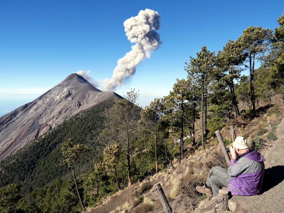
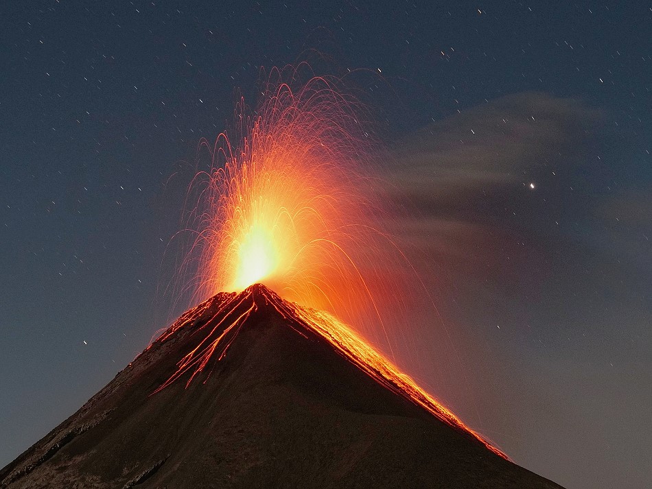
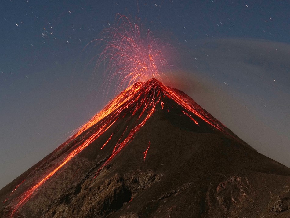
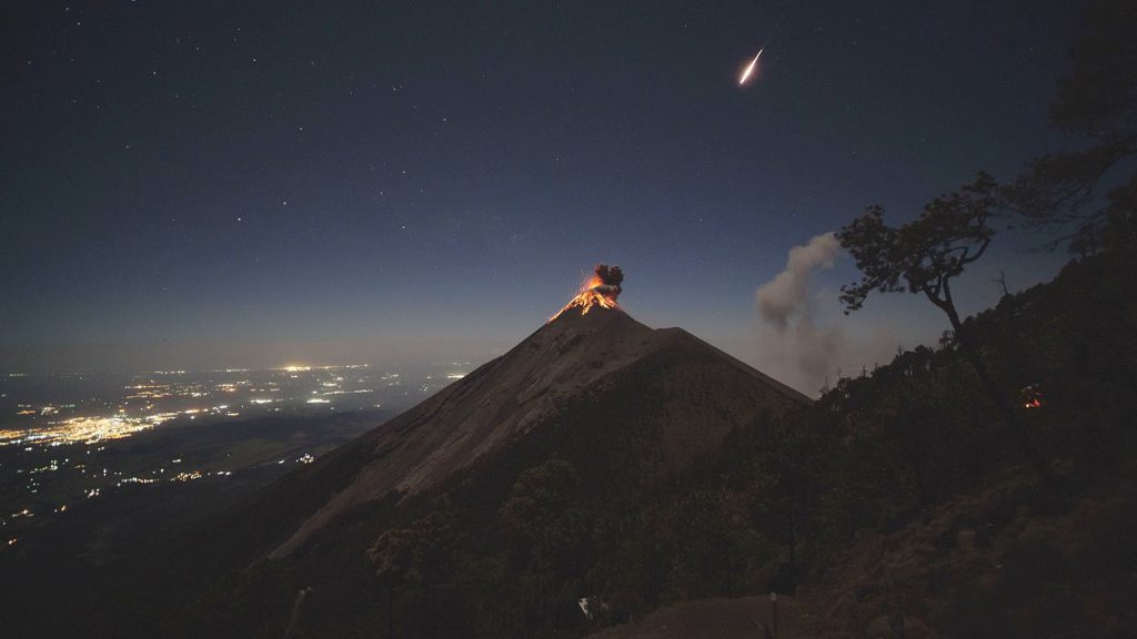
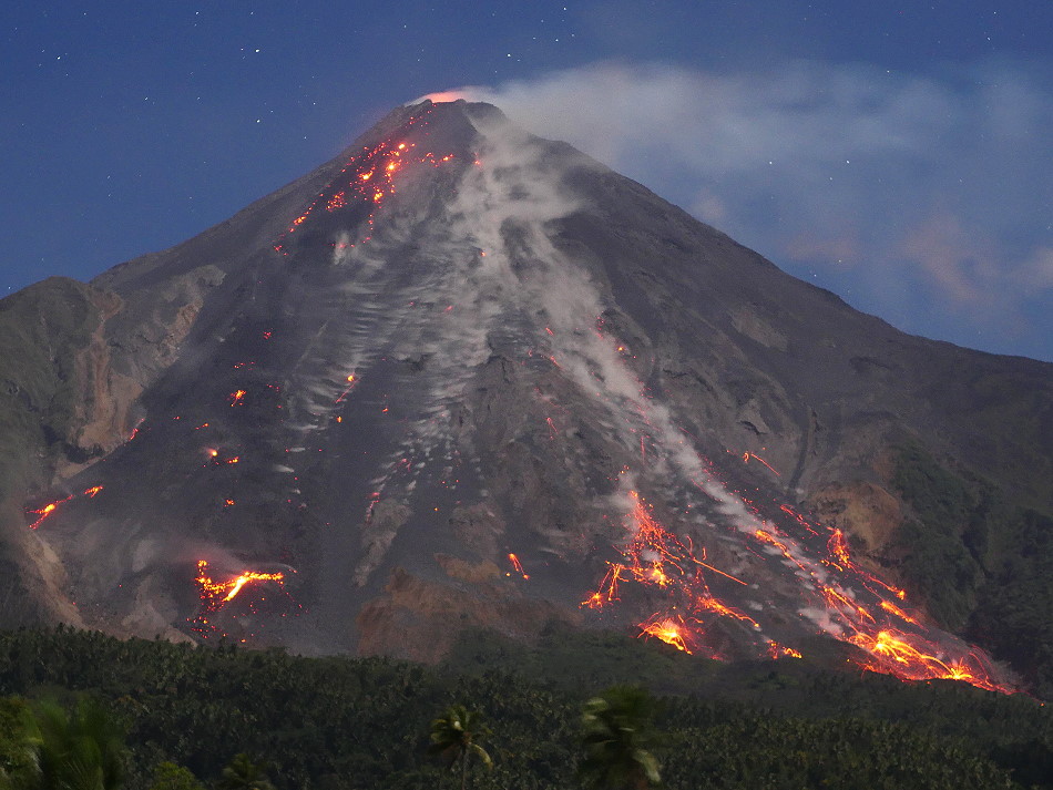
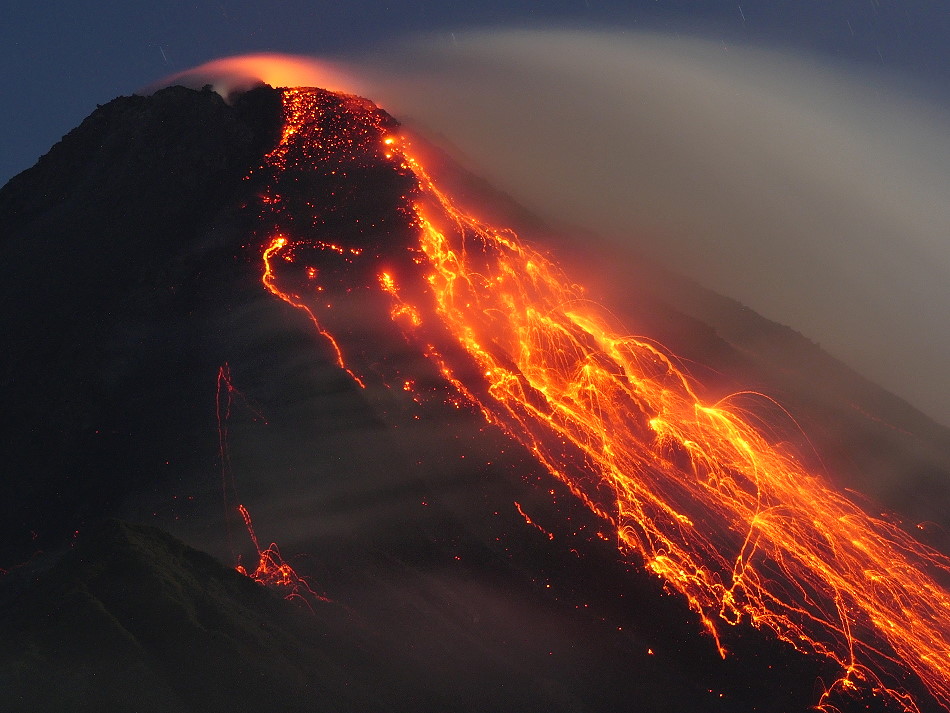
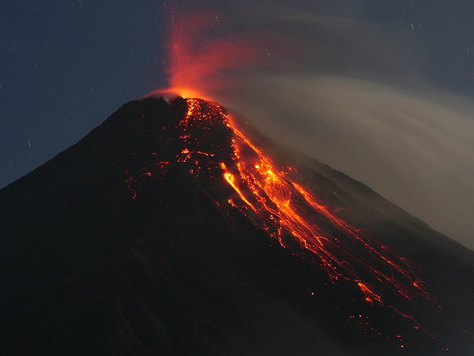
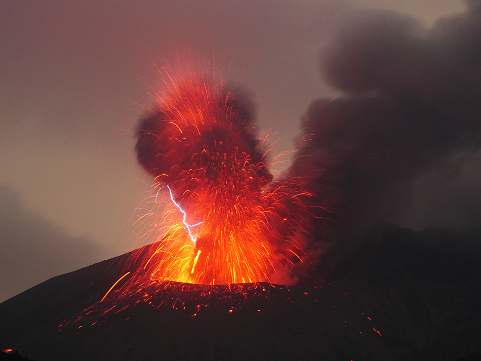
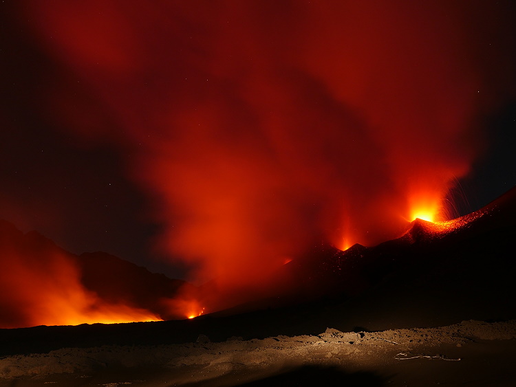
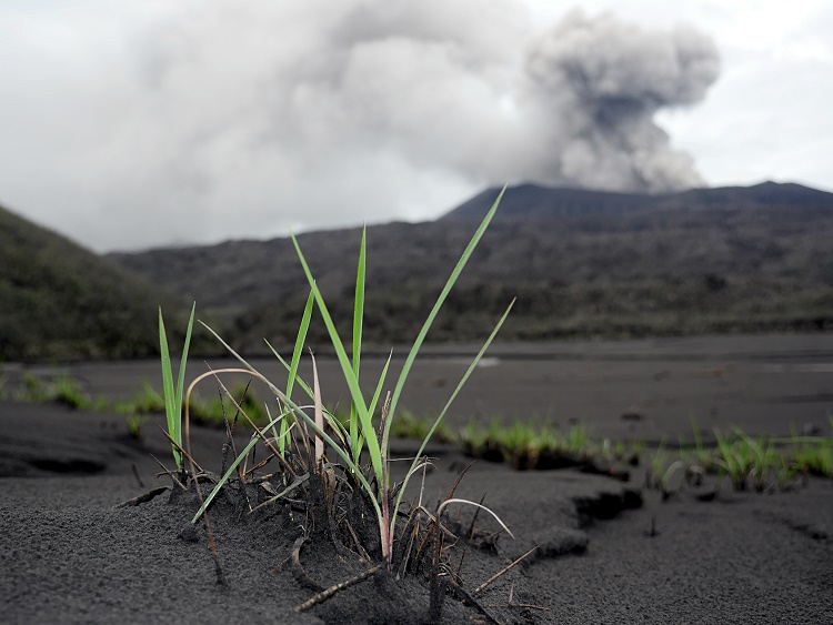
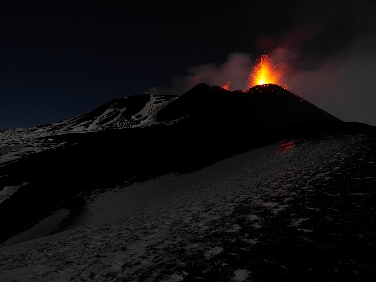
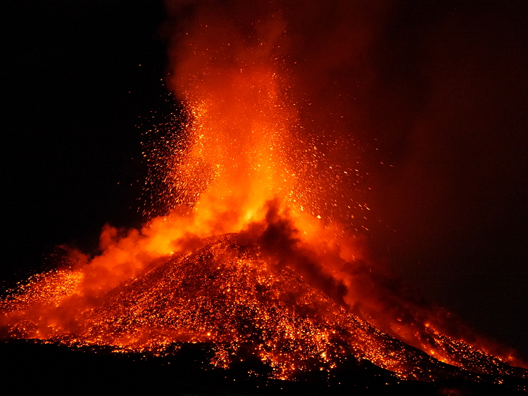
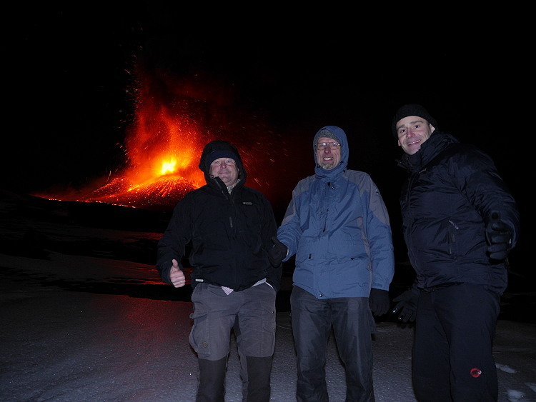
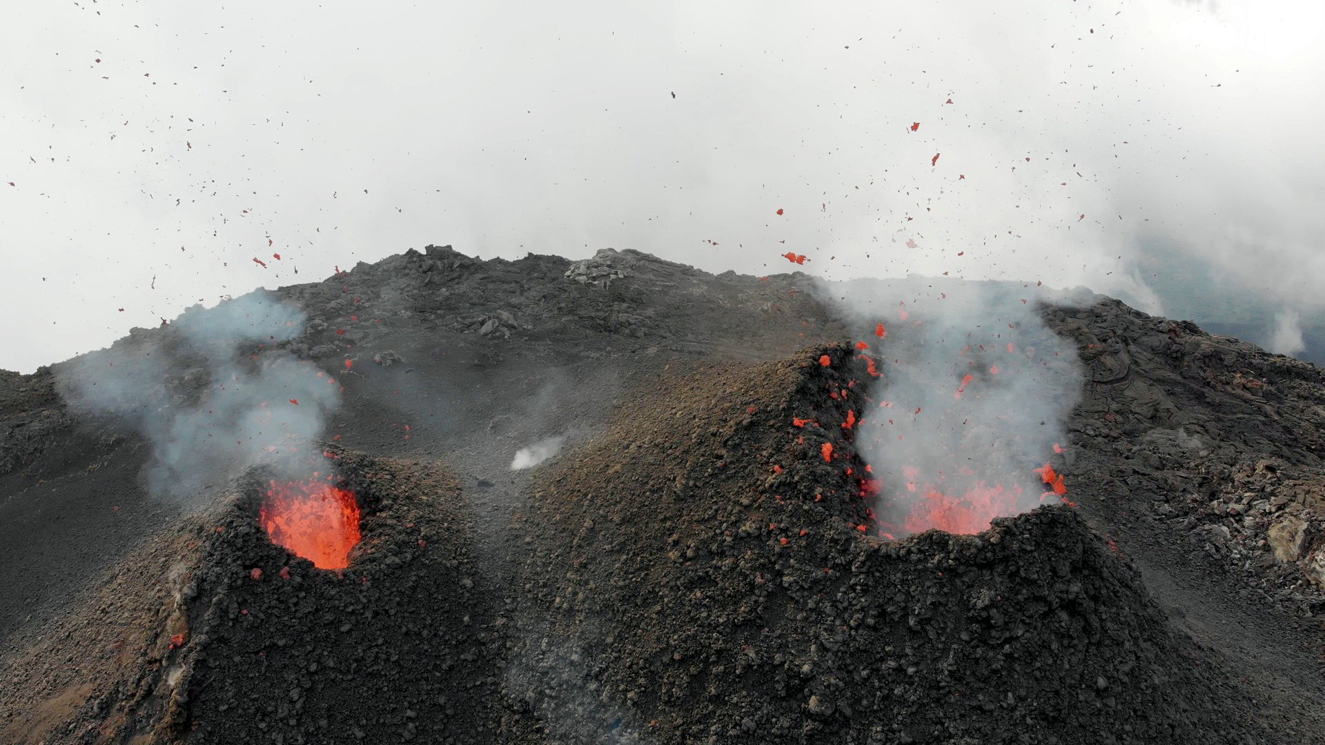
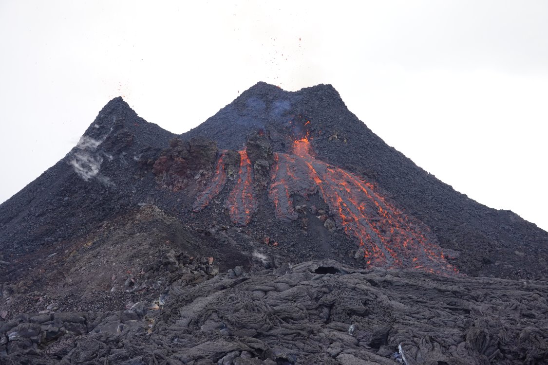
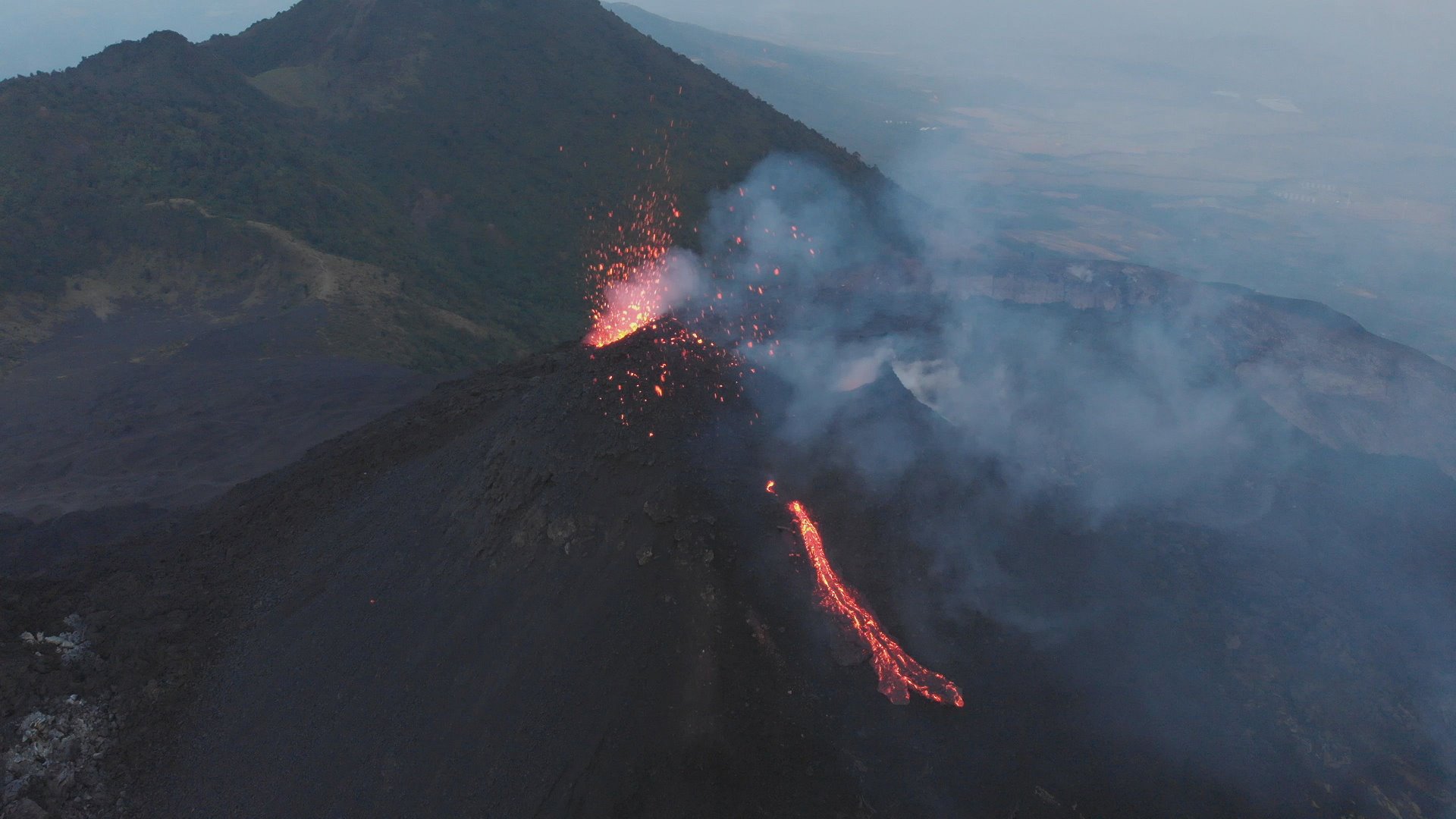
In January 2020 I spent 3 days at the volcano Pacaya in Guatemala. Since months the fire mountain was strombolian active and produced lava flows from time to time. So the volcano attracted me for the 2nd time within 2 years. Compared to March 2018 the hornito was much larger and now had 2 distinct chimneys, both of which were active.

Jaime, the host of Salamandras House picked me up Friday evening with his pickup truck from the airport in Guatemala City. The man from El Salvador greeted me warmly and took me to the supermarket on the way to Pacaya. There is no serious shopping possibility directly at the volcano. Only a small kiosk offers sweets and beer, which is the most important thing to get along at the volcano for a while. Arriving at the inn I thought about climbing up directly in the first night, but somehow the tiredness won. Strong wind and clouds didn’t motivate me very much and so I climbed the Pacaya only the next morning.

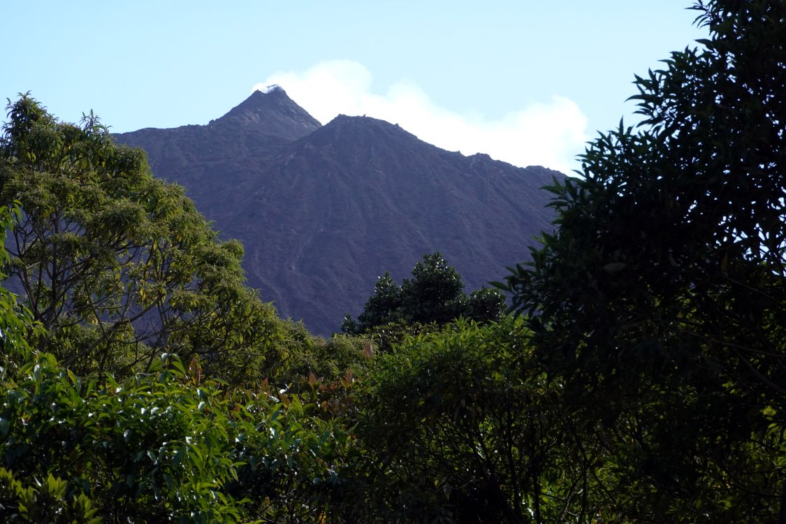
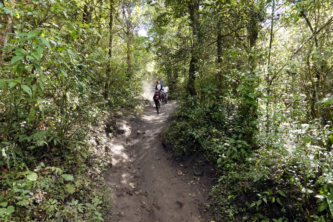
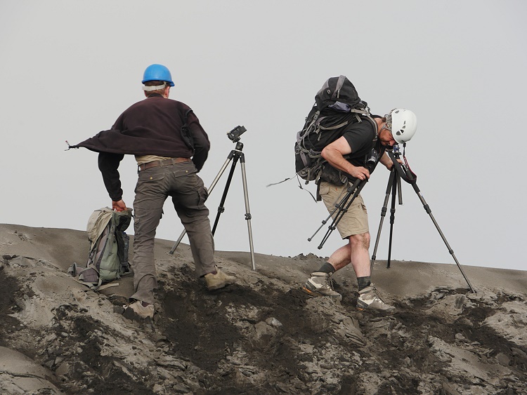
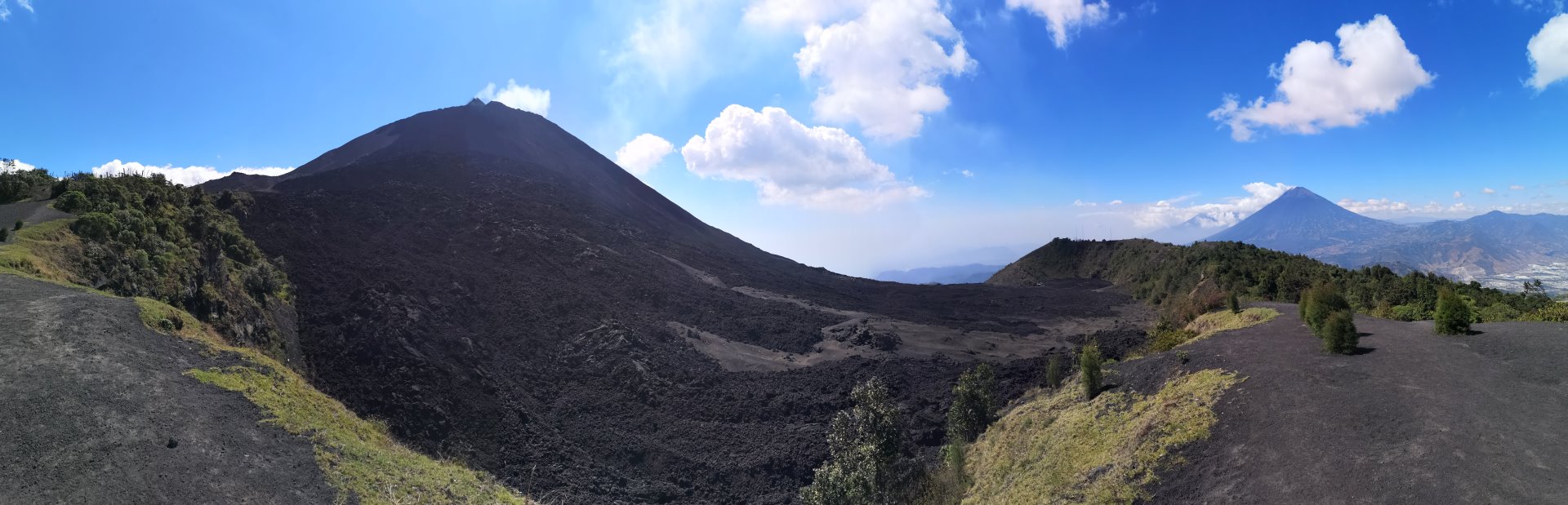
The first part of the ascent did not pose any particular hurdles, except for the fact that the first hundred meters of altitude difference are quite steep. As the park entrance (yes, the Pacaya is protected in a national park and one has to pay 50 Quetzales entrance fee) is located at a height of barely 1700 m, I immediately started to breathe and sweat. But with increasing height at least the sweating stopped. At the end of the vegetation zone, all those volcano hikers who had joined a guided group gathered and looked longingly to the summit. The last 300 meters of altitude difference can still be climbed – contrary to the rules – but one must not be deterred or stopped by the prohibition signs and the rather steep path through loose lapilli. So I stomped on determinedly and stood at the edge of the My Kenney crater at noon and looked at the two hissing chimneys of the hornito.

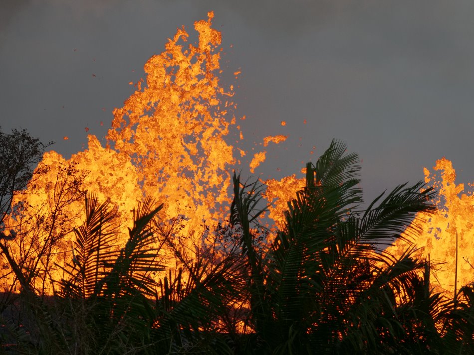
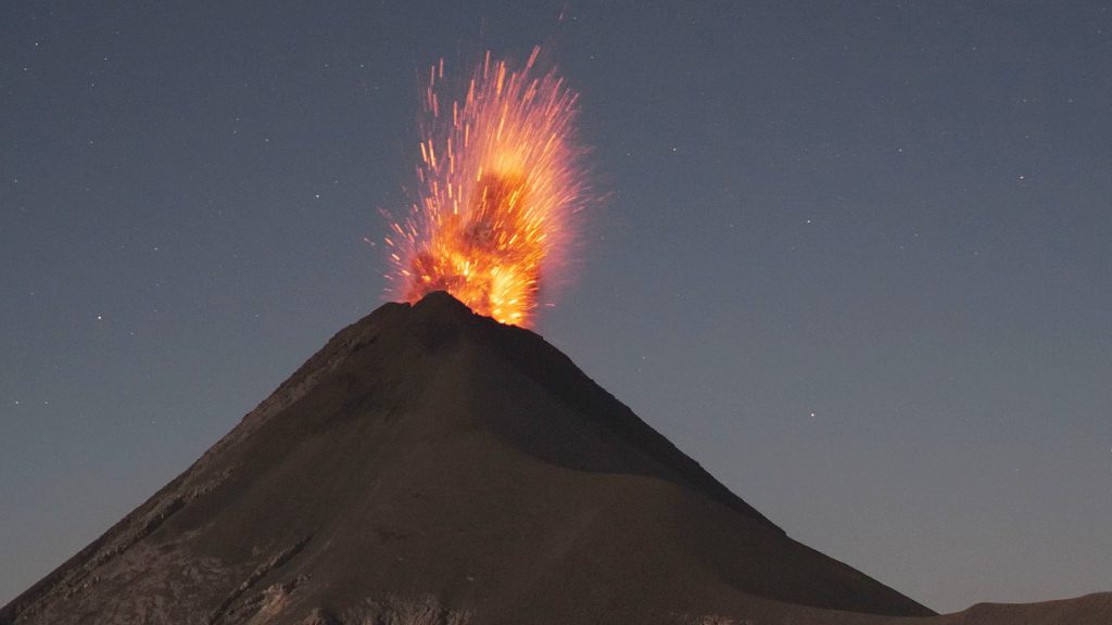
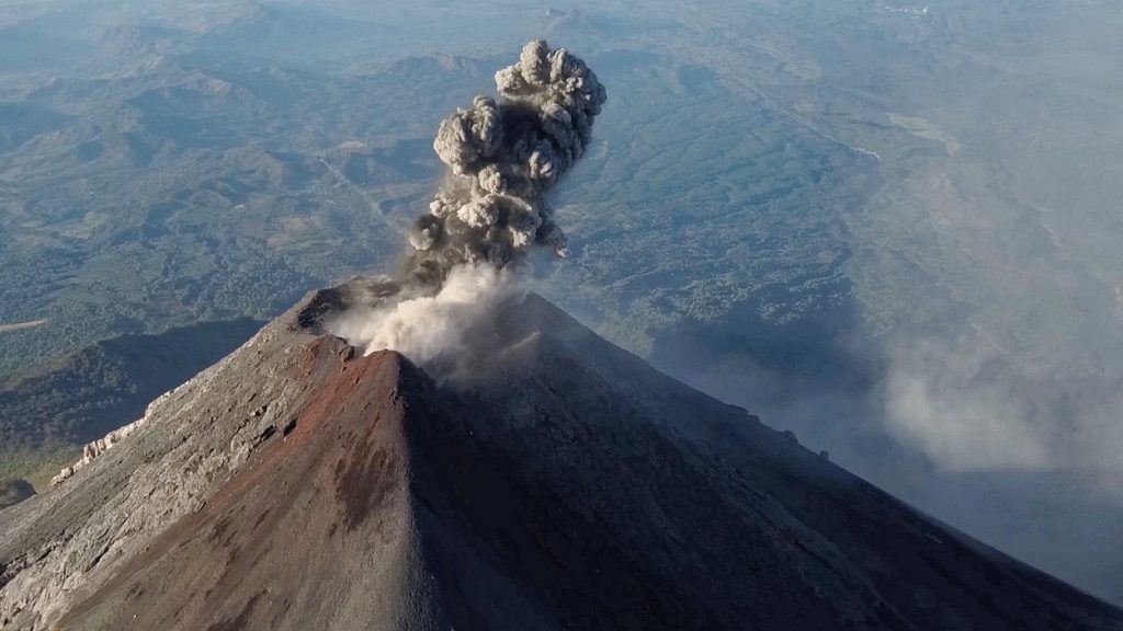
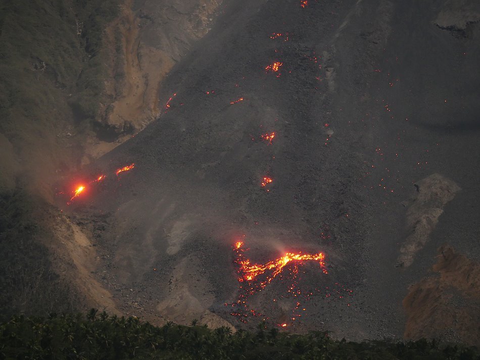
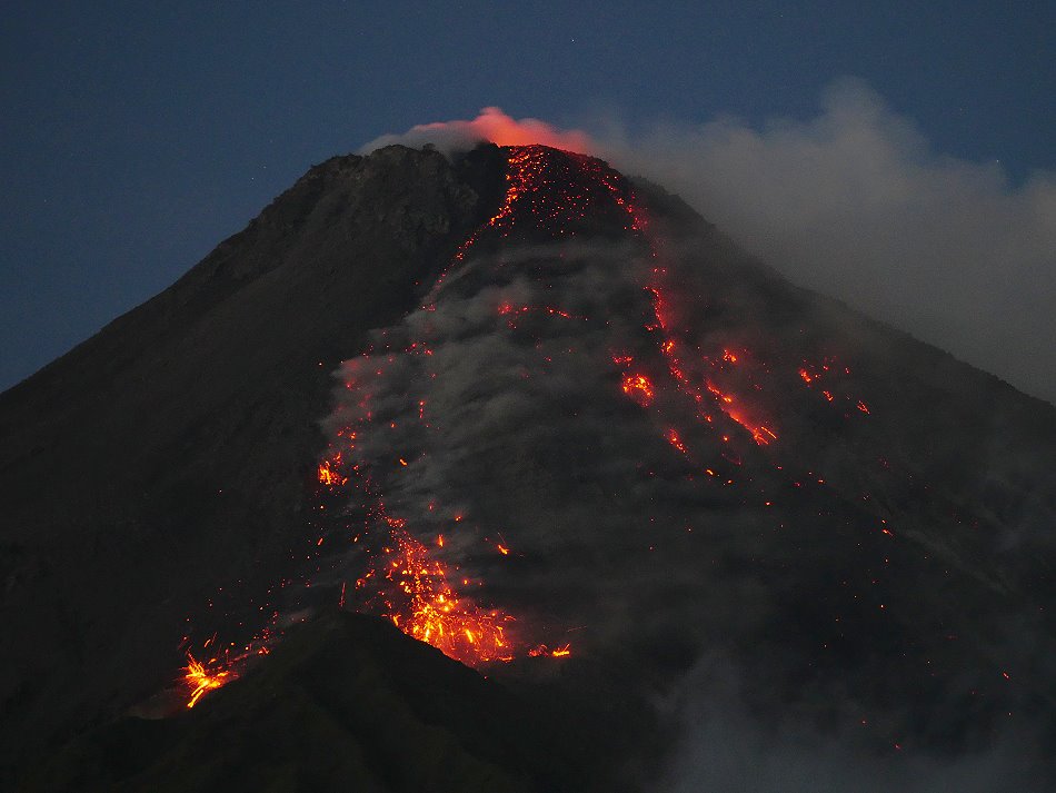
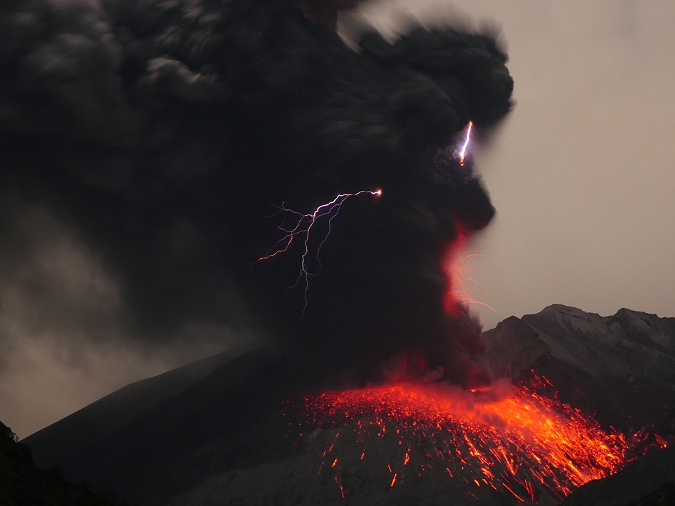
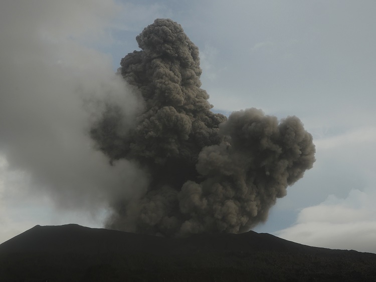
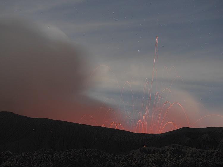
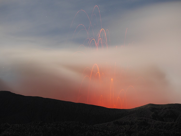
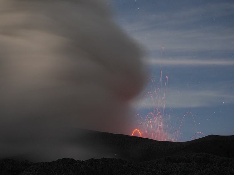
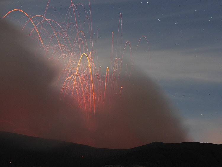
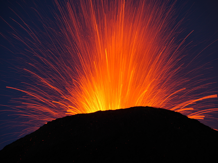
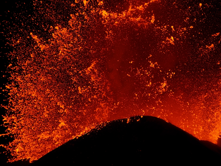
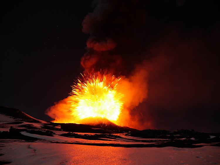
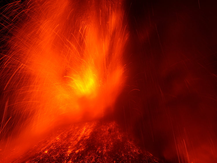
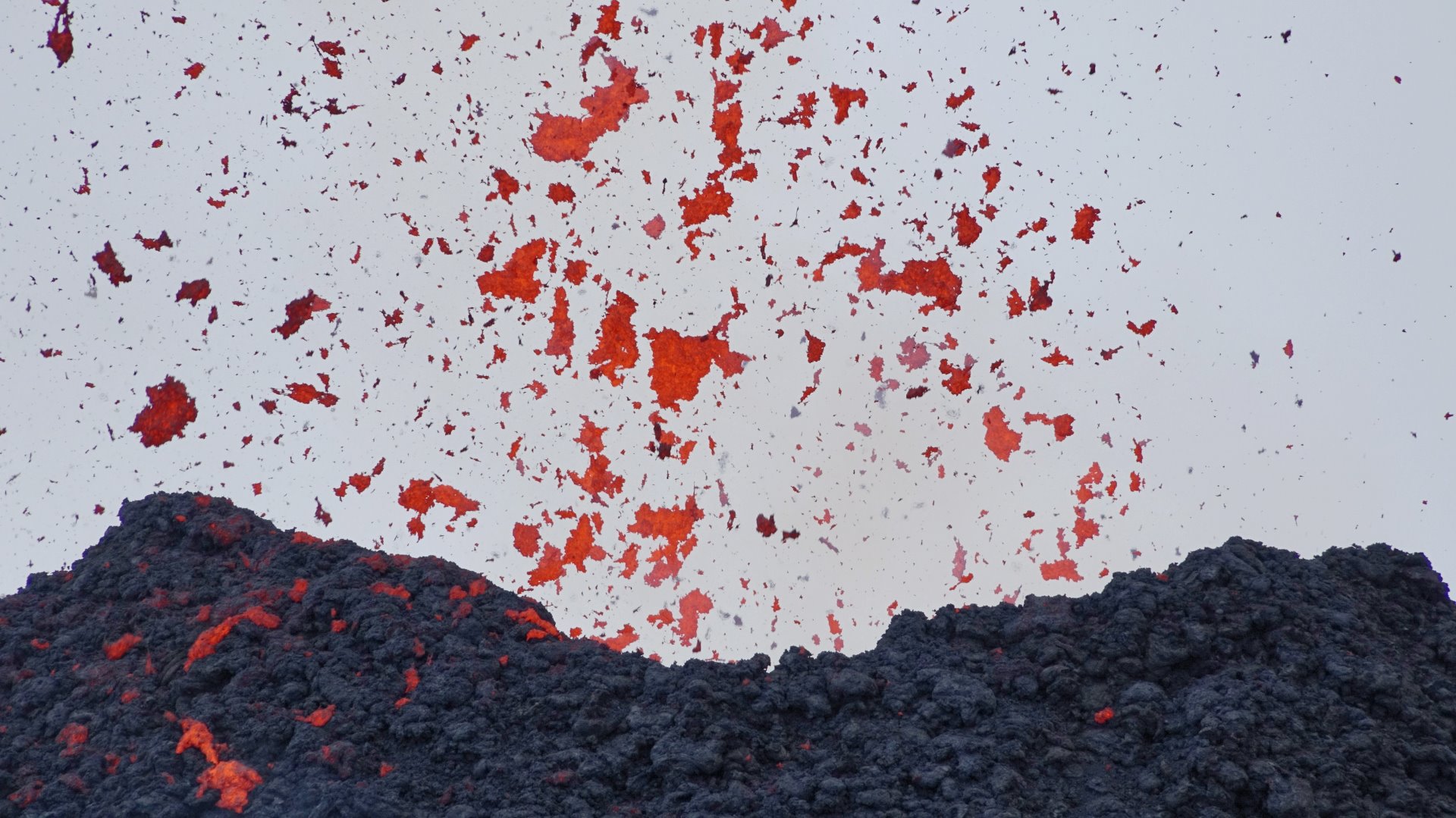
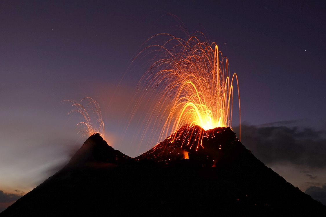
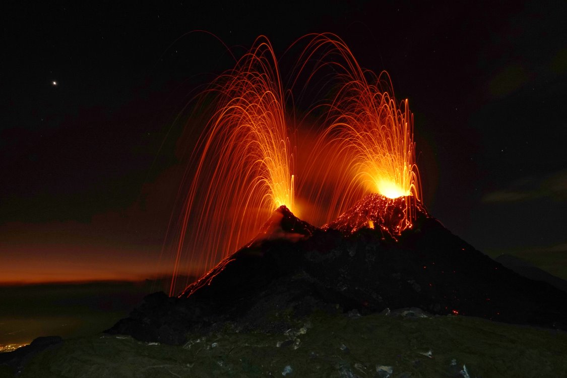
At first, only a few isolated lava lumps were ejected from the mouths of the chimneys, but pretty soon the activity increased to continuous lava spattering. Isolated lava bombs reached respectable heights of about 50 meters. Also the size of the cinders was impressive.

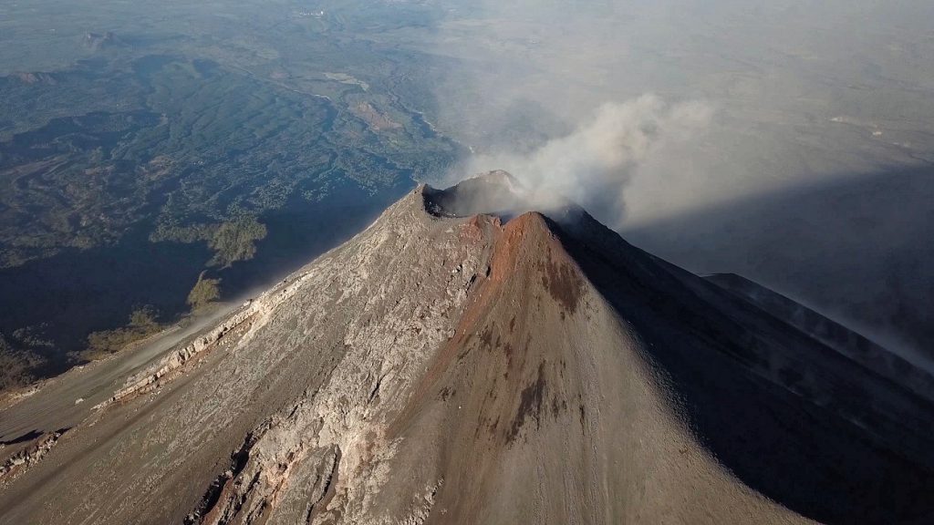
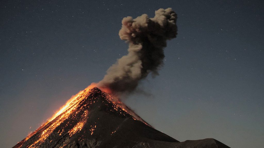
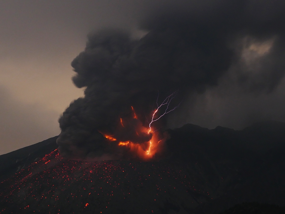
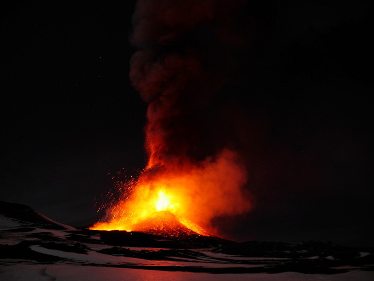
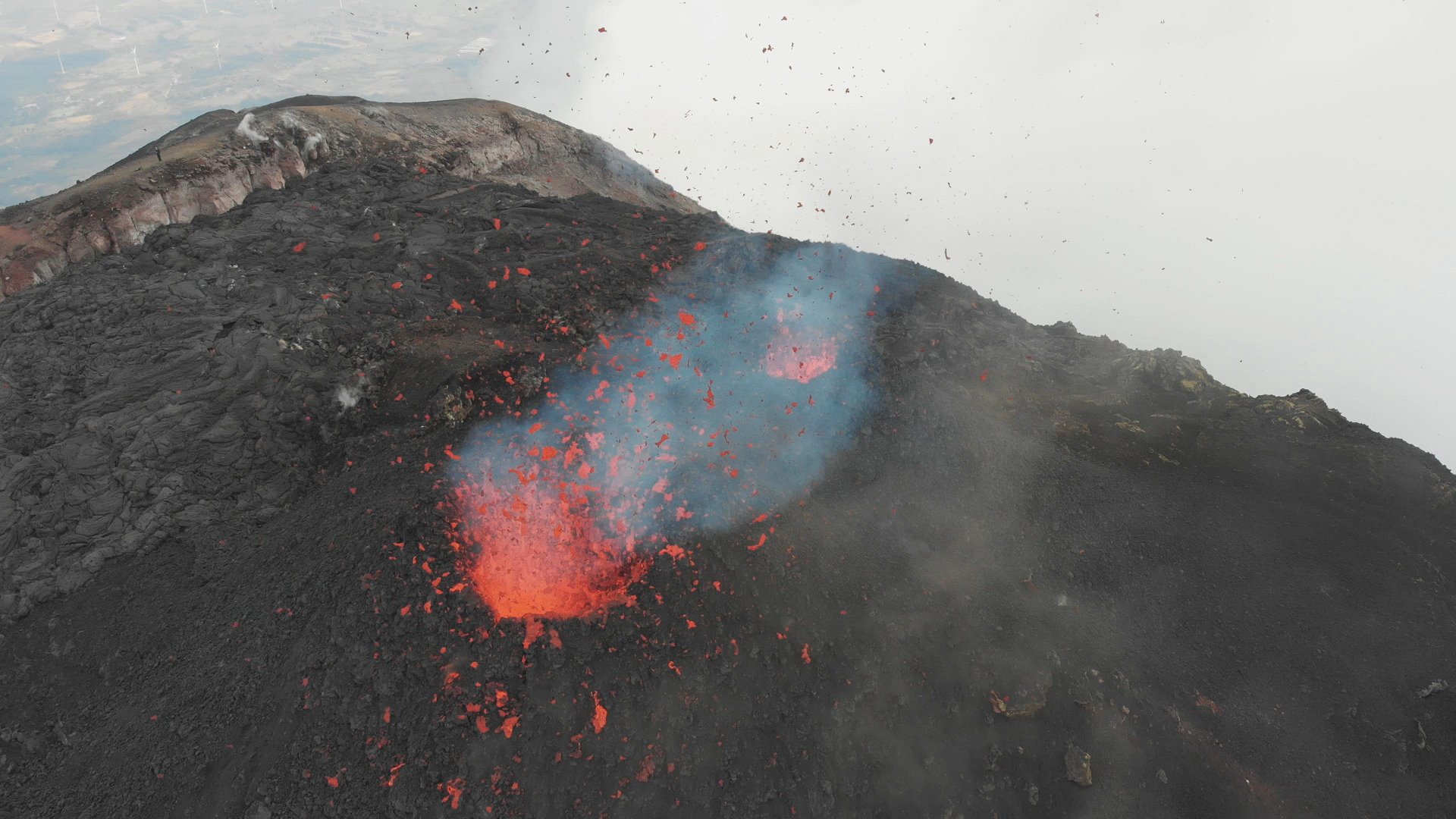
In the late afternoon a new vent opened on the flank of the hornito. Lava flows out of it, which poured over the flank in a multi-armed stream. The spectacle was quite entertaining and ended after 10 minutes.

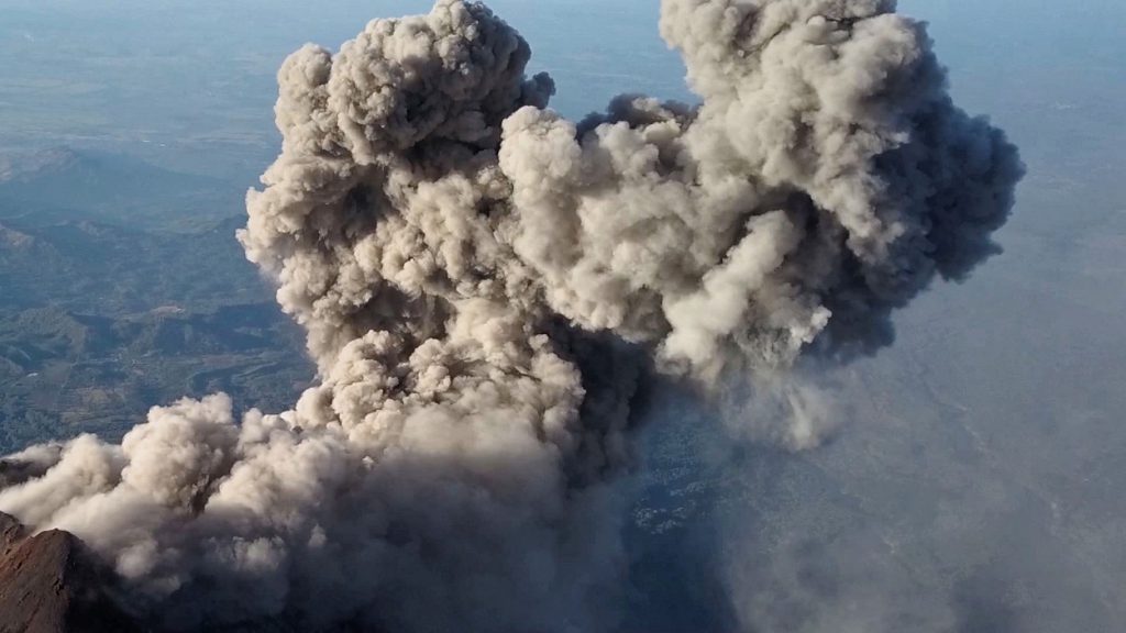
Within 2 hours I flew the 3 batteries of my drone empty and let it float dangerously low over the vents. I was quite surprised that at the end of the battery capacity it had actually not yet been shot down, with the lava bombs taking on the role of missiles: more than once they came dangerously close to the unmanned aircraft.

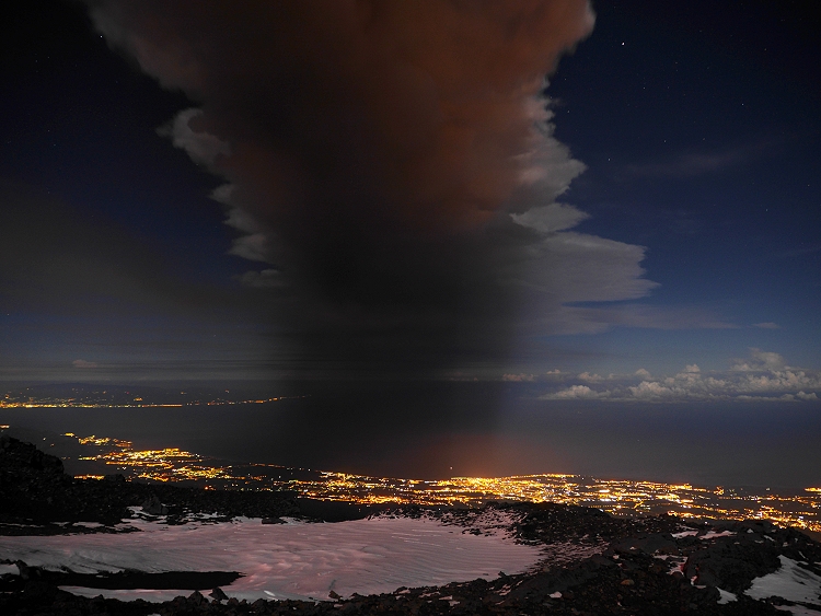
In the evening it became quite windy again at the crater rim, but I persevered and waited for the moonrise. Around 21.30 o’clock our Trabant then pushed itself slowly over the horizon and showed again the contours of the hornito. A little later I started the descent. Arrived down in the forest I paused for a while and let the various voices of the night take effect on me.

2 days later I set off for the Fuego, which my drone should not survive, but more of that elsewhere.

Kilauea: Pictures of Leilani eruption in 2018

In May 2018 a huge eruption of Mount Kilauea on Hawaii started. By the end of the month I visited the site of eruption on Big Island Hawaii. 

The eruption at Kilauea in Hawaii came as no surprise. Already in April the seismic activity increased and the lava lake in the pit crater of Halemaʻumaʻu crater overflowed several times. With a little delay the activity in the Puʻu ʻŌʻō crater also increased. This crater is located in the upper part of the east drift. A larger eruption was thought possible, but what followed was not necessarily expected. At the beginning of May a seismic crisis occurred and the Puʻu ʻŌʻō crater began to collapse. The earthquakes moved along the east rift towards coastal plains and with them the magma that had accumulated under the crater. The magma migrated to the coastal plains and accumulated under the Leilani Estates housing estate, south of the small town of Pahoa. The volcanologists registered a bulge of the ground and cracks formed: a magmatic corridor had formed that ended under the settlement. Whole streets burst open like an overripe tomato. From some cracks it steamed. A little later the first small eruptions took place. In the first days of the volcanic eruption, lava was produced from a residual melt. According to the chemistry, it was the same magma that was responsible for the 1955 eruption. So the magma had lain dormant in the magma reservoir for at least 63 years before it was now displaced by fresh magma from the Puʻu ʻŌʻō crater and erupted as lava at Leilani. On May 20, the eruption intensified: the residual melt had now been ejected and fresh, hotter and thinner lava emerged from the fissures that had formed along the magmatic vein. A few hours later the lava flows reached the ocean. On their way there they destroyed numerous houses and streets. A geothermal power plant was located at the edge of the active fissure along with the lava flows and threatened to explode. A particular danger was posed by the methane gas that was created when the lava buried and charred the vegetation.

Fuego in March 2018

In March 2018, I visited the famose volcano Fuego in Guatemala. I climbed the volcano together with Matin Rietze and spend one night in the camp on the flank of Acatenango. The highlight of the night was a shooting star over the top of Fuego.

Kilauea: Ocean entry on Hawaii


On September 13, 2016, I set off for Hawaii. Of course direct flights were invaluable and so I booked one with 2 stopovers. Already on the first one my luggage got stuck: in the backpack there were not only clothes but also a part of my photo equipment. Until today the luggage remained lost.

On site I met with 2 friends. Together we explored the volcano Kilauea. It is the smaller of the large shield volcanoes of Big Island Hawaii. In the Halema’uma’u crater a lava lake was bubbling and it stood so high that it could be seen from the Jagger Museum.

In the west pit of the Pu’u ‘O’o crater cone a 2nd lava lake was boiling. The hike here was long and very humid due to the eternal rain. When I finally reached the crater and stumbled to the lava lake, it was foggy and I could see little. The lava lake had a diameter of about 50 meters and was covered in thick gas clouds. There were no useful shots and so I started the long way back. Back at my accommodation in Mountain View, the view of Pu’u ‘O’o was cloudless!

The ocean entry

From Pu’u ‘O’o the lava flows start towards the ocean. They have to travel 6 miles before they reach the Pacific Ocean. Recently, lava flow 61g started to enter the Pacific Ocean and wrest new land from it. This land, in the form of a delta of lava, is extremely unstable: the lava cliffs are washed under by the waves, or blown off by an underground lava flow. Thus, the HVO explicitly warns against entering the lava delta. This is also not reachable without a certain amount of effort. The emergency coastal road was closed and kept open for pedestrians only. Resourceful businessmen from Kalapana rented bicycles for 20 USD, with which the 4 miles to the “ocean entry” could be managed relatively fast. Lava flow 61g interrupted the coastal road on a width of 0.6 miles. The lava field was of course closed and who wanted to admire the “ocean entry” from next proximity had to sneak once again. Of course I did that several times. But you should not underestimate the heat on the coastal plain. My water consumption was enormous. It was increased then still with 2 marches on the Pali. 1.2 miles inland a little glowing lava found its way to the surface. Otherwise 61g flowed completely underground through tubes. I gave up the attempt to stay overnight on the fresh lava field. The underfloor heating was set too high.

The lava at the “ocean entry” was especially beautiful from the sea side. We went to sea 3 times, which was not a cheap pleasure. Depending on the boat you had to calculate with 200 – 250 USD per trip. The twilight trips were mostly booked out 2 days in advance. 2 trips were also cancelled on site. Nevertheless, the impressions burned into my memory, especially since the captain of the “Lava One” steered us right up to the cliffs. Officially this is of course forbidden in Hawaii!


Karangetang: Eruption in 2015

Under the light of full moon. © Marc Szeglat

The small volcanic island of Siau is probably known to very few Europeans: it lies about 1/3 of the way between the Indonesian island of Sulawesi and the Philippines. It is one of the spice islands of Indonesia, because most people live from the cultivation and trade of nutmeg and cloves. The climate and the fertile volcanic soil create ideal conditions for the plants. There are also wonderful diving areas and extensive coral reefs off the coast of Siau. And then there is the all dominating volcano Karangetang! In extreme cases, you are nowhere safe from its eruptions on this small island.

The geonauts Thorsten, Martin and Marc set out there at the end of August 2015 to document the eruption of the volcano. When the news about the beginning of the eruption reached us, we were just at the Kawah Ijen in eastern Java. But even if you are already in Indonesia, the way is long and more complicated than e.g. the journey from Germany to Stromboli in Italy. First we had to take 3 domestic flights to Manado, where we arrived late in the evening. After a hotel night we went on an express ferry, which took almost 5 hours.

When we finally reached Siau and the volcano, the morphology of the island with its islets reminded me of a half-sunk caldera, on whose flank the new volcano with its 5 craters had formed. But in the scarce literature on Karangetang there is nothing about a caldera.

First Karangetang presented itself cloudy and we made our way from the harbor to the recommended hotel. This turned out to be adventurous and overpriced, but it was the only one here.

We went to the village to get something to eat and when we were done the clouds had cleared away. Only now we noticed how close the volcano was. From the roof of the hotel we had a box seat with an unobstructed view of the active fire slide: over the southern slope of the volcano, glowing lava avalanches kept coming down, fed by a lava tongue. This extremely tenacious lava flow poured down the slope from the south crater for about 200 m, where it stagnated at first. Some debris avalanches were so large that not much would have been missing and they would have become pyroclastic flows. Of course, we were aiming for these. However, the hotel, like the whole place, was not a safe place if really large pyroclastic flows were to occur. Even more exposed were some smaller places directly below the fire slide.

The next day Karangetang presented itself overcast. Only in the late evening did the curtain of clouds lift and allow a view of the fiery spectacle. The situation had changed significantly in the last hours. Two arms of the tenacious lava flow had left the upper volcanic flank and had almost reached the base of the fire slide. However, the surface of the flows had mostly cooled down and only one front was glowing. We positioned ourselves on a parking lot in a place directly below the fire slide and took pictures of the lava flows. Around midnight some drunken locals became unpleasantly pushy and I had to put them in their place, although I was afraid the situation could escalate. Fortunately our warung-host came by with his truck to check on us and brought us back to the hotel. Half an hour later there would probably have been a brawl.

The next unpleasant incident happened in the morning of our spontaneous departure: at the Lokon on Sualwesi there had been an eruption and we left in a hurry. In the rush Thorsten already paid the hotel and handed over the money to the employee behind the reception. Then he went packing and wanted to pick up the bill afterwards. Then we were told that he had not yet paid. The counter was searched umpteen times for the money and the employee leafed through a notebook several times. Only when Thorsten became energetic and hit the table with his fist did the money reappear. It was in the notebook, which had already been flipped through several times! The two incidents, coupled with the unkempt hotel and the dirt in the village, depressed a little the mood and the otherwise positive image of the volcanic island Api Siau.

Sakurajima: Volcanic lightning

Volcanic lightning on Sakurajima in Japan. The lightning occurs in ash-rich eruptions, mostly during first 20 seconds of the eruption. I saw a shock wave in one of the first morning of my observations in March 2015. This shock wave you will see in the video.

The story of volcanic lightning

I visited the Sakurajima in Japan several times in the past years: the volcanic lightning in the ash clouds always attracted me like a magnet! Photographing at the volcano is never easy, but to capture flash clouds requires special know-how and a lot of patience. I was on the road again with Martin Rietze and after the long flight we went straight to the volcano in the evening after our arrival in Kagoshima. We wanted to spend the night at our favorite place again and set up our cameras. It is about 3 km from the summit of Sakurajima, almost at the end of a small road leading to a lahar dam. But, oh dear, the property with the meadow was fenced in and the meadow was nice and clean and the ground was levelled. What now? With a bad conscience we bypassed the fence and set up our camp at the edge of a bush.

Already in the first night our patience was put to the test: the volcano was unusually quiet and produced only a few miserable ash clouds, so completely without lightning. Then in the morning, all the accumulated energy was discharged in a proper detonation! The generated shock wave was not only visible in the clouds above the crater, but could also be clearly felt as a short shock wave. After the lame night it got us going. But unfortunately the weather got worse and worse and we decided to break up our camp and set off for the volcano Aso. This volcano is about 2 hours drive away from Sakurajima. Aso was strombolian active in the last weeks and especially Martin heard its tempting call.

But, how could it be different, the bad weather reached the volcano with us. Shortly before the clouds closed, we caught a glimpse of the crater and a small ash cloud, then it started to rain. We explored the visitor center at the foot of the crater cone. The ascent to the crater was of course closed. I was quite surprised about the size of the parking lot: in summer there must have been a lot going on here! Well, the Japanese love and adore their volcanoes and like to go hiking there.

In the evening it started snowing and Martin and I spent an uncomfortable night in the car, without any volcano view. Since we had little time, we started the next morning to Sakurajima. We made a short side trip to the Kirishima volcano. There the weather was better and the volcanic landscape was impressive! If the volcano should become active again, you have to go there!

On the way to Sakurajima we stormed a supermarket: the prices in Japan are sometimes enormous! Instead of being self-sufficient, you can better go to one of the few fast food restaurants or buy ready-made schnitzels in a minimarket.

In the evening we took position at Sakurajima again. But also this night was quite quiet. In the morning we had another nice eruption, this time with better weather!

Slowly our time was running out, but the next night we should have more luck. Saku turned up and produced 2 eruptions with volcanic lightning shortly after each other. Our cameras rattled in continuous mode and hardly a flash of lightning slipped through our fingers. In the air was the rumbling of the eruptions and the crackling of electrical discharges that made the hairs on your neck stand up. We looked through our cameras almost euphorically and hoped for more, but no more flashes. That’s how it is at the volcano! You often need a lot of patience for a few precious moments of successful experience.

Picture gallery: Pico do Fogo

Pico do Fogo is Cape Verde’s most active volcano. Fogo is a large volcano with a summit caldera. In it grows the current volcanic cone. In November 2014 an eruption began. On the flank of the current cone a fissure was opened. Strombolian eruptions occur from several vents and lava flows moved in direction of the village of Portela. After a few hours the visitor center was destroyed and two weeks later most houses were burried under lava.

Story behind the pics

Since 2 weeks the Pico do Fogo on the Cape Verde Islands already erupted when the geonauts Richard, Martin and Marc reached the remote volcanic island. Before that, dramatic events took place: on the flank of the volcanic cone in the caldera, an eruption fissure opened up from the lava fountains and fed a lava flow. Only hours after the beginning of the eruption, the lava flow destroyed the National Park’s visitor center. The building had been inaugurated only a few weeks before. It was built with financial help from Germany.

Shortly afterwards, the lava changed direction and flowed slowly but inexorably towards the village of Portela. This was located within the caldera and about 4 km from the cone of Pico do Fogo. The lava flow increased periodically and soon reached the first houses away from the village. It was still hoped that the lava would spare the core of the village, but this hope proved to be in vain. Already on the first day of our stay at the volcano we witnessed how another house was devoured by the lava. Devoured is not the right word: the lava flow tore it from its foundations and pushed it at a snail’s pace until it broke and was enclosed by the lava. The lava flow also crawled across the road and then stopped on the other side. The heat above the lava field created tornados. One of these minitornados suddenly whirled up in front of us, hurled a meter-sized corrugated iron through the air and threw Martin’s camera and tripod over and tore the cap off my head. Sand crunched between my teeth.

We withdrew into the village and paused when loudspeaker announcements called for evacuation. Everyone had to leave the village immediately: elsewhere the lava flow threatened to spill over the temporary road. Many people panicked and tried to save their belongings as fast as possible. When we passed the place, the lava had stopped here too, at least for the moment.
We spent the next 2 days close to the eruption fissure, where several small cinder cones had formed in the meantime. We already marched up there at 4am. On the one hand we wanted to use the dawn at the volcano, on the other hand we set up sentries during the day to close off the area.

We approached the vents up to 250 m. So close to the site of the event I felt the tremor in my trouser bottom. In between there were stronger shocks that made the ground vibrate. Phases with Strombolian, ash eruptions and increased lava flow alternated. The next night the activity increased and the last hours of Portela began. A broad lava flow rolled through the caldera and buried two thirds of the site. Desperate soldiers tried to recover the wine from the winery and dragged the heavy wine barrels to higher ground. Our time at the volcano was already over, but a few days after our return home, the rest of the village was destroyed. Nature knows no mercy!

Photo gallery: Dukono

The photos were taken between 10th and 14th June 2014 on the volcano Dukono. The volcano is located on the Indonesian island of Halmahera. The volcano is constantly active since 2008, but the intensity of the activity varies greatly. We caught the volcano in a very active phase: Volcanic ash rose up to 2.5 km high. At night we were able to observe volcanic lightning and strombolian eruptions. The eruptions hurled lava bombs  beyond the crater rim and presented a serious threat to the observers. Members of the expeditions were Thorsten Böckel, Richard Roscoe and Marc Szeglat.

Sinabung: pyroclastic flows

The eruption of Mount Sinabung started in September 2013, with series of small explosive eruptions. A  lava dome begun to grow in December and some weeks later first pyroclastic flows occurred. The Geonauts reached the volcano in mid-January 2014. We documented the eruption for one week. On some days the volcano was covered by clouds, or the activity was less. But during two nights we observed plenty pyroclastic flows. In some of them we observed volcanic lightning in the rising ash clouds. Most appeared in the night of the 14th January.

The village Sigarang Garang was very badly damaged by the eruption. Many roofs had collapsed under the weight of volcanic ash.

Etna: Paroxysm No. 16/2013

The paroxysmal eruption of Mount Etna appeared in the night between 16th and 17th November 2013. It was the 16th paroxysm this year. I travelled with the Geonauts Martin and Thorsten. We spend the night in our tents close to the rim of “Valle del Bove”, in a distance of 2 km to the active crater. The duration of the eruption was longer than it of most other paroxysm and less nearby all the night. Some spectacular lava bubbles were erupted. Two lava flows streamed to the southwest and southeast. These flows were not so long like others before.