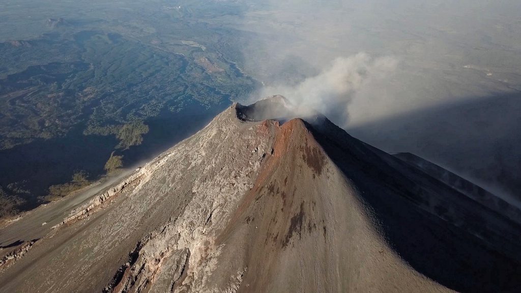
Aerials oft the summit crates of Mount Etna in Sicily. 2 of the 4 craters are in focus: Bocca Nuova and New Southeastcrater. The shuts were made in November 2018, some days before the last flank eruption.
 Marc Szeglat
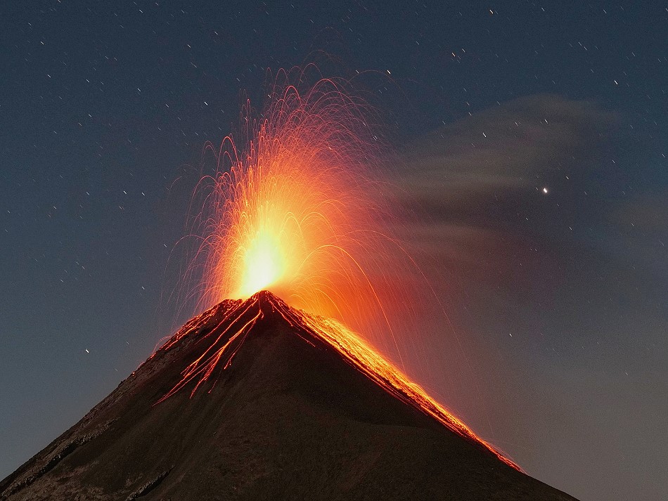
Stromboli: lighthouse of the mediterranean sea
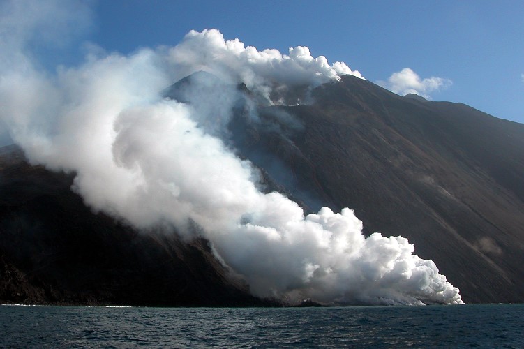 Stromboli is a small island volcano off the north coast of Sicily in Italy. The visible part of the volcano forms an island of only 12 square kilometers. Stromboli reaches a height of 924 m above sea level, but most of it is underwater. Measured from the sea floor, Stromboli is almost 3000 m high.
Together with 6 other islands, Stromboli forms an archipelago known as the Aeolian Islands (often called the Lipari Islands). It lies north of Sicily and west of Calabria in the Tyrrhenian Sea.
Stromboli is a rather young volcano. The current cone is only 40,000 years old. Its morphology has been shaped by at least two major collapse events: about 10,000 years ago the Vancori collapsed and 500 m further north a second stratovolcano erupted in the northeast-opening collapse of the first one. The Cima brought it to a height of 918 meters. It mainly produced andesitic magma.
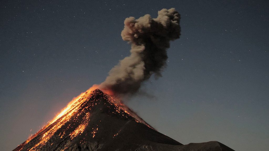
At the beginning of the post-glacial period, the northwestern part of the Cima also collapsed. This created the “Sciara del Fuoco” slope, on the edge of which a ridge leads to the summit: the Cima. 200 m below and 300 m northwest of the Cima, a new crater was formed, consisting of several sectors. This crater has been erupting strombolian for more than 2000 years. Basalts and trachybasalts are the main components of the present eruptions. Some of the extracted cinders fall on the steep slope and roll down to the sea.
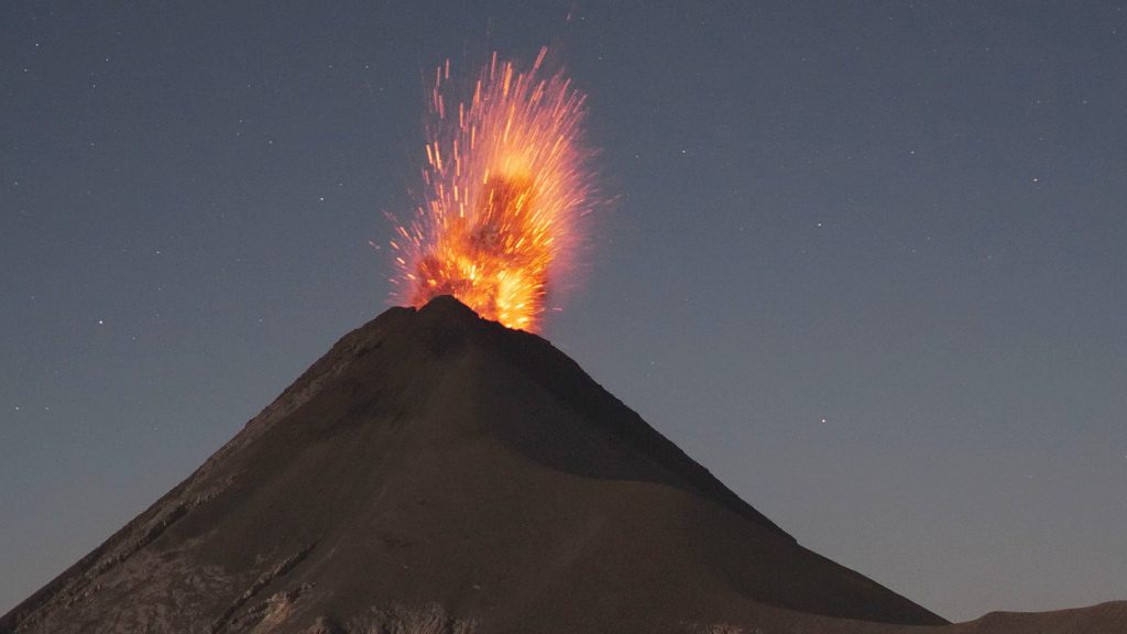
The strombolian activity is occasionally interrupted by phases with stronger eruptions. Paroxysms can occur, but also flake eruptions, in which lava flows are produced that occasionally reach the sea.
In this millennium there have been 3 flank eruptions and several paroxysms. The last of these eruptions led to the closing of the ascent of Cima in June 2018.
Kilauea: Pictures of Leilani eruption in 2018
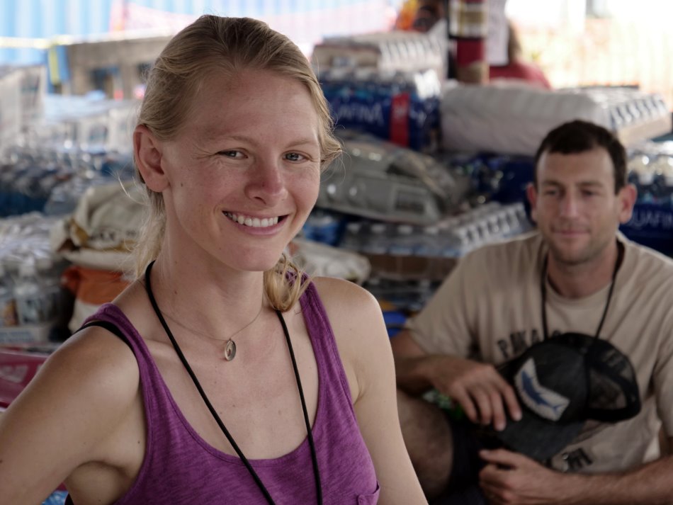
In May 2018 a huge eruption of Mount Kilauea on Hawaii started. By the end of the month I visited the site of eruption on Big Island Hawaii.
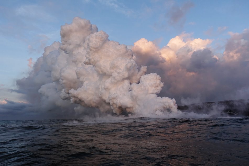
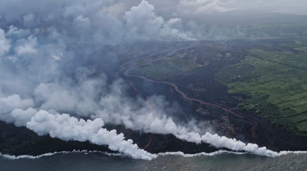
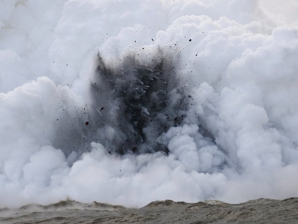
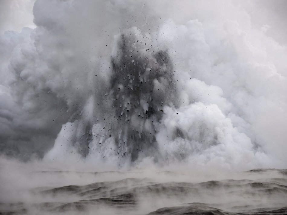
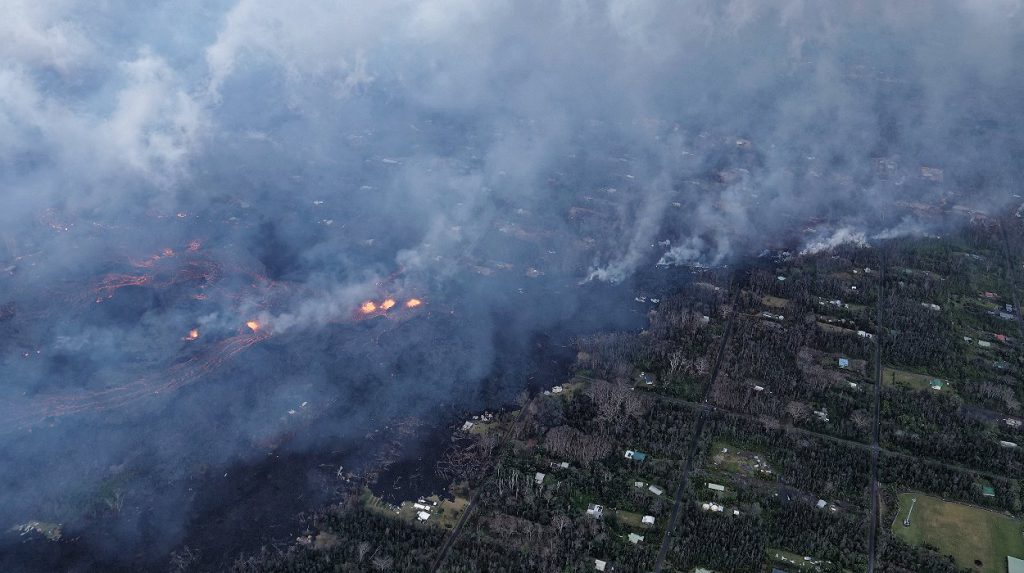
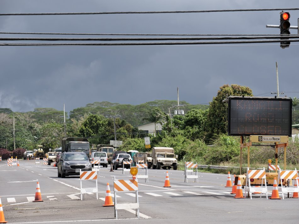
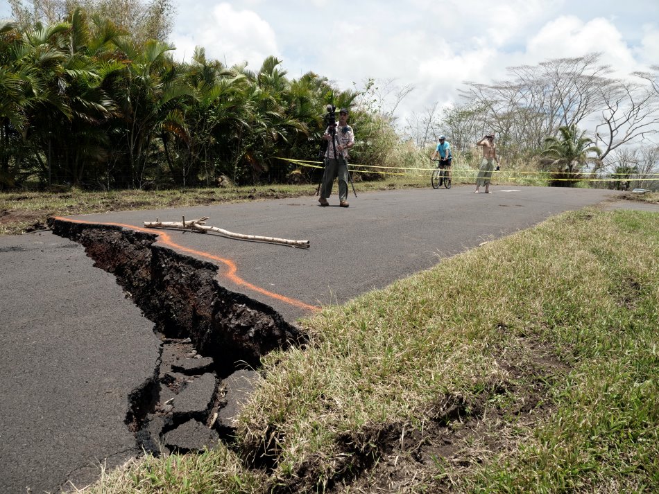
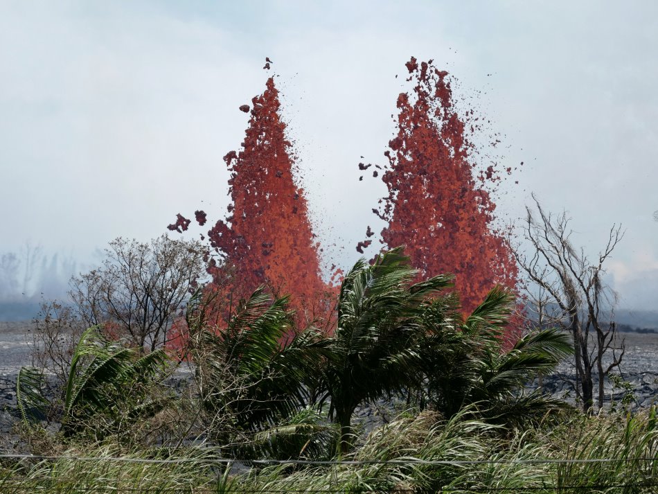
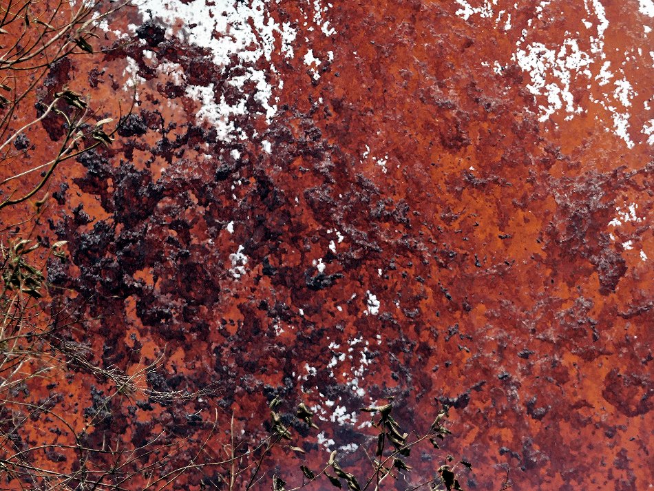
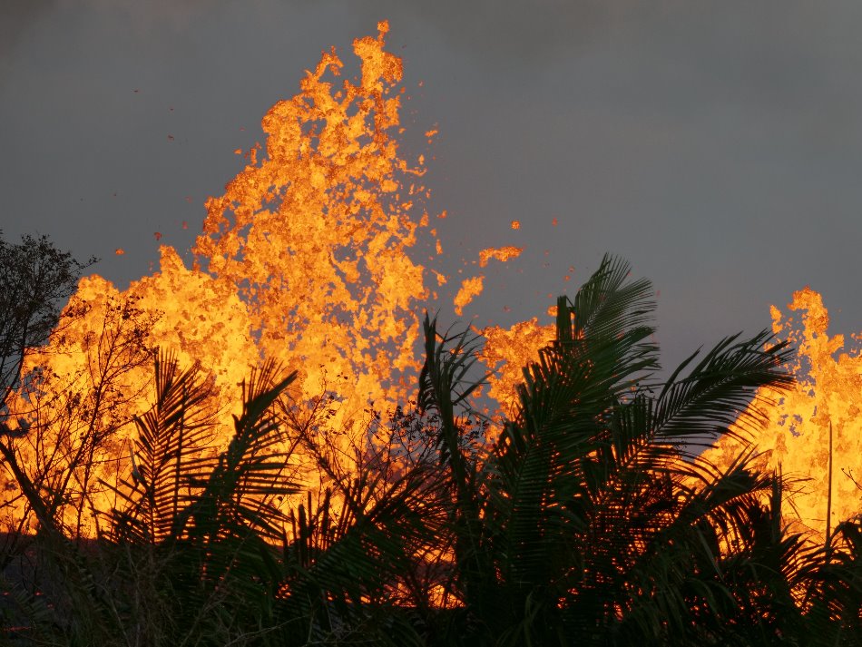
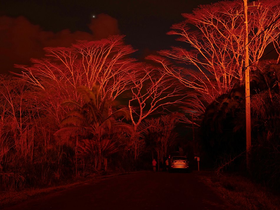
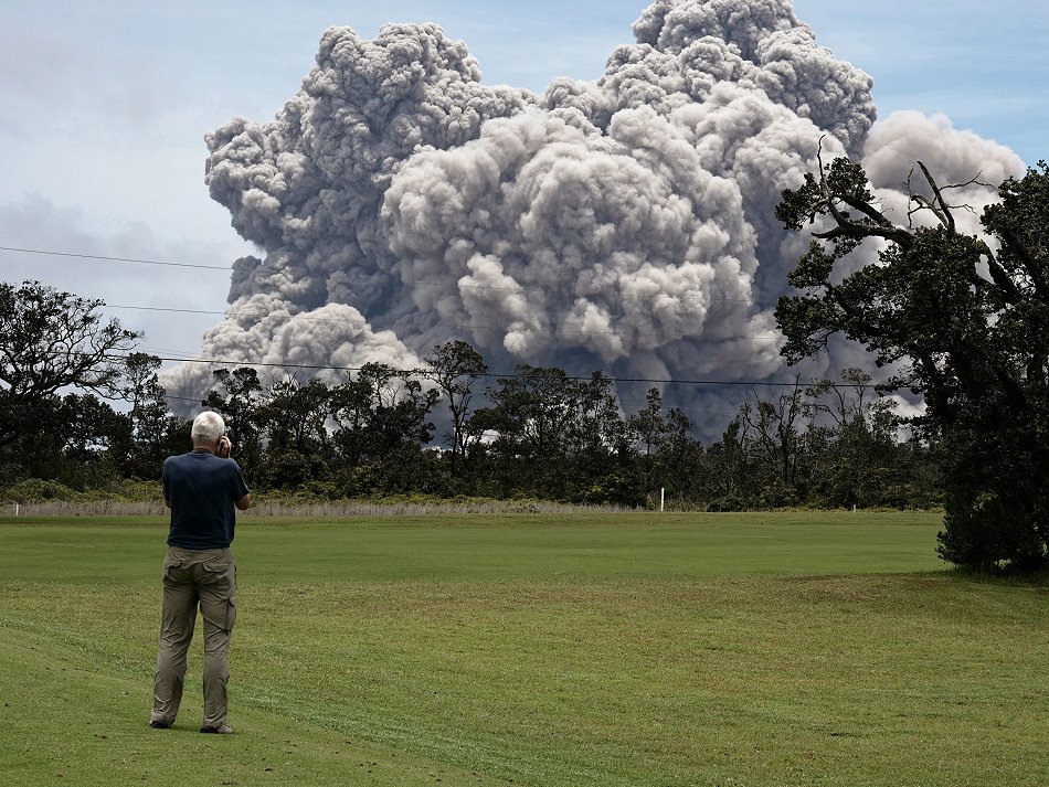
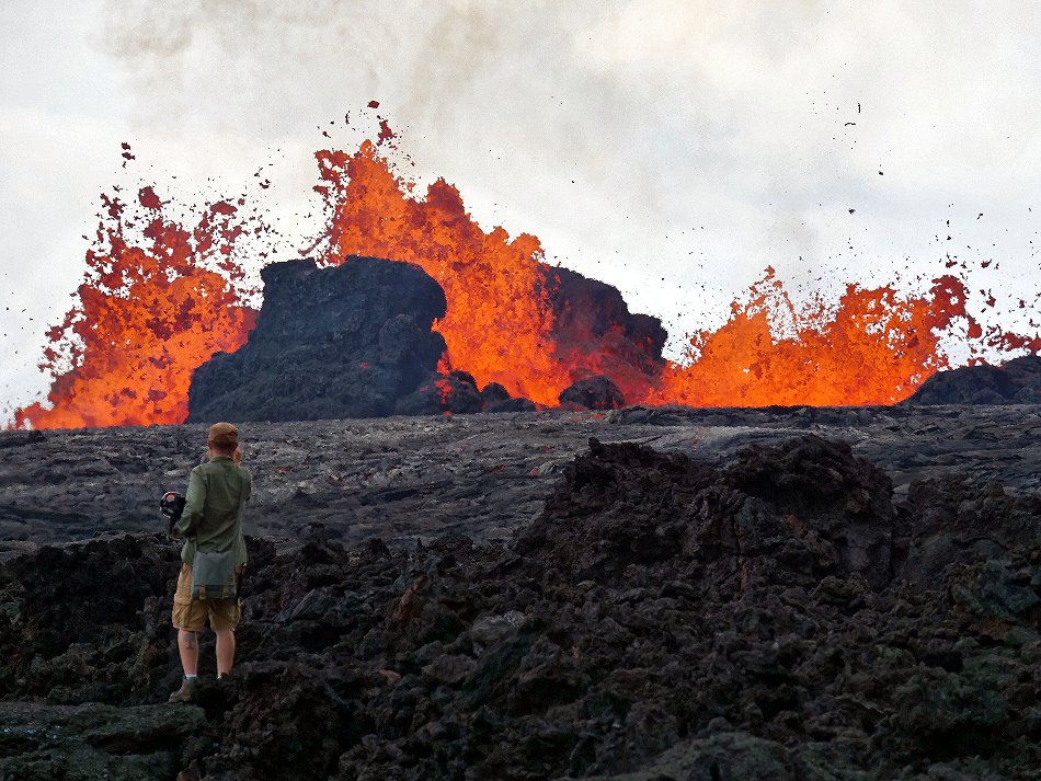
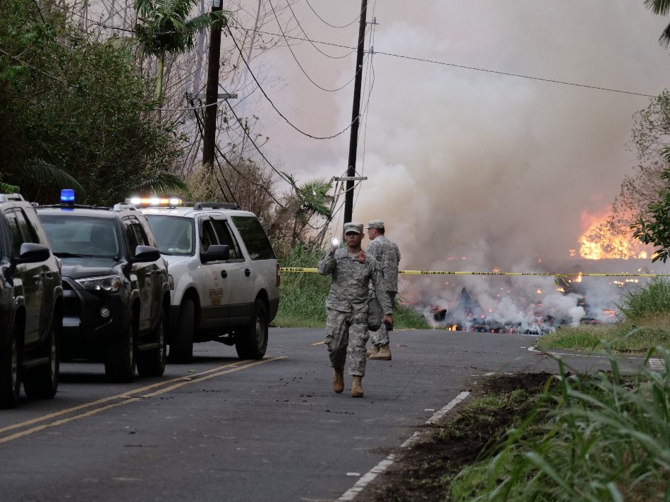
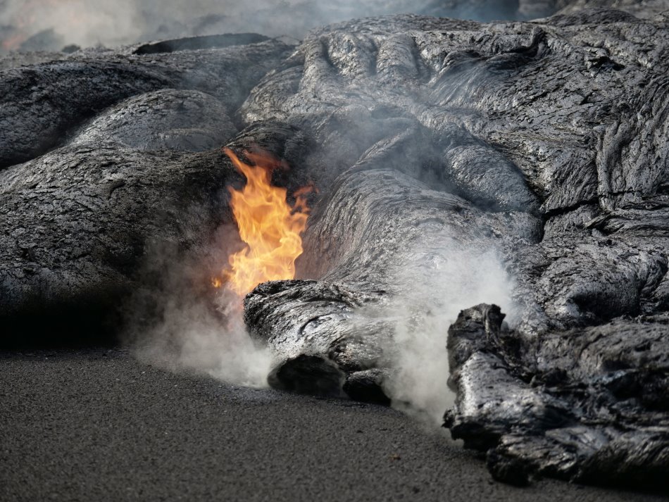
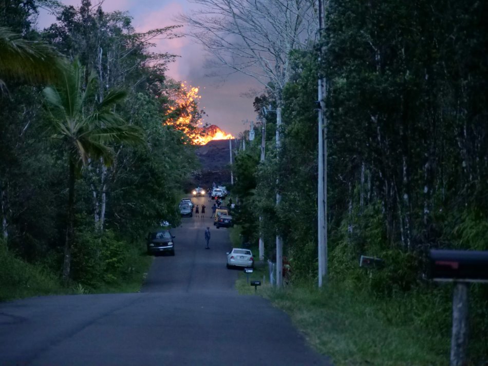
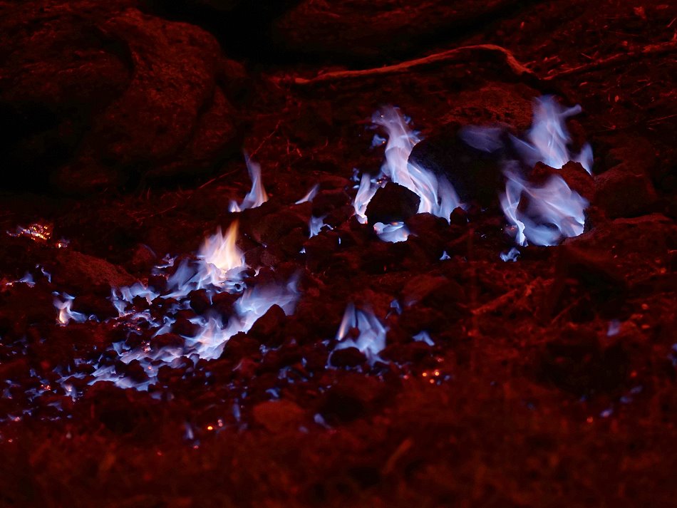
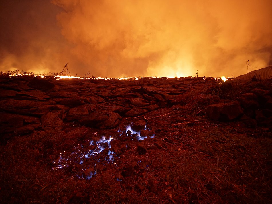
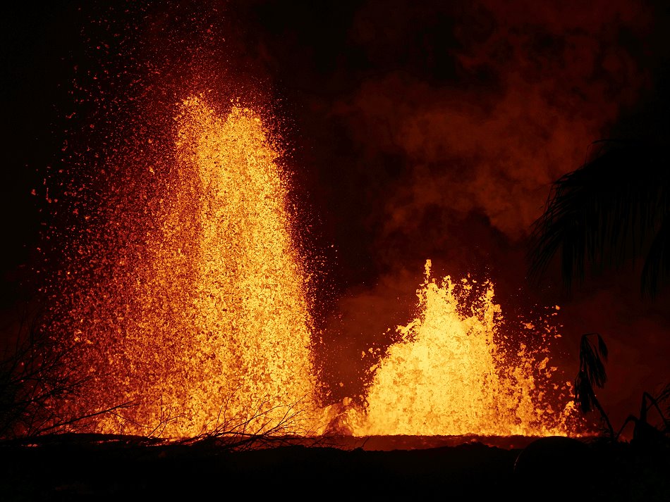
The eruption at Kilauea in Hawaii came as no surprise. Already in April the seismic activity increased and the lava lake in the pit crater of Halemaʻumaʻu crater overflowed several times. With a little delay the activity in the Puʻu ʻŌʻō crater also increased. This crater is located in the upper part of the east drift. A larger eruption was thought possible, but what followed was not necessarily expected. At the beginning of May a seismic crisis occurred and the Puʻu ʻŌʻō crater began to collapse. The earthquakes moved along the east rift towards coastal plains and with them the magma that had accumulated under the crater. The magma migrated to the coastal plains and accumulated under the Leilani Estates housing estate, south of the small town of Pahoa. The volcanologists registered a bulge of the ground and cracks formed: a magmatic corridor had formed that ended under the settlement. Whole streets burst open like an overripe tomato. From some cracks it steamed. A little later the first small eruptions took place. In the first days of the volcanic eruption, lava was produced from a residual melt. According to the chemistry, it was the same magma that was responsible for the 1955 eruption. So the magma had lain dormant in the magma reservoir for at least 63 years before it was now displaced by fresh magma from the Puʻu ʻŌʻō crater and erupted as lava at Leilani. On May 20, the eruption intensified: the residual melt had now been ejected and fresh, hotter and thinner lava emerged from the fissures that had formed along the magmatic vein. A few hours later the lava flows reached the ocean. On their way there they destroyed numerous houses and streets. A geothermal power plant was located at the edge of the active fissure along with the lava flows and threatened to explode. A particular danger was posed by the methane gas that was created when the lava buried and charred the vegetation.
Kilauea: Leilani-Eruption fissure 8 – Part 3
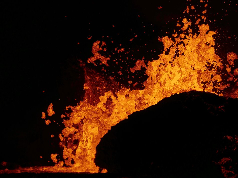
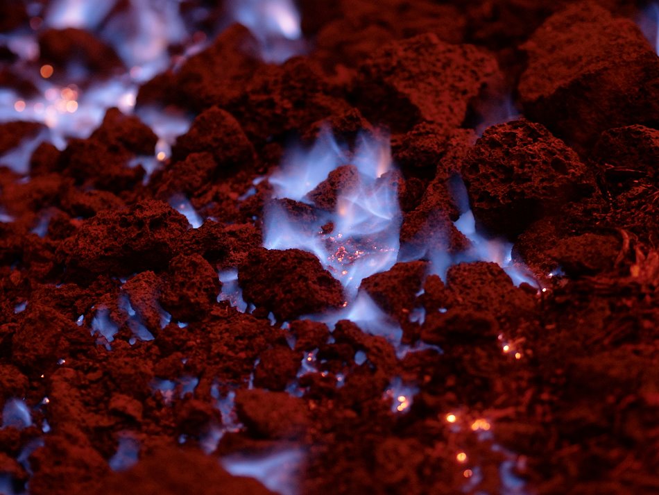
Eruption of Kilauea volcano on Hawaii in May 2018. Watch Leilani’s fissure 8 during night. Lava fountains and blue flames of burning methane, escaping from holes and cracks in the ground in front of the lava flows.
Kilauea: Leilani eruption – Part 2
Eruption of Kilauea on Hawaii. In 2018 fissures opened in Leilani Estates close to Paoha. Several lava fountains feeds lava flows, which destroyed huge parts of the settlement.
Kilauea: Leilani-Eruption in 2018 – Part 1
Kilauea’s Leilani-eruption took place on Hawaii and begun in May 2018. The lava lakes in the craters of Halema’uma’u and Pu’u O’o drained off through the east rift. A dyke intruded on the coastal plain near Pahoa. In Leilani-Estates more than 25 fissures opened. Lava fountains fed lava flows that reached the ocean. Several hundreds houses were destroyed. In this video you can see huge lava fountains.
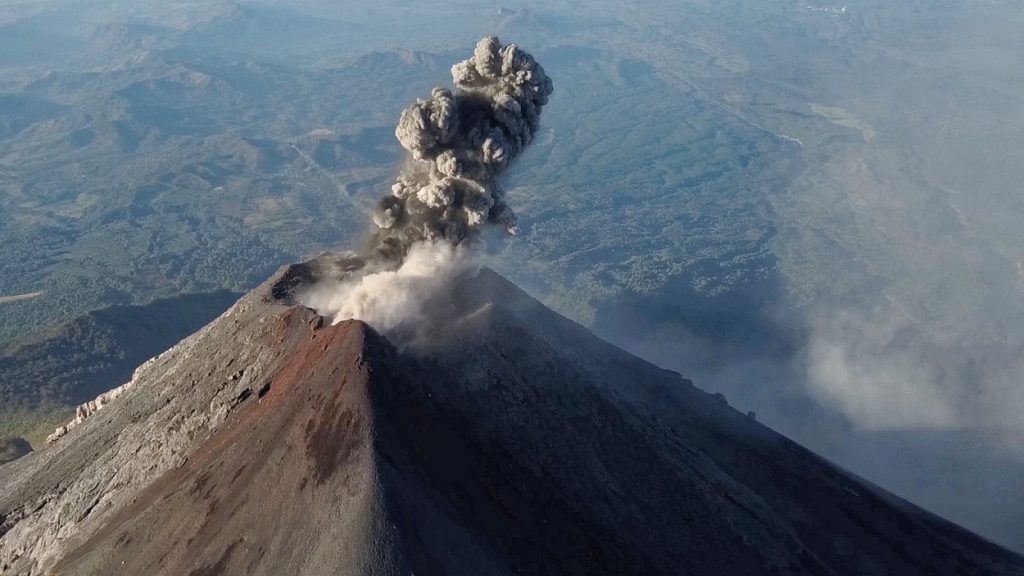
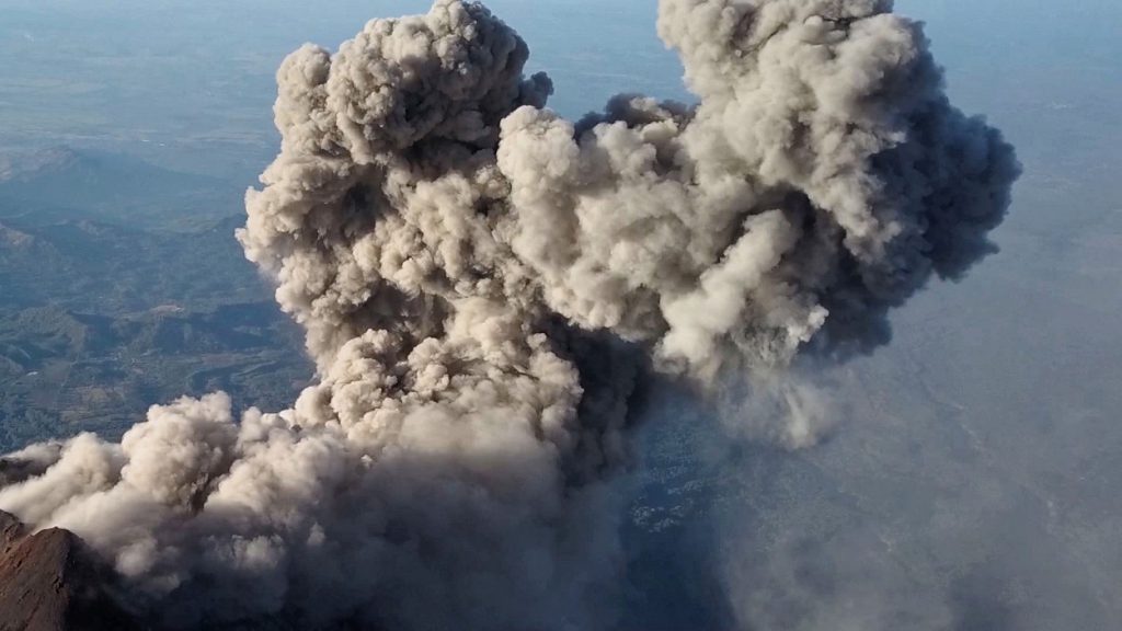
Fuego: Aerials of eruption
Drone-footage of an eruption of volcano Fuego in Guatemala. One shot shows the Acatenango, too.
Fuego in March 2018
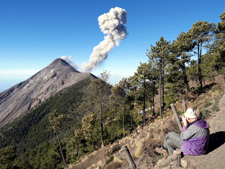

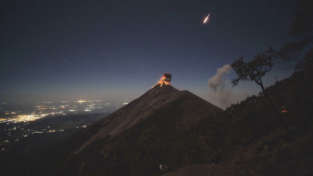
In March 2018, I visited the famose volcano Fuego in Guatemala. I climbed the volcano together with Matin Rietze and spend one night in the camp on the flank of Acatenango. The highlight of the night was a shooting star over the top of Fuego.
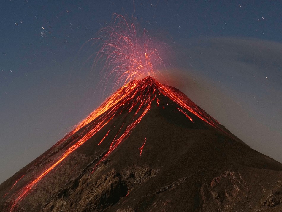
Fuego and shooting stars
Eruptions of volcano Fuego in Guatemala. This footage shows a timelapse with eruptions and shooting stars above the volcano. The Fuego dominates the city of Antigua. It forms a double volcano with Acatenango. In 2018, pyroclastic flows caused destruction and claimed more than 300 lives.
Mayon: Eruption is getting weaker
Mayon’s eruptive activity has continued to decline in the last 24 hours. Yesterday morning (local time) 3 paroxysmal eruptions with lava fountains were observed feeding lava flows. During the day, the eruption has become more effusive again. Most likely, the lava dome grows again and there are still 2 lava flows active. Collapse events on the fronts of the lava flows caused debris avalanches.. A pyroclastic flow was observed. Seismic and sulfur dioxide emissions are at the level of the previous day.