Earthquake Swarm at the Submarine Volcano Kolumbo close to Santorini
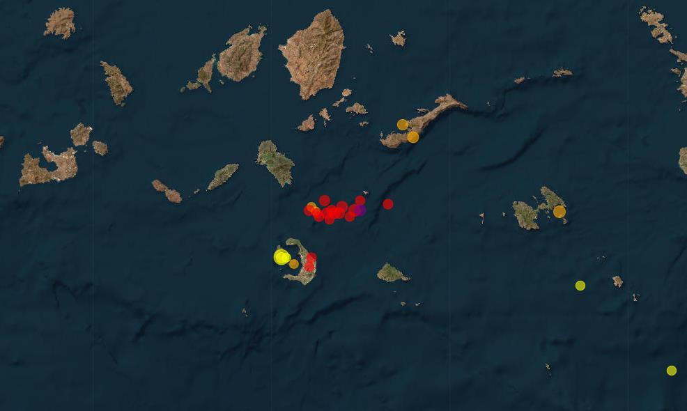 The region around the Greek volcanic island of Santorini remains seismically active. Over the past week, numerous earthquakes have occurred, particularly in the area of the submarine volcano Kolumbo. The strongest quake was recorded on January 25 with a magnitude of 3.6. Its hypocenter was at a depth of 11 kilometers near the coast of Thirasia, the western island of the Santorini archipelago. Tremors were also felt on Nea Kameni and Santorini itself.
In the past 24 hours, activity has continued with over 30 earthquakes, most with magnitudes in the 2.0 range. The deepest hypocenter was measured at 13.3 kilometers. In total, more than 70 quakes have been recorded over the past week. The latest swarm affected the Kolumbo volcano area, consisting of 19 tremors with hypocenters ranging between 5 and 21 kilometers in depth.
Whether these quakes are of tectonic origin or caused by the movement of magmatic fluids remains uncertain. Changes in stress due to ground uplift are also a possible explanation. However, no reports of ground deformation have been issued—likely due to a lack of underwater monitoring stations in the area. The ongoing seismic activity in the region requires continued observation.