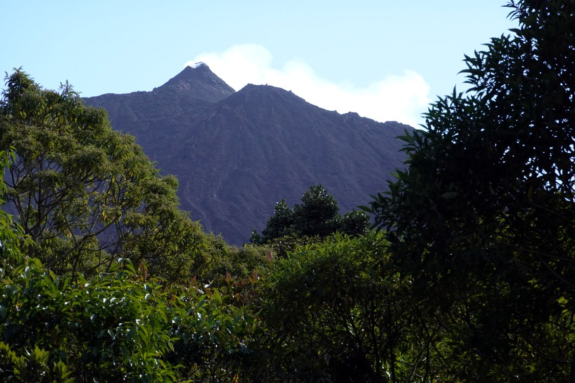
 The seismic crisis started on July 3, 2020 at 07:20 local time and ended around 08:00 local time. This episode was accompanied by surface deformations which remained extremely weak and localized at the top of the Piton de la Fournaise. Since then, no resumption of seismic activity or deformation has been observed.
Several hours without any activity being observed are evidence of the deep stop of magma in the building.
Nevertheless, given the resumption of inflation observed since June 16, a medium-term eruption cannot be ruled out.
Year: 2020
Popocatepetl: Volcano with spirit
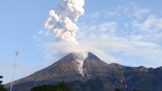
 Close to the Mexican capital the Popocatepetl is still active. Yesterday the CENAPRED Institute published a very atmospheric photo of a sunset eruption. Besides the explosion, 169 ash-steam exhalations and 32 minutes of tremors were recorded. Today, explosive volcanic eruptions were also recorded: the VAAC issued 2 VONA messages according to which volcanic ash had risen to an altitude of 5800 m.
Popocatepetl has become a permanently active volcano in recent years. Only seldom there are longer pauses in eruption. In addition a lava dome grows sporadically in the crater. The ascent is prohibited.
Merapi: new dome growth
 On the Indonesian website krjogja.com it is reported that the Merapi has entered a new phase with dome growth. This information comes from Agus Budi Santoso, the head of the Merapi Volcano section at the BPPTKG. The new intrusion is the 7th phase since the beginning of the eruption and is accompanied by explosive activity and deep seismic. The larger eruptions in the first half of the year would have more than halved the volume of the lava dome to 200,000 cubic metres. Now it looks as if the dome is getting bigger again, increasing the potential danger.
Nishinoshima: Eruption increased
 The Japanese island volcano Nishinoshima continues to make headlines. The VAAC issued numerous VONA warnings of ash clouds. Currently volcanic ash is registered at an altitude of 7300 m above sea level. Since the cinder cone is only a few 100 m high, this represents a remarkably large eruption cloud. The peak value yesterday was 4200 m and was described in Japanese media as the highest ash cloud since the beginning of the eruption. The thermal radiation yesterday had a power of 1860 MW and is therefore also in a very high range. So lava flows are still being produced, which will change the face of the island forever. Nishinoshima is growing and growing. Radar images show that not only the coastline is constantly shifting, but also the cinder cone with the explosive crater is subject to major changes. It looks as if a major collapse has occurred in the south of the cone. Probably the collapse was caused by a new lava flow.
Livecam Fuego
The Webcam was installed by Marc Szeglat (vulkane.net) in cooperation with the Volcanological Society e.V.. To load a new image, please update the page.
The Livecam is located at the foot of the volcano Fuego, not far from the old golf course near La Reunion. Special thanks to Ulrich Schirmer, on whose property the camera is located.
Vulkaneifel: News from the hot spot
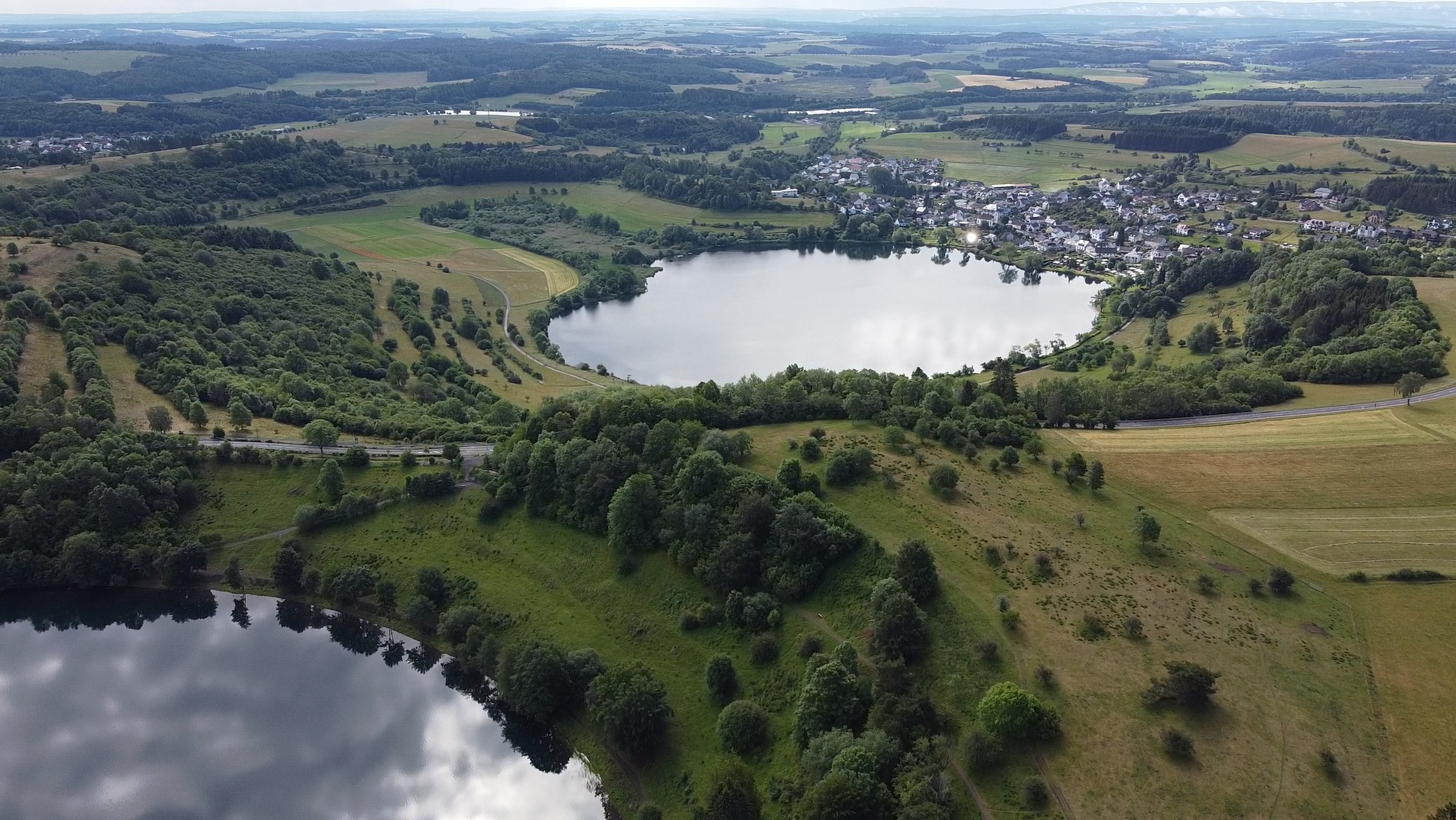 The Volcanic Eifel in the mid-west of Germany is home to a volcanic field that many volcanologists classify as active. The last eruption occurred here 10,900 years ago, exceeding the mark by 900 years from which a volcano is considered extinct. But recent studies show that volcanoes can erupt again even after a much longer dormant period.
For a long time, volcanologists puzzled over how the volcanism of the Eifel came about. 2 theories were put forward: The volcanoes are located on the shoulder of a divergent fault zone. This rift is marked by the course of the river Rhine. So the volcanism could be tectonically caused. But often volcanoes are formed in the middle of a continental plate by mantle plumes, which are often called hotspots. Such a hotspot has also been postulated for the Eifel and detected by seismic tomography. However, this did not tell us whether this hotspot was actually still active. Now a new study has shown that the ground in the area of the Volcanic Eifel is rising and the uplift covers a much larger area than previously suspected. Not only the area around the two volcanic fields of the Eifel is being raised, but also a part of the Rhenish Slate Mountains.
A science team led by Corné Kreemer of the University of Nevada, examined millions of GPS data from Europe collected over 20 years to track down possible ground deformations. In fact, in the Eifel region, the researchers discovered not only a vertical ground elevation, but also a zone of horizontal elongation surrounded by a radial pattern of shortening. This area is significantly larger than the Volcanic Eifel. If one corrects the uplift rates of the ground by the value of the isostatic rise, which is still caused by the melting of ice during the last ice age, one arrives at an uplift rate of about 1 mm per year. Scientists describe the rate of uplift as remarkable and assume that it is caused by the buoyancy forces of the mantle plume. Such uplift forces in a rock body can only occur if the rock is less dense than the surrounding rock, which is the case with a plume if at least part of the rock is in the form of melt. These conclusions suggest that the volcanoes of the Eifel could one day become active again. However, there are no signs of an imminent volcanic eruption.
(Source: https://doi.org/10.1093/gji/ggaa227)
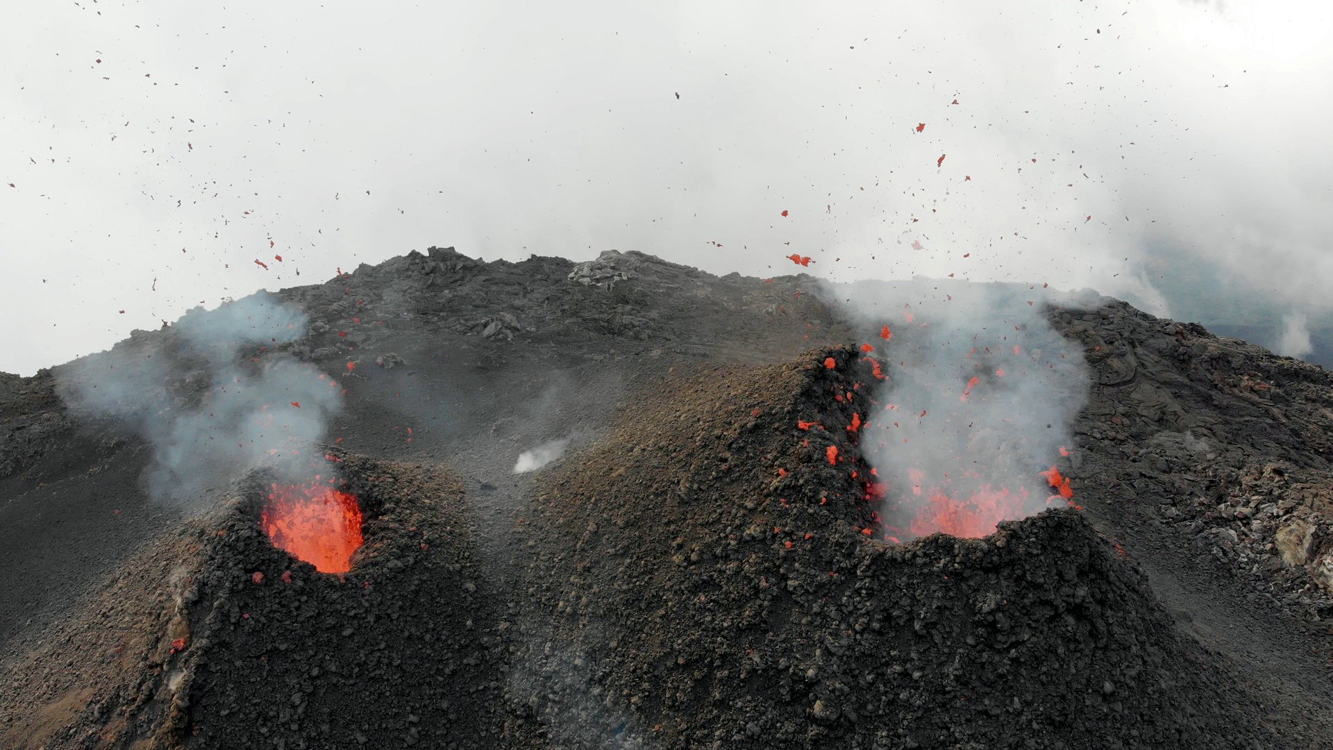
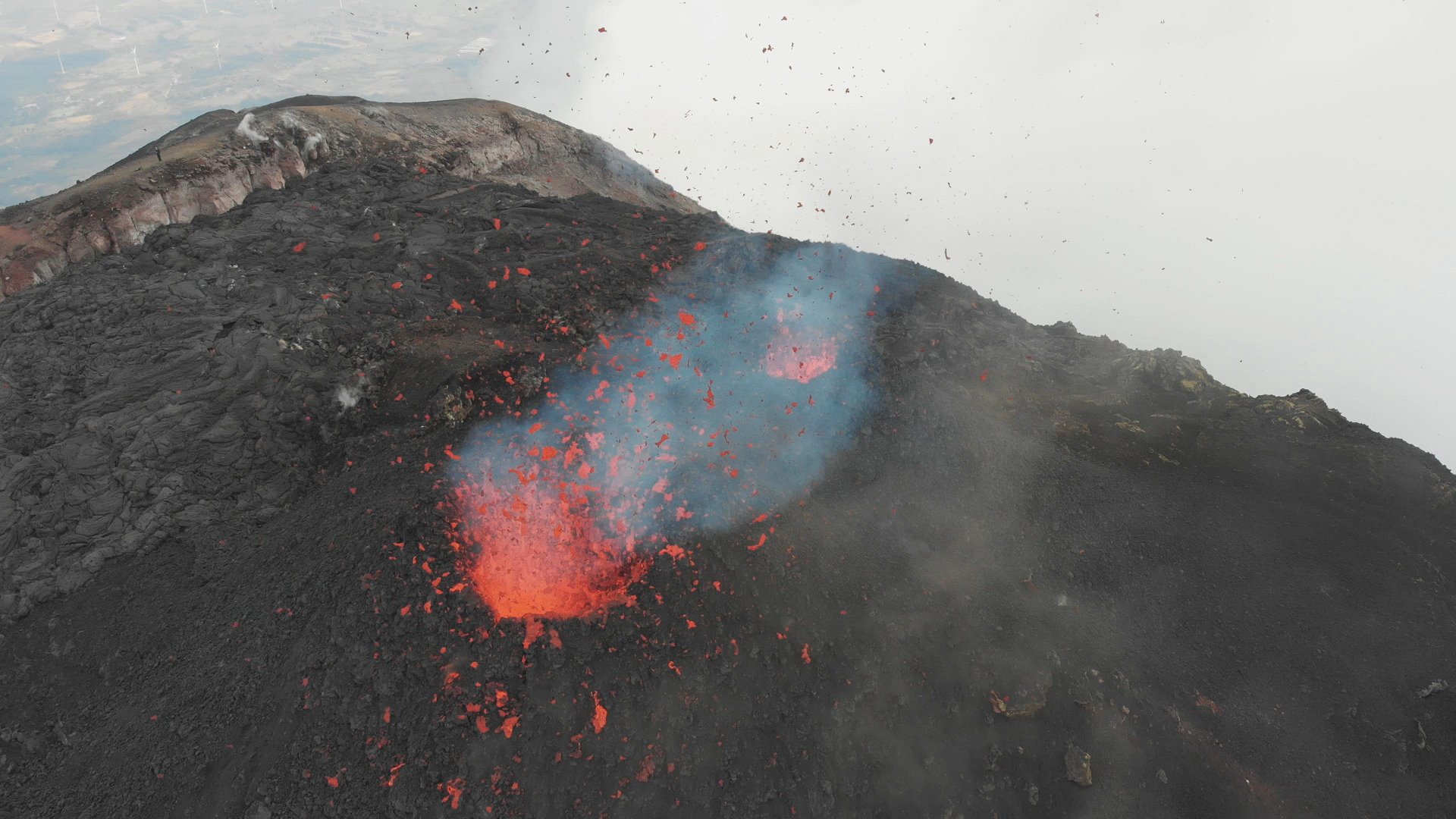
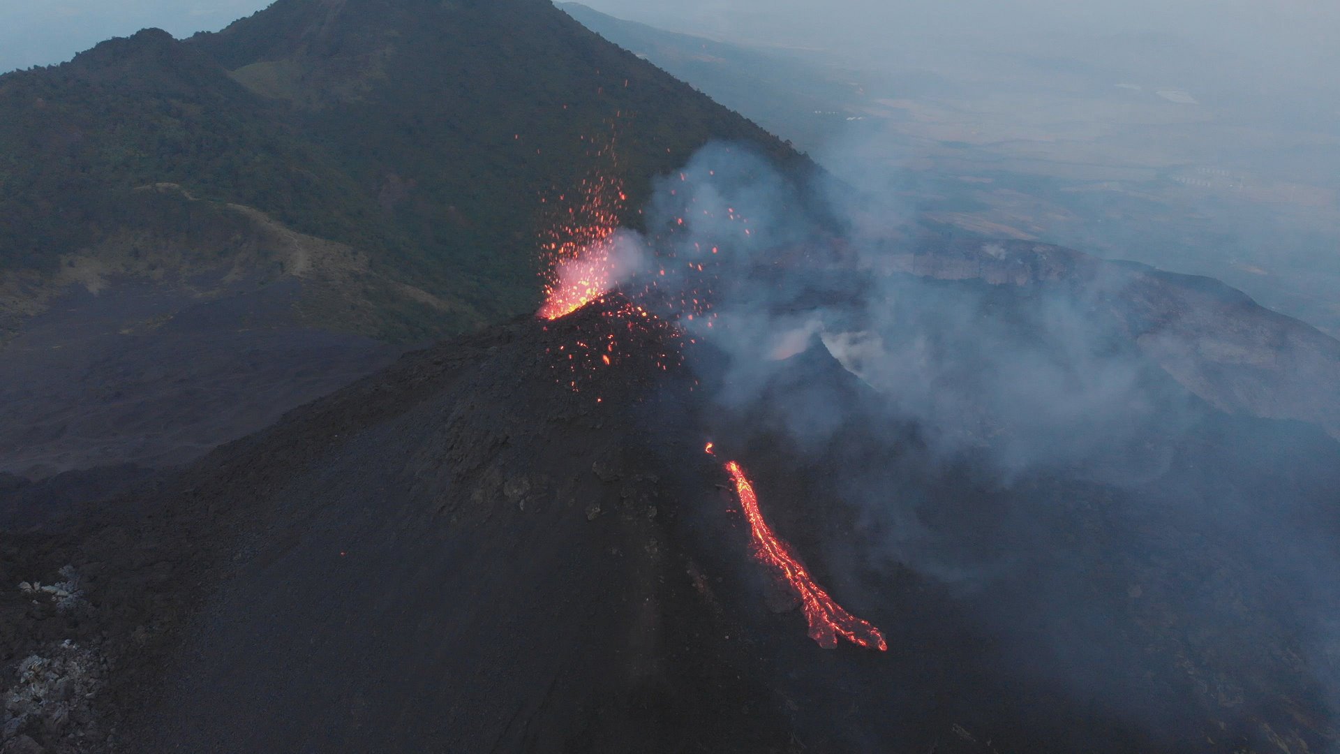
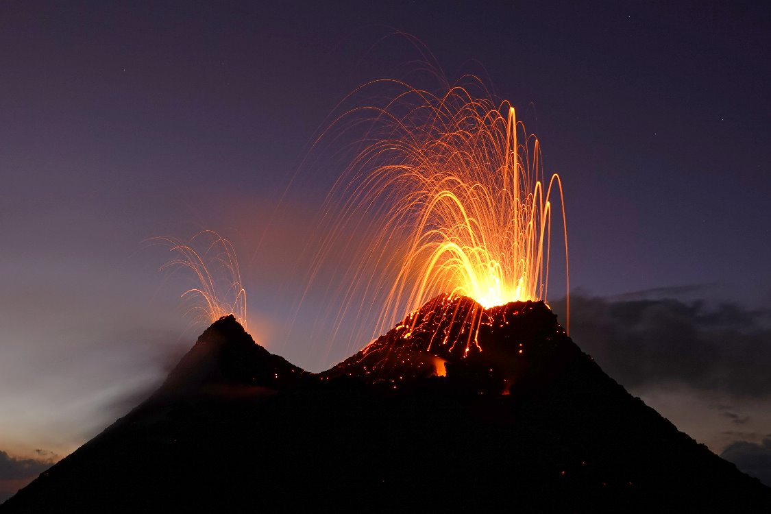
Pacaya: Drone shots from January
Eruptions of volcano Pacaya in Guatemala during my stay in January 2020. I climbed the McKenney crater and stood up in front of the active hornito. Lava spattering and mild strombolian eruptions took place. A episode with a lava flow was the highlight of this day.
In the spring of 2021, the volcano’s activity increased significantly. A series of smaller paroxysms occurred, producing ash clouds rising to an altitude of 3800 m. A short eruptive fissure developed on the lower western flank of Mc Kenney cone. Lava flows up to 3 km long flowed down the volcanic slope and reached farmland. Some buildings were destroyed.
Pacaya in 2020
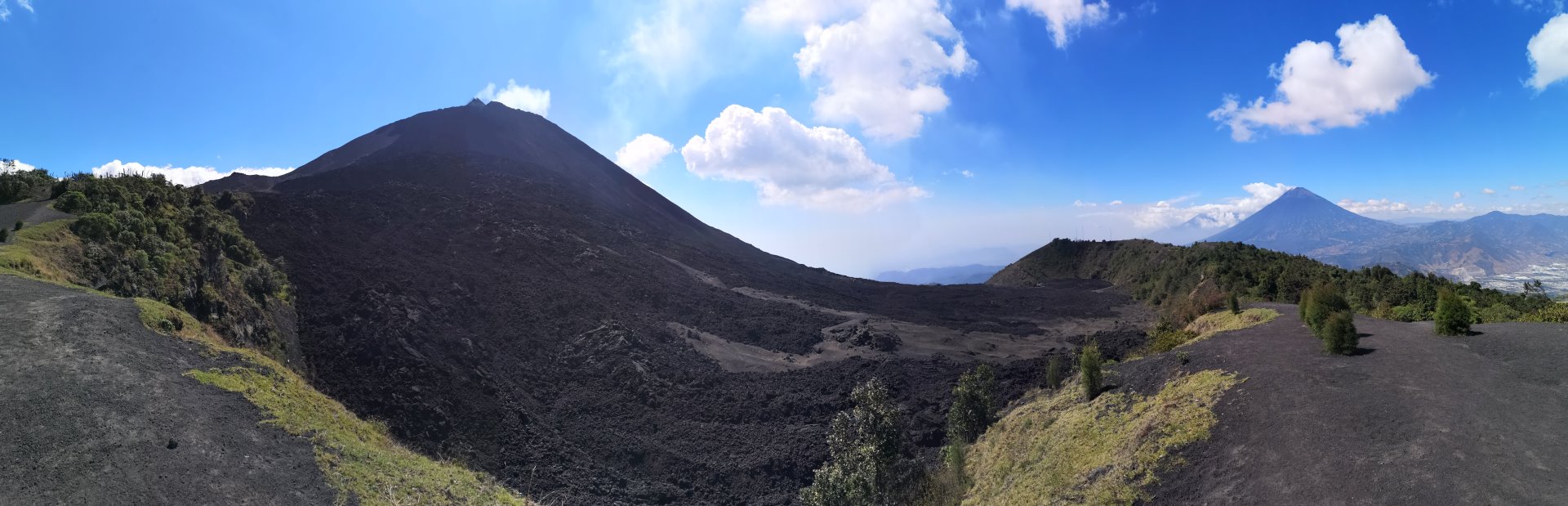
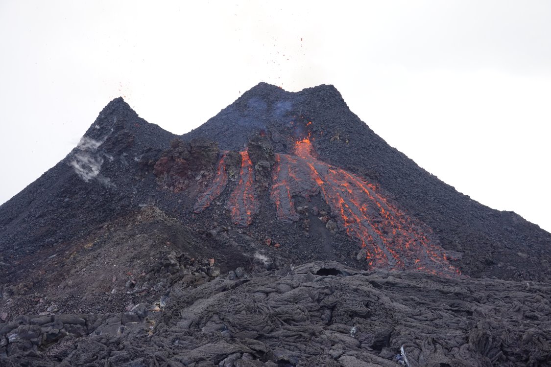
In January 2020 I spent 3 days at the volcano Pacaya in Guatemala. Since months the fire mountain was strombolian active and produced lava flows from time to time. So the volcano attracted me for the 2nd time within 2 years. Compared to March 2018 the hornito was much larger and now had 2 distinct chimneys, both of which were active.
Jaime, the host of Salamandras House picked me up Friday evening with his pickup truck from the airport in Guatemala City. The man from El Salvador greeted me warmly and took me to the supermarket on the way to Pacaya. There is no serious shopping possibility directly at the volcano. Only a small kiosk offers sweets and beer, which is the most important thing to get along at the volcano for a while. Arriving at the inn I thought about climbing up directly in the first night, but somehow the tiredness won. Strong wind and clouds didn’t motivate me very much and so I climbed the Pacaya only the next morning.
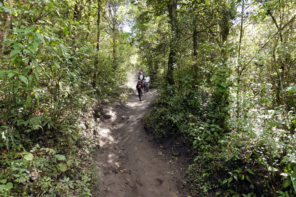
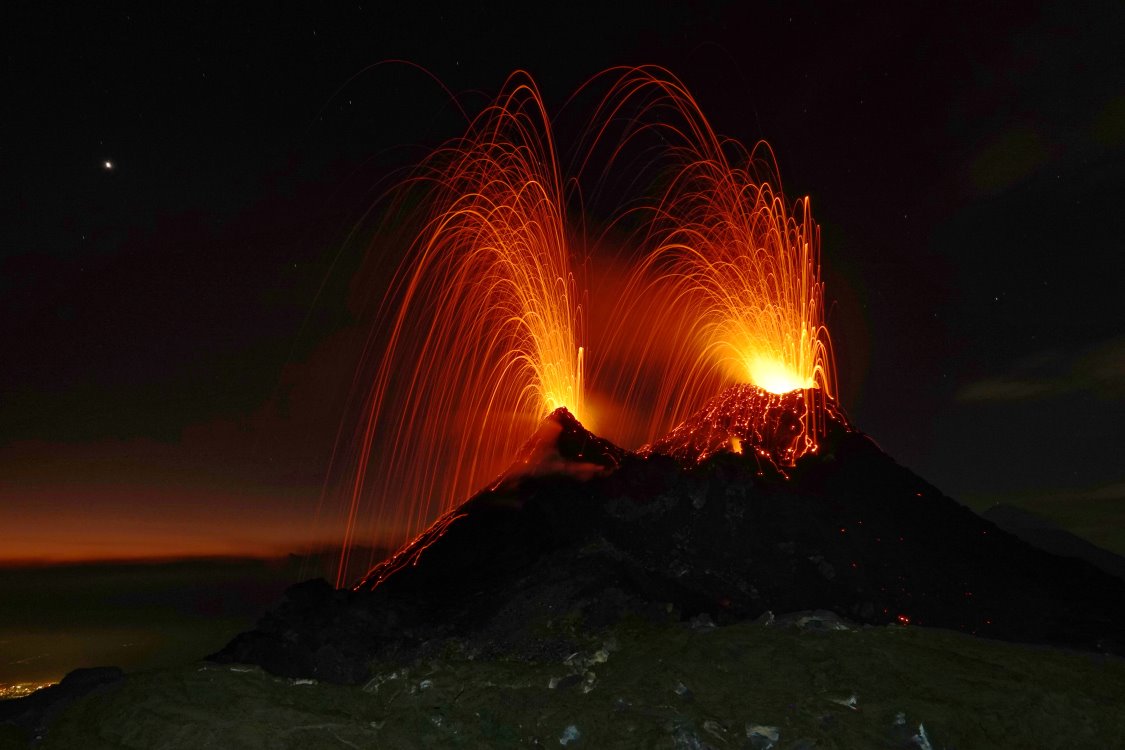
The first part of the ascent did not pose any particular hurdles, except for the fact that the first hundred meters of altitude difference are quite steep. As the park entrance (yes, the Pacaya is protected in a national park and one has to pay 50 Quetzales entrance fee) is located at a height of barely 1700 m, I immediately started to breathe and sweat. But with increasing height at least the sweating stopped. At the end of the vegetation zone, all those volcano hikers who had joined a guided group gathered and looked longingly to the summit. The last 300 meters of altitude difference can still be climbed – contrary to the rules – but one must not be deterred or stopped by the prohibition signs and the rather steep path through loose lapilli. So I stomped on determinedly and stood at the edge of the My Kenney crater at noon and looked at the two hissing chimneys of the hornito.
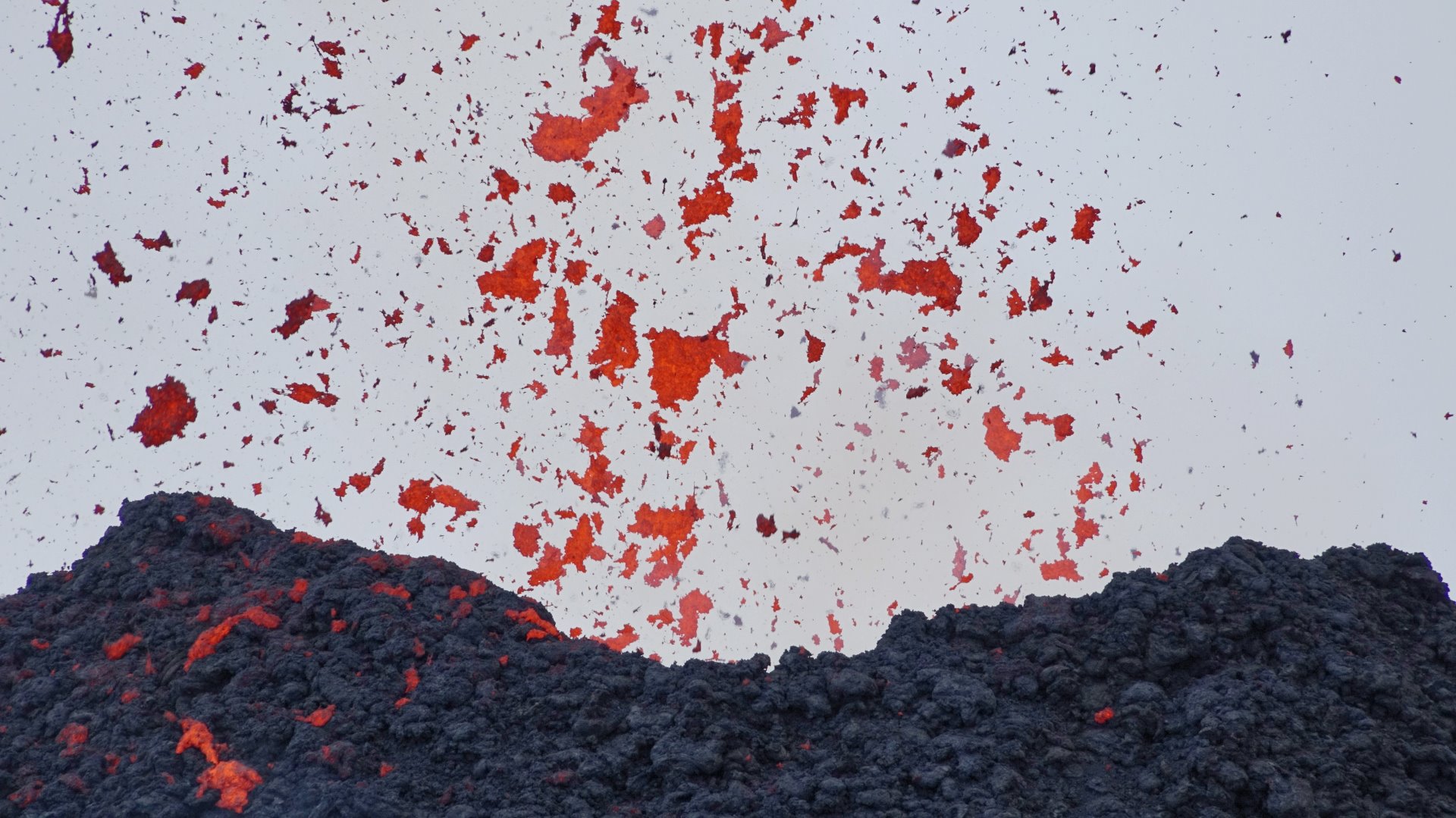
At first, only a few isolated lava lumps were ejected from the mouths of the chimneys, but pretty soon the activity increased to continuous lava spattering. Isolated lava bombs reached respectable heights of about 50 meters. Also the size of the cinders was impressive.
In the late afternoon a new vent opened on the flank of the hornito. Lava flows out of it, which poured over the flank in a multi-armed stream. The spectacle was quite entertaining and ended after 10 minutes.
Within 2 hours I flew the 3 batteries of my drone empty and let it float dangerously low over the vents. I was quite surprised that at the end of the battery capacity it had actually not yet been shot down, with the lava bombs taking on the role of missiles: more than once they came dangerously close to the unmanned aircraft.
In the evening it became quite windy again at the crater rim, but I persevered and waited for the moonrise. Around 21.30 o’clock our Trabant then pushed itself slowly over the horizon and showed again the contours of the hornito. A little later I started the descent. Arrived down in the forest I paused for a while and let the various voices of the night take effect on me.
2 days later I set off for the Fuego, which my drone should not survive, but more of that elsewhere.
Iceland: Is a volcanic eruption imminent?
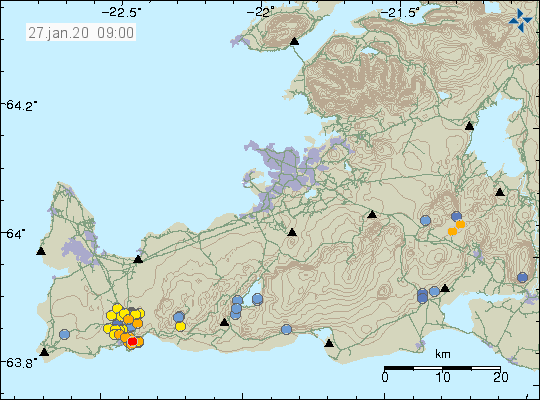 The Icelandic volcanologists of the Institute IMO express concern about the current situation on the Reykjanes Peninsula. In the vicinity of Grindavik, there have been repeated swarm quakes in recent months, which were quite strong. Since 21 January, GPS measurements now show a rise in the ground that has not been seen there for decades. Under the volcano Þorbjörn the ground is rising by 3-4 mm per day. This rise is caused by magmatic fluids rising under the volcano. In all probability it is magma that causes Þorbjörn to rise. As a result, the civil defence has declared the VONA warning level “yellow”. Residents of the area will be invited to an information meeting tomorrow. There they will be informed about how to prepare for a possible volcanic eruption.
Campi Flegrei: Tremor amplitude increases
 While all eyes look at the Philippine Taal volcano, there is also something interesting going on under the European pedant Campi Flegrei. The INGV Napoli yesterday published a new report on the situation of the large caldera volcano, which can erupt at a similar rate as the Taal. The focus of the report is the thermal area around the fumarole of Pisciarelli , which is located on the north-western crater rim of the Solfatara. There one can observe an increase in the tremor amplitude. Although it is primarily a fumarolic tremor, which occurs at a depth of less than 1 km and is therefore in the area of the hydrothermal system, it also represents the overall state of the magmatic system of the caldera. The volcanologists see a correlation between changes in the geochemistry of the fluids, the soil deformation with peaks of 60 cm uplift and the fumarolic tremor. Therefore, it is quite possible that the Caldera volcano is slowly preparing for an eruption.