At 12:17 p.m. another strong eruption occurred at Stromboli (Sicily). The explosion produced an ash cloud several kilometres high. Lava boulders even landed on the outer flank of the cone, about where the ascent route leaves the reed belt. On the side of Ginostra the vegetation burned to about 200 m height. A pyroclastic flow ran over Sciara del Fuoco. The eruption was announced shortly before by a significant increase in inflation. According to an initial assessment, the explosion was not quite as strong as the one on July 3. Nevertheless, the risk potential was very high. There have not yet been any reports of victims, but it is quite conceivable that there were.
Month: August 2019
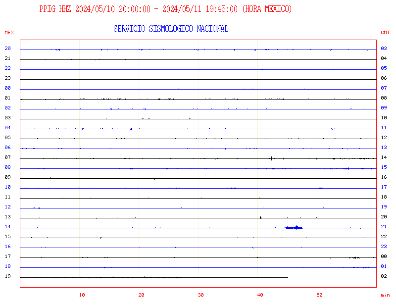
Popocatepetl livecam

Here you can see live cam and data of the volcano Popocatepetl. More seismograms are available. To load new pictures, please click this link.
Piton Fournaise: Livecam

Livecam on the Piton de la Fournaise. Location of the camera: Piton Basaltes. © OVPF. To load a new image, please update the page.

Livecam Fournaise. Cam-location Partage. © OVPF
Thermal radiation at the Fournaise
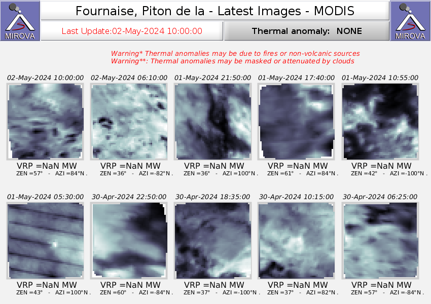
Thermal radiation of the volcano Piton de la Fournaise. © MIROVA
Campi Flegrei
The Italian caldera volcano Campi Flegrei is located in the urban area of Pozzuoli and only 20 km away from Vesuvius. The name is derived from the Greek phlégein which means ‘to burn’. Freely translated, the name means “burning fields”. The name alone does not give a good idea! In fact, the Caldera volcano is often classified as a super volcano. The reason for this classification was a gigantic eruption about 37,000 years ago: ash deposits have been detected even at a distance of over 1000 km.
Anak Krakatau with eruption
VSI today reports an eruption at Anak Krakatau. Since the volcano was hidden in the haze, there was no visual confirmation of the eruption. However, a seismic eruption signal was registered. It lasted 60 seconds and had a maximum amplitude of 46 mm. All probability was a phreatic eruption. The volcanic island was the target of an expedition only a few days ago, during which the water temperature of the crater lake was measured.
Stromboli with strong activity
 Yesterday Stromboli turned up and increased its activity again. In the night to Sunday a new lava flow became active. According to LGS the lava front reached a height of 600 m above sea level. From the front of the lava flow there were occasional debris avalanches. Lava rocks jumped over Sciara del Fuoco into the sea. The explosive activity was also high: an average of 28 eruptions per hour were recorded. In the evening continuous lava spattering took place from some vents. The most northeastern vent generated strong strombolian eruptions. Glowing tephra reached a height of about 300 m. Some explosions were very loud. The infrasound pressure was correspondingly high. The volcanologists measured very high sulphur dioxide emission and a strong tremor.
Sinabung on Sumatra
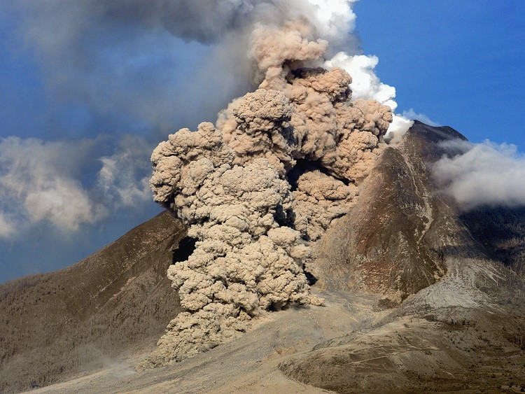 Sinabung is volcano in the north of the Indonesian island Sumatra near the city of Berastag iand about 50 km southwest of Medan. Sinabung lies 25 km northwest of Lake Toba . Its height is 2460 m. The stratovolcano consists mainly of andesite and dacite.
The eruption of Sinabung on August 29, 2010 was the first known eruption in the last 400 years. Since then the volcano has erupted several times, the last time on 8 August 2020.
The Pleistocene and Holocene stratovolcano shows numerous lava flows on its flanks. The mountain summit has an elongated shape, as previous eruptions formed several summit craters along a line running roughly in a north-south direction. It marks the course of a fault zone.
History of volcanic activity since 1920
In 1912 solfatars were observed in the area of the summit and the upper flanks.
2010
Following an eruption in August 2010, more than 18,000 people were evacuated. A second eruption increased the number of refugees to 27,000. Volcanic ash reached the megacity of Medan. In a third eruption on 3 September, the most violent since the new eruption, the volcano ejected an ash fountain several kilometres high into the atmosphere. The accompanying earthquake was still felt 8 km away.
2013
On the morning of September 15, 2013, the Sinabung erupted again. Until 18 September, four eruptions occurred. Thousands of people were evacuated from eleven villages within a radius of three kilometres. During another eruption on the morning of 3 November, a seven-kilometre column of smoke was observed. A zone of three kilometres around the volcano was evacuated. On November 14, 2013, a pyroclastic flow descended the volcano’s southeastern flank. On November 18, 2013, an ash cloud was ejected after an explosion, rising to a height of up to 11.3 kilometers. Further eruptions occurred during the night of 23 to 24 November 2013, following which the Indonesian Centre for Volcanology and Geological Disaster Control issued the highest warning level. Tens of thousands of inhabitants were evacuated.
2014
The series of outbreaks will continue in 2014. More than 50 outbreaks were observed on 4 January. The safety zone around the volcano has been extended from five to seven kilometres. On the night of 14 January, numerous volcanic flashes were observed in the clouds of pyroclastic flows. This phenomenon is relatively rare and often occurs only during much stronger volcanic eruptions. The ash precipitation caused the plants in the fields to wither. Numerous house roofs collapsed under the weight of the volcanic ash. The village of Sigarang Garang was particularly affected. On February 1 a stronger eruption occurred, which claimed 16 lives [10] among the population living nearby. More than 30,000 people had to leave their homes. [11] In October 2014 it erupted again several times. In the meantime the region around the volcano was covered with a layer of ash.
2015
From 13 June 2015 onwards, new outbreaks are reported with one to two kilometre high outbreak columns (plumes). The evacuation measures were therefore maintained or renewed.
2016
Sinabung eruption on 9 June 2019
On 22 May 2016, another outbreak occurred, killing seven people who were in the restricted zone in violation of the ban. They were caught in a hot avalanche of ash and debris.
2017
As a high ash column formed above the volcano on 25 October 2017, the authorities declared a radius of 7 km a restricted area. Thousands of people fled. From 26 December, the volcano began to emit ash again. The grey ash cloud rose to a height of 4600 metres.
2018
The series of outbreaks that had been going on for years continued on 11 January 2018. The volcano spewed ash and formed a column of smoke over a kilometre high. The eruption was accompanied by earth tremors lasting almost 5 minutes. Another eruption on 19 February 2018 caused an ash cloud five kilometres high. Nobody was injured.
2019
In 2019, a strong eruption occurred on 9 June, during which the volcanic ash reached a height of 12.2 km. During this eruption, pyroclastic flows of 3 to 3.5 km in length were formed, which flowed off towards the south and southeast.
2020
On 8 August 2020 the volcano erupted, and an ash column rose four kilometres into the sky. On 10 August, the column reached a height of seven kilometres.
Sources: WIKIPEDIA, GVP, vulkane.net
Ol Doinyo Lengai: Mountain of god
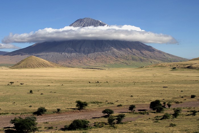 Ol Doinyo Lengai is a 2960 m high volcano in the East African Rift Valley. It is located in northern Tanzania, about 120 km northwest of Arusha at Lake Natron.
The volcano is for the Masai the seat of their god Engai and the volcanic eruptions symbolize the wrath of the god. In the language of the Massai Ol Doinyo Lengai means as much as Gottesberg. In times of need the Massai make sacrifices. Often only milk and cattle blood is sacrificed, but occasionally a goat is also exposed in the crater.
For volcanologists Ol Doinyo Lengai is of special interest for another reason: it produces the coldest lava in the world. Its temperature varies between 490 and 590 degrees. This makes it only about half as hot as ordinary lava. It is extremely low viscosity and can flow as fast as water. The lava is natrocarbonatitic that was erupted in historical times only at this unique volcano. Of course, only a small part is made of natrocarbonatitic, the greater part is made up of foidite and phonolite.
The Ol Doinyo Lengai is located in the East African Rift Valley. It lies above the so-called Tanzania Craton.
The Crater of Ol Doinyo Lengai
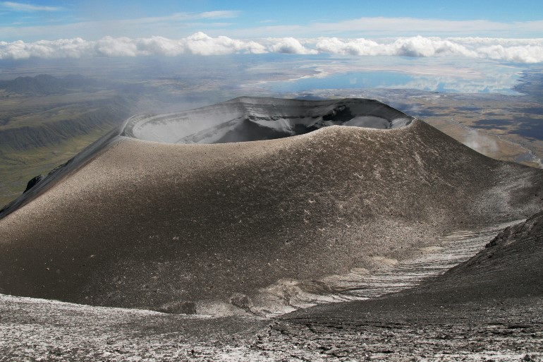 The eruptive activity takes place mainly in the central crater area, which is filled with the eruption products. The level of the crater filling is subject to constant change. Sometimes its possible to walk in. A few meters below its surface, a large magma reservoir bubbles and large cavities are formed. Above ground, the lava erupts mainly effusive. Lavaspattering causes hornitos to grow, which tend to collapse suddenly. This makes the volcano very dangerous.
On our expeditions, injuries have been frequent. A Masai porter had both legs amputated. He collapsed through a thin crust of solidified lava into the lava flow below.
The level of crater filling is subject to constant change.
After a major eruption in 2007, the former crater was filled and a new cone with a deeper crater was formed.
Stromboli: Lavastream flows again
The activity at Stromboli continues. Webcam observers in our FB group reported brisk explosive activity from at least 6 conveyor chutes: Stromboli fires from all pipes! In addition, MIROVA today again registers thermal radiation with an output of 126 MW. On the thermal cam of the LGS you can see a lava flow that reaches quite far down. The picture below shows the current Livecam picture.
Mayotte: more earthquakes
Unlike in the Pacific South Seas, there are no floating pumice carpets or pronounced manifestations of volcanism on the water surface off the island of Mayotte in the Indian Ocean. On the other hand, the ongoing earthquake activity indicates that the probably largest submarine volcanic eruption of modern times is continuing. Yesterday there was an earthquake of magnitude 3.1 at a depth of 32 km. The quake is part of a swarm quake that has lasted since last May and is associated with magma ascent.